
Waterfall Name: Natural Bridge Falls, Diana twn
Aka: ————-
Location: Diana twn
First Visit: 12-15-2012
State: New York State
Region: Northern Region
County: Jefferson County
Park Area: ————-
NYS Tourism Region: Thousand Island-Seaway
NYDEC Region: Western Adirondacks/Eastern Lake Ontario
Waterfall Challenge: ————-
Waterfall Location: N44.06663 W75.49133
Parking: N44.06663 W75.49133
Trailhead: ————-
Trail Name, Reference to: ————-
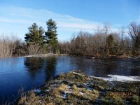
Stream, River: Indian River
Height, Type: Various,see comments
Elevation: 825-800 ft
Level of Difficulty, Hiking Distance: Roadside view
Whitewater Rte, Canoe Rte Map: ————-
Maps: ————-
My Resource: Northern New York Waterfalls
Book Resource: Backyard Cascades of Northern New York, 2019 by David J Schryver,Alphabetical Order,pg78
Brochures, Travel Guides, Visitor Guides: ————-
Trail_URL: ————-
Additional Information: World Waterfalls Database
Photos, Information Contributed to other Websites: Dig the Falls
Landmark: ————-
Nearest Intersection: Factory Rd and N Croghan Rd and Depot St
Directions: From the intersection of Hwy 3 and Co Rd 41 in Natural Bridge, take Hwy 3 east for .1 mile. Turn right onto Depot St and drive for .2 miles. Park anywhere along this intersection. Walk up the road on Depot St, across both bridges. The falls are on both sides of the road.
Comments, Notes: Lower Falls is a 10 ft cascade, Main Falls is a 25 ft step, Reservoir Falls is a 8-10 ft Slide, Upper East Falls is a 5 ft Cascade, and Upper West Falls is a 5 ft Cascade
————-
————-
