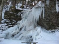
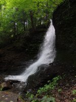
Waterfall Name: Bucktail Falls
Aka: ————-
Location: Spafford Twn
First Visit: 03-23-2008
State: New York State
Region: Central Region
County: Onondaga County
Park Area: Green Gully
NYS Tourism Region: Finger Lakes-Wine Country
NYDEC Region: Central New York
Waterfall Challenge:————-
Waterfall Location: N42.82257 W76.24128
Parking: N42.82273 W76.24117
Trailhead: ————-
Trail Name, Reference to: ————-
Stream, River: Bucktail Creek
Height, Type: 35ft,Plunge Cascade,28ft?
Elevation: 900 ft
Level of Difficulty, Hiking Distance: Roadside view
Whitewater Rte, Canoe Rte Map: ————-
Maps: Western New York All-Outdoors Atlas & Field Guide, 2008,A3,pg120
My Resource: Western New York All-Outdoors Atlas & Field Guide, 2008,A3,pg120
Book Resource: 200 Waterfalls in Central and Western New York: A Finder’s Guide Paperback – June 5, 2018, by Rich and Sue Freeman,Waterfalls in Onondaga, Madison and Oneida Counties,pg327
Brochures, Travel Guides, Visitor Guides: ————-
Trail_URL: ————-
Additional Information: World Waterfall Database
Photos, Information Contributed to other Websites: Dig the Falls
Landmark: Green Gully
Nearest Intersection: Moon Hill Rd and Sawmill Rd and Masters Rd
Directions: From I-81 S in Tully, Take exit 14 to the right towards Rt-80/Tully and drive for .2 miles. Turn left onto Hwy 11a and drive for 1.6 miles. Bear left onto Lake Rd and drive for 1.3 miles. Turn left onto Song Lake Rd and drive for .1 miles. Turn right onto Song Mountain Rd and drive for 1.2 miles. Turn right onto Otisco Valley Rd and drive for 4.8 miles. Turn left onto Saw Mill Rd and drive for .6 miles. Turn right onto Moon Hill Rd for 228 ft.
Comments, Notes: From Bucktail Falls, heading Northwest on Moonhill Road, there appears to be a seasonal waterfall located here N42.82366 W76.24301. For now I have named this Bucktail 2 only because it is within sight of Bucktail Falls. It is not on the same stream. Topographical maps does not show a stream exists.
————-
————-


