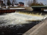
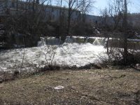
Camden Dam and Falls – 2 Dams Historical
Camden Dam and Falls – 2 Dams Historical
Location: |
Camden |
First Visit: |
3/31/2009 |
Region: |
Central |
County: |
Oneida |
Gps of Falls: |
N43.33232 W75.74910 |
Gps of Parking: |
N43.33357 W75.74780 |
Landmark: |
Fastrac |
Stream/River/Watershed: |
West Branch Fish Creek, Mad River |
Height of Falls/Type: |
Dam and Falls |
Elevation: |
500 ft |
Level of Difficulty/Hiking Distance: |
Roadside |
My Resource: |
Camden New York Historical Society |
Photos And Information I Contributed To or Posted To Other Websites: |
Digthefalls |
Nearest Intersection: |
Main St And Preston Hill St |
Directions: |
From I-90 W, in Westmoreland, Take exit 32 to the right towards Rt-233/Westmoreland/Rome and drive for .7 miles. Turn right onto Cider Street and drive for .1 miles. Turn right onto Highway 233 and drive for 5.7 miles. Take the Rt-49 W/Rt-69 W/Rt-365 W ramp to the left and drive for .4 miles. Take the Rt-49 W/Rt-69 W ramp to the right towards Rt-26 N/Rt-46/Downtown Rome and drive for 1.3 miles. Keep left onto Erie Blvd E and drive for 18 miles. Turn left onto Highway 13 and drive for .2 miles. |
Comments/Notes: |
There is a small community park here with a picnic table and fire pit this was newly put in |
Home » Camden Dam and Falls - 2 Dams Historical » Camden Falls Dam (2) 4-2-2014, 12-24-2012, 3-31-2009
Home » Camden Dam and Falls - 2 Dams Historical » Camden Dam and Falls 12-24-2012, 4-2-2014, 3-31-2009, 10-2-2010


