Virginia (Fairfax County) and Maryland Border (Montgomery County)
The Potomac River flows into the Atlantic Ocean
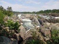
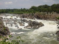
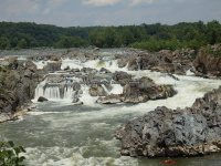
I had visited Great Falls as a part of a vacation to trip with my grandchildren, and to meet up with a Marine Grandmother. I had done not extensive research regarding Great Falls whitewater routes. I actually did not realize the greatness of the area. I had only visited the one location at the visitor center on the Virginia side. This was a very easy walk to three observation decks. I have split up my photos taken in each of the observation deck locations. The entire walk to the three observation decks is approximately a .5 round trip.
The following information should not be relied upon as completely accurate. I compiled my resources to the best of my ability. The links provided below is what was used. I only included information in regards to the section of Great Falls seen from the observation decks. The map I have included shows ALL the points that I could figure out.
I plan to revisit this location in the future. It will take more than a day to hike the Great Falls area from both sides of the state line.
Great Falls (Center Lines) (Streamers)
Great Falls (Virginia Lines) (The Spout)
Great Falls (Maryland Lines)
Great Falls Mather Gorge to Lock 10
Guide to Mystery Move Spots of the Potomac River, Mather Gorge By Stephen Strothers, Greg Steiger, Mr E, & now with updates and comments from Steve Graybill
Overlook 1 |
Virginia |
Fairfax County |
N38.99651 W77.25367 |
Trail |
Overlook 2 |
Virginia |
Fairfax County |
N38.99591 W77.25343 |
Trail |
Overlook 3 |
Virginia |
Fairfax County |
N38.99512 W77.25291 |
Trail |
Great Falls (Virginia Lines)
| U-Hole (Class 5.0, Mile 0.4) |
N38.99728 W77.25380 |
Norman’s Leap (Right) |
Small Ledges, Slide |
| S-Turn (Class II-IV) 0.3 |
N38.99677 W77.25353 |
A short pool separates S-Turn from the Spout |
Angled Ledge |
| The Spout (Class 5.0, Mile 0.5) |
N38.99648 W77.25339 |
The Curtain (Big Toe) ???? |
18-22 ft, 4 ft |
Drop, Slope |
| The Crack (Class 5.2) |
Alternate line to the Spout |
Great Falls (Center Lines)
| Grace Under Pressure (Class 5.1, Mile 0.4) |
N38.99740 W77.25334 |
12 ft |
| The Sliding Board (Class 5.2) |
N38.99722 W77.25321 |
Bottom of Grace |
| The Ledges (Class IV+, Mile 0.5) |
N38.99700 W77.25304 |
3-5 ft |
Ledges |
The Pool above the Fingers. To the right Angel Slot, Left, Next to Charlie’s Hole (MD side) is Hollywood Boulevard that goes toward the Twist n’ Shout, and the Subway
| Hollywood Boulevard |
Funnels toward Twist n’ Shout, and the Subway |
| The Fingers (Class 5.0, Mile 0.5) aka The Streamers |
N38.99653 W77.25274 |
| Twist and Shout (Class 5.2) aka The Thumb |
A Narrow Twisty Flume |
| Subway (Class 5.3) |
Cave at the bottom |
Double Drop |
| The Middle Finger (Class 5.0) |
20 ft, 4 ft, 8 ft, 12 ft |
Drop, Slot. Slide, Boof |
| The Ring Finger (Class 5.1) aka Flatliner |
| The Pinky Finger (Class 5.1) aka Angel Hair |
Entrance Angel Slot |
Great Falls (Maryland Lines)
| Pummel (Class 5.0, Mile 0.5) aka Sunburst |
N38.99742 W77.25260 |
Small Chutes |
To the left of the Notch, Below Pummel (from left to right): Pencil Sharpener, Z-Turn, and Charlie’s Hole
| Pencil Sharpener (Class 5.0, Mile 0.5) |
N38.99726 W77.25245 |
Slide |
| Charlie’s Hole (Class 5.2, Mile 0.5) |
N38.99697 W77.25260 |
10 ft, 3-5 ft |
Sluice, Ledges |
| Z-Turn (Class 5.0, Mile 0.5) |
N38.99716 W77.25246 |
Twisting Drop |
| SOS Wave |
Just above the Horseshoe |
| Horseshoe (Class 5.1, Mile 0.6) |
N38.99681 W77.25245 |
Horseshoe Wave aka Snodgrass ??? |
Portion of Mather Gorge
| FishBowl aka The Shoe |
N38.99634 W77.25257 |
Formed by the Horseshoe slab and Streamers slab, Located below the Streamers, Fishladder waves in Portage “The Shoe” |
| Fisherman’s Eddy |
N38.99549 W77.25226 |
Directly below the Observation Deck 2 & 3 |
| O-Deck Wave (Class III) |
Adjacent to Fisherman’s Eddy |
| Dunkin’ Stronut’s aka Running Errands |
N38.99524 W77.25163 |
Above Portage/Fishladder, Below the wall at O-Deck |
| Portage Hole aka Simon Says (Portage Rapids, Portage Waves aka Fishladder Rapid Waves ???) |
N38.99488 W77.25081 |
Upstream of the Fishladder |
| S-Turn (Class 5.0, Mile 0.5) |
N38.99429 W77.24983 |
Above Simple Pleasures |
| Simple Pleasures |
Downstream corner on the Maryland side of S-Turn |
| Watkin’s Wedge |
Above Sandy Beach put in on Maryland side, Just below the Fishladder |
| Fifth Slide (Class 5.0, Mile 0.5) |
N38.99511 W77.24934 |
Overlooking S-Turn, Skirtless Boof on the left |
Slide |
| Bermuda Triangle |
N38.99528 W77.24825 |
Formed by the Fishladder slab and Potomac’s main slab, at the mouth of the Fishladder. |
| Triple Pleasures |
Above Bermuda Triangle and Simple Pleasures |
| Original content here is published under these license terms: | X |
|
| License Type: | General Public License | |
|
| License Abstract: | The GNU General Public License is a free, copyleft license for software and other kinds of works. You may re-publish the content (modified or unmodified) providing the re-publication is itself under the terms of the GPL. |
|
| License URL: | http://www.gnu.org/licenses/gpl.html |
Like this:
Like Loading...


