Waterfall Name: Maltanner Creek Falls
Aka: Cupid’s Retreat
Location: Fairfield Twn
First Visit: 03-30-2013
State: New York State
Region: Central Region
County: Herkimer County
Park Area: ————-
NYS Tourism Region: Adirondack Mountains
NYDEC Region: Western Adirondacks/Eastern Lake Ontario
Waterfall Challenge:————-
Waterfall Location: N43.13873 W74.95375
Parking: N43.13846 W74.95254
Trailhead: ————-
Trail Name, Reference to: ————-
Stream, River: Maltanner Creek
Height, Type: 10ft Step
Elevation: 700 ft
Level of Difficulty, Hiking Distance: Roadside views
Whitewater Rte, Canoe Rte Map: ————-
Maps: ————-
My Resource: I Found This Just Driving Around
Book Resource: ————-
Brochures, Travel Guides, Visitor Guides: ————-
Trail_URL: ————-
Additional Information: Russell Dunn
Photos, Information Contributed to other Websites: Dig the Falls, Northern New York Waterfalls
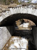
Landmark: There Is An Arch On Left Side Of Rd When Heading South On 29
Nearest Intersection: Rte 29 and Reservoir St
Directions: From I-90 W, at Indian Castle, Take exit 29A to the right onto Rt-169 towards Little Falls/Dolgeville and drive for 2.7 miles. Turn left onto Hwy 167 W and drive for .2 miles. Turn right onto E Main St and drive for .3 miles. Turn right onto Salisbury St and drive for .2 miles. Turn right onto E Monroe St and drive for 6.9 miles. Turn left onto Hwy 29 and drive for 2.8 miles.
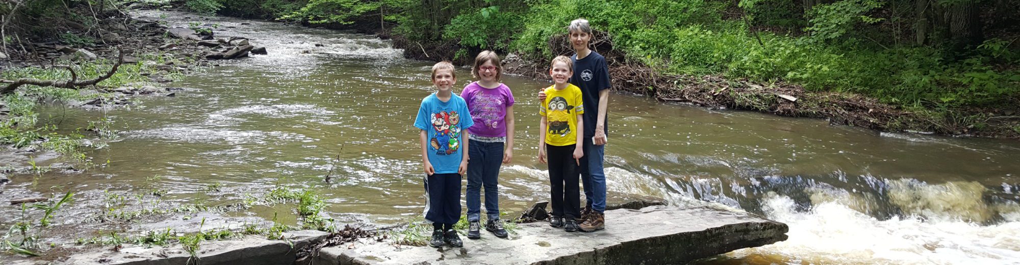
Comments, Notes: This is a busy section of road. Either park before the bridge or after and walk back.
————-
————-
————-
