Waterfall Name: Valley Falls
Aka: Schaghticoke Falls
Location: Schaghticoke Pittstown
First Visit: 02-22-2014
State: New York State
Region: Eastern Region
County: Rensselaer County
Park Area: ————-
NYS Tourism Region: Capital-Saratoga
NYDEC Region: Capital Region/Northern Catskills
Waterfall Challenge: ————-
Waterfall Location: N42.89815 W73.57340 Dam N42.90450 W73.56290
Parking: N42.89778 W73.57293
Trailhead: ————-
Trail Name, Reference to: ————-
Stream, River: Hoosic River
Height, Type: Rapids Dam
Elevation: 270 ft ? 291 ft
Level of Difficulty, Hiking Distance: Roadside Views
Whitewater Rte, Canoe Rte Map: ————-
Maps: ————-
My Resource: Hudson Valley Waterfall Guide “From Saratoga And The Capital Region To The Highlands And Palisades” By Russell Dunn
Book Resource: Hudson Valley Waterfall Guide “From Saratoga And The Capital Region To The Highlands And Palisades” By Russell Dunn
Brochures, Travel Guides, Visitor Guides: ————-
Trail_URL: ————-
Additional Information: ————-
Photos, Information Contributed to other Websites: ————-
Landmark: Boston and Main Railroad
Nearest Intersection: South River Rd and Powder Mill Rd
Directions: From I-87 N near Clifton Park, Take exit 9 to the right onto Rt-146 towards Clifton Park/Halfmoon and drive for .2 miles. Take the Rt-146 E ramp to the right towards US-9/Halfmoon/Mechanicville/Stillwater and drive for 2.5 miles. Turn left onto Hwy 146 and drive for 3.8 miles. Turn right onto Park Ave for 263 ft. Turn left onto Main St N and drive for .3 miles. Turn right onto Hwy 67 and drive for 5.6 miles. Turn left onto Hwy 40 and drive for 1.5 miles. Turn right onto Hwy 67 and drive for 1.5 miles
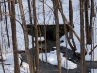
Comments, Notes: Could not find but with the ice we could have missed it. It is possible that this location was viewed from the bridge over the Hudson River from Highway 67, eastside?