
Waterfall Name: Black River Community Overlook Park
Aka: Black River Village Falls
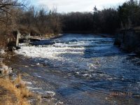
Location: Black River
First Visit: 12-15-2012
State: New York State
Region: Northern Region
County: Jefferson County
Park Area: ————-
NYS Tourism Region: Thousand Island-Seaway
NYDEC Region: Western Adirondacks/Eastern Lake Ontario
Waterfall Challenge: ————-
Waterfall Location: N44.00985 W75.79234
Parking: N44.01089 W75.79253
Trailhead: ————-
Trail Name, Reference to: ————-
Stream, River: Black River
Height, Type: Dam and Falls
Elevation: 550 ft
Level of Difficulty, Hiking Distance: Roadside view
Whitewater Rte, Canoe Rte Map: ————-
Maps: ————-
My Resource: https://www.watertown-ny.gov/DocumentView.asp?DID=333
Book Resource: Waterfalls of New York State Paperback – August 9, 2012, by Scott Ensminger, David Schryver, Edward Smathers,North Country Region,pg180
Brochures, Travel Guides, Visitor Guides: ————-
Trail_URL: ————-
Additional Information: Black River Blueway
Photos, Information Contributed to other Websites: Dig the Falls/Northern New York Waterfalls
Landmark: Poors Island
Nearest Intersection: S Main St and W Dexter St and Public Sq and E Dext
Directions: From the intersection of Hwy 3 (W Rutland St) and S Main St in Black River, take S Main St north for .4 miles. Turn right onto E Dexter St and park anywhere along the street.
Comments, Notes: ————-
————-

Pingback: Waterfalls of New York State 100+ Challenge, Dig the Falls, part 5, The North Country Region - Bobbieswaterfalls