

Waterfall Name: Genesee Lower Falls
Aka: Lower Letchworth Falls, Lower Falls
Location: Portage Twn
First Visit: 07-15-2006
State: New York State
Region: Western Region
County: Livingston County
Park Area: Letchworth State Park
NYS Tourism Region: Finger Lakes-Wine Country
NYDEC Region: Western Finger Lakes
Waterfall Challenge: Finger Lakes Region Waterfall Challenge Paperback – October 30, 2019, by John Haywood, Julie Hughes Romano, Bella Romano, Edward Smathers,Livingston,pg14
Waterfall Location: N42.58537 W78.02103
Parking: N42.58851 W78.01596
Trailhead: N42.58704 W78.01764
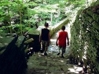
Trail Name, Reference to: Best Viewed From West Side Trail # 6A Footbridge
Stream, River: Genesee River
Height, Type: 30ft,40ft (70ft total),Block (15ft???)
Elevation: 825 ft
Level of Difficulty, Hiking Distance: Moderate with stairs .6 Mile Roundtrip
Whitewater Rte, Canoe Rte Map: ————-
Maps: Western New York All-Outdoors Atlas & Field Guide, 2008,E1,pg114
My Resource: Western New York All-Outdoors Atlas & Field Guide, 2008,E1,pg114
Book Resource: 200 Waterfalls in Central and Western New York: A Finder’s Guide Paperback – June 5, 2018, by Rich and Sue Freeman,Waterfalls in Monroe, Livingston and Ontario Counties,pg79
Brochures, Travel Guides, Visitor Guides: Letchworth Park
Trail_URL: https://parks.ny.gov/parks/attachments/LetchworthTrailMapNorth.pdf, https://parks.ny.gov/parks/attachments/LetchworthTrailMapSouth.pdf
Additional Information: Information for the Letchworth State Park Waterfall Locations maybe quoted text. The best source of information is by purchasing “A Waterfall Guide to Letchworth State Park” by Scott A. Ensminger and Douglas K. Bassett.
Photos, Information Contributed to other Websites: Dig the Falls
Landmark: Best Viewed From West Side Trail # 6A Footbridge
Nearest Intersection: Park Rd and Lower Falls Rd and Archery Field Rd
Directions: Mount Morris Entrance: From I-390 N in Groveland, Take exit 7 to the right onto Rt-408 towards Rt-63/Geneseo and drive for .4 miles. Turn left onto Hwy 408 and drive for 2 miles. Turn right onto Canal Al for 357 ft. Turn right onto Main St and drive for 1.1 miles. Portageville Entrance: From I-390 N, in Dansville, Take exit 4 to the right onto Rt-36 towards Dansville and drive for .2 miles. Turn left onto Clara Barton St and drive for .2 miles. Turn left onto W Jefferson St and drive for .4 miles. Turn left onto Ossian St and drive for 19.5 miles. Turn right onto Hamilton St and drive for .3 miles. Turn right onto Hwy 19a and drive for .3 miles.
Comments, Notes: A little extra info from south to north: 1st valley, Lee’s Landing 1.5 miles long, Great Bend gorge 3.75 miles long, 2nd valley, Gardeau Valley 6.5 miles long, then Mt. Morris Canyon (Mt. Morris Highbanks) 7.5 miles long, and then Mt. Morris Dam. Named/Numbered trails in Letchworth State Park: #01 – Gorge – 7.00 Miles. #02 – Mary Jemison – 2.50 Miles. 2a – Hemlock – 1.70 Miles. #03 – Pond – 0.75 Miles, #04 – Birch – 1.00 Miles. #05 – Lees Landing – 0.60 Miles, #06 – Portage – 0.80 Miles, #07 – Genesee Valley – 5.75 Miles, #08 – River Rd – 2.75 Miles, #08a – Blue Jay – 0.40 Miles, #09 – Dishmill Creek – 3.00 Miles, #10 – Big Bend Road – 2.50 Miles, #10a – Trillium – 0.80 Miles, #11 – Deer Run – 1.50 Miles, #12 – Seneca – 0.80 Miles, #13 – St. Helena – 1.00 Miles, #14 – Gardeau – 0.60 Miles, #15 – Smokey Hollow – 2.40 Miles, #16 – Bear Hollow – 2.00 Miles, #17 – Big Flats – 1.25 Miles, #18 – Kisil Point – 2.00 Miles, #19 – Gibsonville – 0.75 Miles, #19a – Chipmunk – 0.25 Miles, #20 – Highbanks – 4.60 Miles, #21 – Powerline – 1.00 Miles, #22 – Sycamore – 0.80 Miles, FLT – Finger Lakes Trail – 21.50 Miles
————-
————-
————-

Pingback: The Following Pages Are Now Published 3/21/2015 - Bobbieswaterfalls