Spruce Creek Falls, Herkimer County, New York
Spruce Creek Falls, Herkimer County, New York
AKA: |
Ellwells Falls |
Location: |
Salisbury Twn |
First Visit: |
1/13/2013 |
Region: |
Central |
County: |
Herkimer |
Gps of Falls: |
N43.14029 W74.78698 |
Gps of Parking: |
N43.14088 W74.78776 |
Landmark: |
1857 Salisbury Center Covered Bridge |
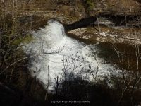
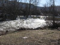
Stream/River/Watershed: |
Spruce Creek |
Height of Falls/Type: |
10 ft, Slide |
Elevation: |
1025 ft |
Level of Difficulty/Hiking Distance: |
Short |
Whitewater Rte/Canoe Rte Map: |
|
My Resource: |
Mohawk Region Waterfall Guide “From the Capital District to Cooperstown & Syracuse” By Russell Dunn 2007 |
Book Resource: |
Mohawk Region Waterfall Guide “From the Capital District to Cooperstown & Syracuse” By Russell Dunn 2007 |
Photos And Information I Contributed To or Posted To Other Websites: |
Northern New York Waterfalls |
Nearest Intersection: |
Hwy 29 and Fairview Rd |
Directions: |
From I-90 W, at Indian Castle, Take exit 29A to the right onto Rt-169 towards Little Falls/Dolgeville and drive for 2.7 miles. Turn right onto Hwy 167 E and drive for .4 miles. Turn left onto Hwy 167 and drive for 7.6 miles. Turn right onto Helmer Ave N and drive for 2.3 miles. Turn left onto Kingsley Rd for 519 ft, and park beside the road before the bridge. Spruce Creek Lower Falls Parking. Continue on Kingsley Rd and drive for .1 miles. Turn right onto Fairview Rd and drive for .1 miles. This will bring you to the parking area on the west side of the covered bridge. Spruce Creek Upper Falls Parking |
Comments/Notes: |
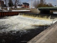
This bridge in Salisbury Center, carries Fairview Rd over Spruce Creek. It is a 50 foot span Kingpost with an Arch, built in 1875. National Register of Historic Places Date: June 19, 1972 |
For additional information on the 2 locations here please click on the following links:
Spruce Creek Upper Falls
Spruce Creek Lower Falls


")