Category Archives: Finger Lakes Region Waterfall Challenge

18 of Western New York State Parks and Waterfalls

Western New York Parks and Waterfalls

18 of Western New York State Parks and Waterfalls you can visit

1. Akron Lower Falls, Akron Falls Park, Akron Town Park, Erie County

Akron Falls Park, Erie County New York 2014

Akron Falls Park, Erie County New York 2014


2. Buttermilk Falls, North Evans, Hobuck Flats, Erie County

Buttermilk Falls, Erie County, New York, North Evans 2014

Buttermilk Falls, Erie County, New York, North Evans 2014


3. Emery Park Falls, Emery County Park
4. Eternal Flame Falls, Chestnut Ridge Park
5. West Falls (West Zoar Valley), West Falls Town Park
6. Papermill Falls, Community Park
7. Genesee Upper Falls aka Upper Letchworth Falls, Upper Falls
8. Honeoye Lower Falls, Harry Allen Park
9. Rochester Middle Falls, Maple Wood Park
10. Turning Point Park Falls – North Falls, Turning Point Park
11. Bridal Veil Falls, Niagara Falls, Niagara Falls State Park
12. Three Sisters Island Falls, Niagara Falls, Niagara Falls State Park
13. Grimes Glen Falls #7 Second Falls, Devil’s Bedroom, Grimes Glen
14. Glen Falls (Holley), Public Park
15. Stony Brook Glen, Lower Falls, Stony Brook State Park
16. Wolcott Falls, Wolcott Falls Park
17. Cascade Mill Falls, Keuka Outlet Park
18. Seneca Mill Falls, Keuka Lake Outlet

Lickbrook Falls Trail, no water!

Lickbrook Falls Trail, no water!

Powered by Wikiloc

Denison Falls at Cayuga Nature Center

Denison Falls at Cayuga Nature Center

Powered by Wikiloc

Excelsior Glen Upper section

Excelsior Glen Upper section

Powered by Wikiloc

Taughannock Falls State Park, Taughannock Upper Falls

Taughannock Falls State Park, Taughannock Upper Falls

Powered by Wikiloc

Taughannock Falls State Park, South Rim Trail

Taughannock Falls State Park, South Rim Trail

Powered by Wikiloc

Taughannock Falls State Park, Main Falls Trail

Taughannock Falls State Park, Main Falls Trail

Powered by Wikiloc
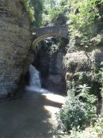
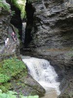
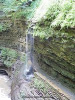
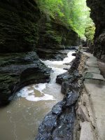
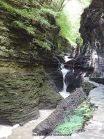
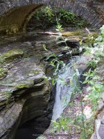
Diamond Falls, Watkins Glen State Park, Schuyler County, New York

Watkins Glen State Park and Waterfalls

Watkins Glen State Park and Waterfalls

Watkins Glen State Park and Waterfalls
Watkins Glen State Park and Waterfalls Schuyler County, Watkins Glen, New York

Stream or River: Glen Creek flows into Seneca Lake
Elevation: 1010 ft to 490 ft

Dates Visited:
6/13/1991 8/21/2004 8/10/2013

Maps and Resources used to gather information:
Western New York all outdoors Atlas & Field Guide Publication 2008 102 B3      
Watkins Glen Trail Map
200 Waterfalls In Central And Western New York By Rich And Sue Freeman
Finger Lakes Tourism Alliance website
World Waterfall Database
Nyfalls
Falzguy

Directions:
From I-90 W , Take exit 42 to the right onto Rt-14 towards Geneva/Lyons and drive for .7 miles. Take the Rt-14 S ramp to the right towards Rt-96/Geneva/Clifton Springs and drive for 5.8 miles. Turn right onto Castle Street and drive for .2 miles. Turn left onto Main Street and drive for 35.8 miles.                 
              
Length of Hike: 3 Miles Round Trip
Indian Trail 1.5 miles one way
South Rim Trail 4.5 miles one way
Gorge Trail 1.5 miles one way

Parking areas:
Parking N42.37550 W76.87305
Parking #2 N42.37427 W76.89228
South Parking N42.36961 W76.87263


Entrance Cascade Falls
Hike: approx. .2 to .3 miles
Falls: N42.37504 W76.87350
Landmark: Under the Sentry Bridge
Height: 41 ft
Elevation: 534 ft
Type: Cascade

Still Water Gorge
Falls: N42.37469 W76.87398
Landmark: The View Upstream From The Sentry Bridge
Height:
Elevation: 602 ft
Type: Chutes/Flumes/Pools

Minnehaha Falls aka Curtain Cascade Falls
Falls: N42.37451 W76.87488
Landmark: Flows into the heart shaped pool.
Height: 21 ft
Elevation: 657 ft
Type: Cascade

Cavern Cascade Falls
Hike: approx. .3 to .4 mile
Falls: N42.37447 W76.87557
Landmark: Walk Behind Falls And Into Spiral Tunnel
Height: 50 ft
Elevation: 677 ft
Type: Cascade/Flume

Whispering Falls
Falls: N42.37437 W76.87756
Landmark: Located in the section called the Narrows
Height:
Elevation: 734 ft
Type:

Diamond Falls
Hike: approx. .4 to .5 mile
Falls: N42.37432 W76.87786
Landmark: Located in the section called the Narrows.
Height: 12 ft
Elevation: 744 ft
Type:

The Narrows
Falls: N42.37410 W76.87842
Landmark: Lovers Lane
Height:
Elevation: 750 ft
Type: Chutes/Flumes/Pools

Glen Cathedral
Falls: N42.37385 W76.87929
Landmark: Folly Bridge Sylvan Rapids is in this area.
Height:
Elevation: 813 ft
Type: Chutes/Flumes/Pools

]

Sylvan Rapids
Falls: N42.37400 W76.87884
Landmark: This Is In The Section Known As Glen Cathedral
Height:
Elevation: 796 ft
Type: Rapids

Central Cascade Falls
Hike: approx. .6 mile
Falls: N42.37358 W76.88069
Landmark: Pass Thru Tunnel And Walk To Bridge Over It
Height: 60 ft
Elevation: 817 ft
Type: Plunge Cascade

Glen Of Pool Falls
Falls: N42.37344 W76.88140
Landmark: The Glen Of Pools Leads To Rainbow Falls.
Height:
Elevation: 827 ft
Type: Chutes/Flumes/Pools

Triple Cascade Falls
Falls: N42.37272 W76.88258
Landmark:
Height: 26 ft
Elevation: 858 ft
Type: Cascade

Rainbow Falls
Falls: N42.37275 W76.88254
Landmark: You Will Walk Under This Waterfall, stop long enough for a quick cool off!
Height: 95 ft
Elevation: 860 ft
Type:

Pluto Falls
Falls: N42.37231 W76.88484
Landmark: Located In The Section Of Spiral Gorge (Frowning Cliff)
Height: 9 ft
Elevation: 914 ft
Type:

]

Glen Omega Falls
Falls: N42.37218 W76.88519
Landmark:
Height:
Elevation: 925 ft
Type:

Pool Of Nymphs
Falls: N42.37211 W76.88540
Landmark: This Is In The Section Known As Glen Arcadia: Pluto Falls Glen Omega Falls
Height:
Elevation: 927 ft
Type: Chutes/Flumes/Pools

Mile Point Falls aka Arcadia Falls
Falls: N42.37186 W76.88641
Landmark: This marks the 1 mile mark of your hike. This is a stone bridge over this. You can walk over this and take the south rim trail back down or continue on up another half mile and take the shuttle back down.
Height: 12 ft
Elevation: 921 ft
Type: Cascade

Fairies Pool Falls
Falls:
Landmark:
Height:
Elevation: 950 ft
Type: Chutes/Flumes/Pools

Jacobs Ladder
Falls: N42.37139 W76.89098
Landmark: This Is The Section At The Top Of The Gorge Where The Rail Bridge Is
Height:
Elevation: 960 ft
Type: Chutes/Flumes

Taughannock Falls, Tompkins County, New York

Taughannock Falls State Park – Taughannock Creek & Waterfalls

Taughannock Falls State Park – Taughannock Creek & Waterfalls

Taughannock Falls State Park – Taughannock Creek & Waterfalls
Taughannock Falls State Park, Tompkins County, New York, Town of Ulysses
Stream or River: Taughannock Creek flows into Cayuga Lake

Other named waterfalls: Taughannock Lower Falls, Taughannock Upper Falls There are several more smaller falls.

Dates Visited: 7/15/2006 9/02/2006 5/6/2012

Maps and Resources used to gather information:
Western New York all outdoors Atlas & Field Guide Publication 2008 103 A5
200 Waterfalls In Central & Western New York “A Finders’ Guide” By Rich And Sue Freeman 2002
New York Waterfalls “A Guide For Hikers & Photographers” by Scott E. Brown 2010
Taughannock Falls State Park
Taughannock Falls State Park Map
falzguy
nyfalls
American Whitewater
American Whitewater

Directions:
From the New York State Thruway, take Exit 41 to 318 East for 4 miles. Head South on Route 89 for 35 miles.

Length of Hike:
Gorge Trail: 3/4 mile Easy
South Rim Trail: 1 1/8 mile Moderate
North Rim Trail: 1.5 mile Moderate

Parking areas:
Podunk Road Put In
N42.52331 W76.66265
Rt 96 bridge take out
N42.52989 W76.63718
Parking 4 Taughannock Park Road
N42.53058 W76.62130
Parking 3 Jacksonville Road
N42.53201 W76.61633
Falls Overlook Parking Taughannock Park Road
N42.53859 W76.60858
Parking Gorge Road
N42.54370 W76.59780

Taughannock Falls
Falls: N42.53533 W76.61067
Landmark: Crossover bridge at the base of the falls
Height: 215 ft
Elevation: 675 ft
Type: Plunge

Taughannock Lower Falls
Falls: N42.54473 W76.60126
Height: 15 ft
Elevation: 425 ft
Type: Step Cascade

Taughannock Upper Falls
Falls: N42.53236 W76.61586
Landmark: Railroad Trail
Height: 100 ft span
Elevation: 725 ft to 700 ft
Type: Narrow Cascade

From the Podunk Road to Rt 96 bridge section
Utilizing google imagery and the whitewater route, there is mention of description of 2 main sections. The following is approximate locations. The others may only be small rapids.

Falls Class 3+(4) double-ledge drop (8 ft)100+ft slide.  
N42.52793 W76.65260 900 ft
Falls                      N42.53047 W76.65101 889 ft
Falls                      N42.53071 W76.64827    869 ft
Falls                      N42.53224 W76.64458    865 ft
Falls                      N42.53216 W76.64284    866 ft
Falls  Class 3+(4) drop
N42.53162 W76.64186    866 ft
Falls                      N42.53081 W76.64084    847 ft
Falls                      N42.52991 W76.63889    852 ft
Falls                      N42.52965 W76.63788    850 ft
——————————————————————————————————-
From Rte. 96 bridge to Jacksonville Road section
Falls                      N42.52959 W76.63641    859 ft
Falls                      N42.52926 W76.63071    842 ft
Falls                      N42.52926 W76.62871    844 ft
Falls                      N42.52914 W76.62734
Falls                      N42.53309 W76.61734
Falls                      N42.53241 W76.61691    810 ft
——————————————————————————————————
From Jacksonville Road down to Highway 89
Falls                                                    N42.53237 W76.61589
Railroad Trail                                    N42.53247 W76.61556   775 ft
Taughannock Upper Falls           N42.53329 W76.61396
The next 2 maybe the Triple Drop section
Falls                                                    N42.53487 W76.61199
Falls                                                    N42.53528 W76.61105   704 ft
Tompkins Taughannock Falls    N42.53559 W76.61044
Crossover bridge                             N42.53689 W76.60901   573 ft
Falls                                                    N42.53872 W76.60363   533 ft
Falls                                                    N42.54332 W76.60238   414 ft
Taughannock Lower Falls           N42.54496 W76.60075   404 ft