Category Archives: Dam and Falls

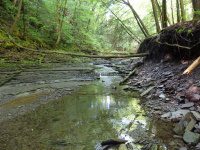
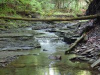
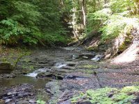
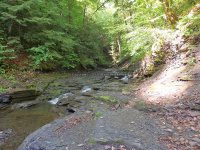
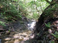
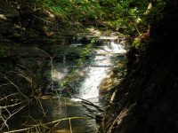
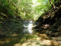
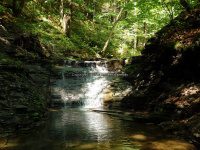
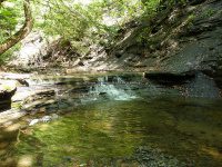
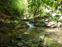
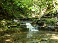
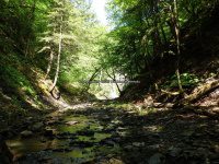
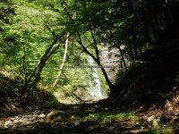
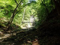
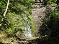
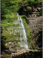
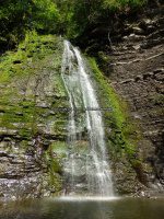
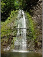
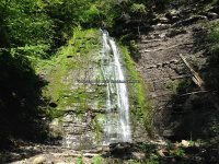
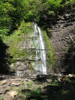
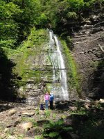
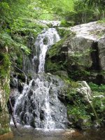
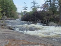
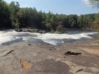
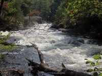
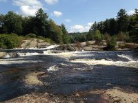
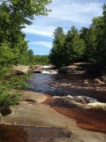
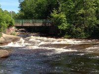
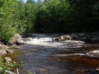
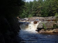
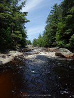
Shallow Pond Falls (3 waterfalls)

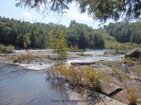
Shallow Pond Outlet – 3 Waterfalls

AKA:
—–
Location:
Webb Twn
First Visit:
6/25/2016
Region:
Central
County:
Herkimer
Park/Area:
—–
Gps of Falls:
N43.91938 W75.03960
Gps of Parking:
N43.89661 W75.05433
Gps of Trailhead:
—–
Trail Name/Reference to:
—–
Landmark:
2.0 miles one way .3 miles up from Kettle hole
Stream/River/Watershed:
Shallow Pond Outlet
Height of Falls/Type:
12 ft, first 2 falls are a series of twisting ledges, #3 upper most cascade drops 12 ft
Elevation:
1927 ft
Level of Difficulty/Hiking Distance:
2.0 miles one way
Wikiloc:
Whitewater Rte/Canoe Rte Map:
—–
Maps:
—–
Trails Websites:
—–
My Resource:
Discover the Northwestern Adirondacks, Four-Season Guide to the Oswegatchie Wilderness, 3rd Edition 2007, Barbara McMartin & Bill Ingersoll
Book Resource:
Discover the Northwestern Adirondacks, Four-Season Guide to the Oswegatchie Wilderness, 3rd Edition 2007, Barbara McMartin & Bill Ingersoll
Brochures/Travel Guides/Visitor Guides:
—–
Additional Information:
—–
Photos And Information I Contributed To or Posted To Other Websites:
Nearest Intersection:
Necessary Dam Rd and Stillwater Rd
Directions:
From County Rte 28 and Big Moose Rd, in Eagle Bay, Get on Big Moose Rd and drive north for 5.8 miles. Turn left onto Big Moose Rd and drive for 11.7 miles. Turn right onto Stillwater Rd, and drive .4 miles. Turn left onto Necessary Dam Rd and drive 1.2 miles to parking area for trailhead.
Comments/Notes:
—–
Shallow Pond Outlet Falls, Herkimer County, New York State, Waterfall

Shallow Pond Outlet Falls, Herkimer County, New York State, Waterfall

For additional information please click on the following links
Shallow Pond Falls #1
Shallow Pond Falls #2
Shallow Pond Falls #3

Kettle Hole Falls, Shallow Pond Outlet Falls, Stillwater-Wikiloc

Powered by Wikiloc

Ohisa Creek – 3 Main Waterfalls

Ohisa Creek – 3 Main Waterfalls

AKA:
—–
Location:
Stark Twn
First Visit:
5/30/2016
Region:
Central
County:
Herkimer
Park/Area:
—–
Gps of Falls:
—–
Gps of Parking:
N42.94244 W74.82590
Gps of Trailhead:
—–
Trail Name/Reference to:
—–
Landmark:
There is a gate, and enough room for maybe 2 cars to park.
Stream/River/Watershed:
Ohisa Creek
Height of Falls/Type:
15 ft, 10 ft, 80 ft, Cascades, Ledges, Slides, Freefall
Elevation:
881 ft to 1293 ft
Level of Difficulty/Hiking Distance:
This is a moderate to difficult hike. Give yourself at least 2 hours. You will be walking the stream bed most completely all the way. Use caution as it is slippery and dangerous in spots.
Wikiloc:
—–
Whitewater Rte/Canoe Rte Map:
—–
Maps:
—–
Trails Websites:
—–
My Resource:
Book Resource:
—–
Brochures/Travel Guides/Visitor Guides:
—–
Additional Information:
—–
Photos And Information I Contributed To or Posted To Other Websites:
—–
Nearest Intersection:
Hwy 168 and Fiery Hill Rd and Cramers Cors Rd
Directions:
From the intersection of Hwy 5 and Hwy 167, in Little Falls, Get on Hwy 167 and drive south for 2.0 miles. Bear left onto Hwy 167. Turn left onto Hwy 5s. Turn right onto Hwy 167 and drive for 2.2 miles. Keep left onto Newville Rd and drive for 0.2 miles. Bear left onto Newville Rd and drive for 1.8 miles. Turn right onto Newville Rd and drive for 0.3 miles. Turn right onto Johnny Cake Rd and drive for 1.0 miles. Turn left onto Travis Rd and drive for 1.7 miles. Turn left onto Hwy 168 and drive for 1.6 miles.
Comments/Notes:
From the gate by the roadside, you will see a worn path to the left that leads straight down to the creek bed. Follow the creek up until its end at the 80 ft waterfall. Keep in mind that electronic devices, cell phones, satellite may not work. Ours did not, even wikiloc did not track!!
Home » Ohisa Creek - 3 Main Waterfalls » Ohisa Creek falls on 5-30-2016

Ohisa Creek falls on 5-30-2016

Ohisa Creek falls on Herkimer Ny 5-30-2016_00001.JPG
Ohisa Creek falls on Herkimer Ny 5-30-2016_00001.JPG (Bobbie Sweeting)
Share on Twitter
Share on Pinterest
Ohisa Creek falls on Herkimer Ny 5-30-2016_00002.JPG
Ohisa Creek falls on Herkimer Ny 5-30-2016_00002.JPG (Bobbie Sweeting)
Share on Twitter
Share on Pinterest
Ohisa Creek falls on Herkimer Ny 5-30-2016_00003.JPG
Ohisa Creek falls on Herkimer Ny 5-30-2016_00003.JPG (Bobbie Sweeting)
Share on Twitter
Share on Pinterest
Ohisa Creek falls on Herkimer Ny 5-30-2016_00004.JPG
Ohisa Creek falls on Herkimer Ny 5-30-2016_00004.JPG (Bobbie Sweeting)
Share on Twitter
Share on Pinterest
Ohisa Creek falls on Herkimer Ny 5-30-2016_00005.JPG
Ohisa Creek falls on Herkimer Ny 5-30-2016_00005.JPG (Bobbie Sweeting)
Share on Twitter
Share on Pinterest
Ohisa Creek falls on Herkimer Ny 5-30-2016_00006.JPG
Ohisa Creek falls on Herkimer Ny 5-30-2016_00006.JPG (Bobbie Sweeting)
Share on Twitter
Share on Pinterest
Ohisa Creek falls on Herkimer Ny 5-30-2016_00007.JPG
Ohisa Creek falls on Herkimer Ny 5-30-2016_00007.JPG (Bobbie Sweeting)
Share on Twitter
Share on Pinterest
Ohisa Creek falls on Herkimer Ny 5-30-2016_00008.JPG
Ohisa Creek falls on Herkimer Ny 5-30-2016_00008.JPG (Bobbie Sweeting)
Share on Twitter
Share on Pinterest
Ohisa Creek falls on Herkimer Ny 5-30-2016_00009.JPG
Ohisa Creek falls on Herkimer Ny 5-30-2016_00009.JPG (Bobbie Sweeting)
Share on Twitter
Share on Pinterest
Ohisa Creek falls on Herkimer Ny 5-30-2016_00010.JPG
Ohisa Creek falls on Herkimer Ny 5-30-2016_00010.JPG (Bobbie Sweeting)
Share on Twitter
Share on Pinterest
Ohisa Creek falls on Herkimer Ny 5-30-2016_00011.JPG
Ohisa Creek falls on Herkimer Ny 5-30-2016_00011.JPG (Bobbie Sweeting)
Share on Twitter
Share on Pinterest
Ohisa Creek falls on Herkimer Ny 5-30-2016_00012.JPG
Ohisa Creek falls on Herkimer Ny 5-30-2016_00012.JPG (Bobbie Sweeting)
Share on Twitter
Share on Pinterest
Ohisa Creek falls on Herkimer Ny 5-30-2016_00013.JPG
Ohisa Creek falls on Herkimer Ny 5-30-2016_00013.JPG (Bobbie Sweeting)
Share on Twitter
Share on Pinterest
Ohisa Creek falls on Herkimer Ny 5-30-2016_00014.JPG
Ohisa Creek falls on Herkimer Ny 5-30-2016_00014.JPG (Bobbie Sweeting)
Share on Twitter
Share on Pinterest
Ohisa Creek falls on Herkimer Ny 5-30-2016_00015.JPG
Ohisa Creek falls on Herkimer Ny 5-30-2016_00015.JPG (Bobbie Sweeting)
Share on Twitter
Share on Pinterest
Ohisa Creek falls on Herkimer Ny 5-30-2016_00016.JPG
Ohisa Creek falls on Herkimer Ny 5-30-2016_00016.JPG (Bobbie Sweeting)
Share on Twitter
Share on Pinterest
Ohisa Creek falls on Herkimer Ny 5-30-2016_00017.JPG
Ohisa Creek falls on Herkimer Ny 5-30-2016_00017.JPG (Bobbie Sweeting)
Share on Twitter
Share on Pinterest
Ohisa Creek falls on Herkimer Ny 5-30-2016_00018.JPG
Ohisa Creek falls on Herkimer Ny 5-30-2016_00018.JPG (Bobbie Sweeting)
Share on Twitter
Share on Pinterest
Ohisa Creek falls on Herkimer Ny 5-30-2016_00019.JPG
Ohisa Creek falls on Herkimer Ny 5-30-2016_00019.JPG (Bobbie Sweeting)
Share on Twitter
Share on Pinterest
Ohisa Creek falls on Herkimer Ny 5-30-2016_00020.JPG
Ohisa Creek falls on Herkimer Ny 5-30-2016_00020.JPG (Bobbie Sweeting)
Share on Twitter
Share on Pinterest
Ohisa Creek falls on Herkimer Ny 5-30-2016_00021.JPG
Ohisa Creek falls on Herkimer Ny 5-30-2016_00021.JPG (Bobbie Sweeting)
Share on Twitter
Share on Pinterest
Ohisa Creek falls on Herkimer Ny 5-30-2016_00022.JPG
Ohisa Creek falls on Herkimer Ny 5-30-2016_00022.JPG (Bobbie Sweeting)
Share on Twitter
Share on Pinterest
Ohisa Creek falls on Herkimer Ny 5-30-2016_00023.JPG
Ohisa Creek falls on Herkimer Ny 5-30-2016_00023.JPG (Bobbie Sweeting)
Share on Twitter
Share on Pinterest
Ohisa Creek falls on Herkimer Ny 5-30-2016_00024.JPG
Ohisa Creek falls on Herkimer Ny 5-30-2016_00024.JPG (Bobbie Sweeting)
Share on Twitter
Share on Pinterest
Ohisa Creek falls on Herkimer Ny 5-30-2016_00025.JPG
Ohisa Creek falls on Herkimer Ny 5-30-2016_00025.JPG (Bobbie Sweeting)
Share on Twitter
Share on Pinterest
Ohisa Creek falls on Herkimer Ny 5-30-2016_00026.JPG
Ohisa Creek falls on Herkimer Ny 5-30-2016_00026.JPG (Bobbie Sweeting)
Share on Twitter
Share on Pinterest
Ohisa Creek falls on Herkimer Ny 5-30-2016_00027.JPG
Ohisa Creek falls on Herkimer Ny 5-30-2016_00027.JPG (Bobbie Sweeting)
Share on Twitter
Share on Pinterest
Ohisa Creek falls on Herkimer Ny 5-30-2016_00028.JPG
Ohisa Creek falls on Herkimer Ny 5-30-2016_00028.JPG (Bobbie Sweeting)
Share on Twitter
Share on Pinterest
Ohisa Creek falls on, Herkimer County, Ny 5-30-2016

High Falls Gorge (4 Named Waterfalls)

High Falls Gorge (4 Named Waterfalls)

High Falls Gorge (4 Named Waterfalls), Essex County, Wilmington Town
Stream or River: West Branch Ausable River flows into Lake Champlain
Date Visited: 8/17/2008
Nearest Intersection: Highway 86 and Fox Farm Road
Resources Used: Eastern Ny All Outdoors Atlas And Field Guide Publication 2008 Pg 95 E5
Adirondack Waterfall Guide “New York’s Cool Cascades” By Russell Dunn

High Falls Trail Map
Adirondack Great Walks & Day Hikes A Guide To Paths Less Taken In The Northeast’s Last Great Wilderness. You Can Download Or Request Brochures Here
Directions: From I-87 in Westport, Take exit 32 to the right towards Lewis/Willsboro drive for .3 miles. Turn left onto Stowersville Road and drive for 1.7 miles. Turn left onto US 9 and drive for 5.1 miles. Turn right onto Water Street and drive for 1.1 miles. Turn right onto Highway 9n and drive for 9.3 miles. Turn right onto Highway 9n and drive for 1.8 miles. Bear right onto Highway 9n and drive for 9.6 miles. Turn left onto Fox Farm Road and drive for .9 miles. Turn left onto Highway 86 and drive for 2.2 miles.
Trail Descriptions:
The Waterfall Walk is a moderate .5 mile loop, with many stairs.
The Easy Path is a .25 mile loop and is handicap accessible.

Main Falls aka Upper Falls (which has also at one point in time been referred to as Climax Falls)

From the first overlook upstream is Main Falls and below the overlook is Mini Falls
Mini Falls aka Lower Falls

From the first overlook upstream is Main Falls and below the overlook is Mini Falls
Master Pothole
From the second bridge over the river, called the center of the gorge, both Upper and Lower Falls can be viewed from here. Looking upstream is Mini Falls. Looking downstream is the top of Rainbow Falls. When you return to the Waterfall Walk, to continue downstream, the Master Pothole is located to the left of the path. Look Straight down.
Rainbow Falls

Can be viewed from the bridge (center of the gorge, or from the last bridge.
Climax Falls

The last bridge over the river, you look upstream to see Climax Falls first, then above that is Rainbow Falls.

Hanging Spear Falls-Flowed Lands

Hanging Spear Falls-Flowed Lands

Hanging Spear Falls-Flowed Lands, Essex County, Town of Newcomb, Adirondack Park

Hanging Spear Falls-Calamity Brook Trail

Powered by Wikiloc

Stream or River: Opalescent River flows into the Hudson River
Date Visited: 10/15/2008
Resources Used:
Eastern Ny All Outdoors Atlas And Field Guide Publication 2008 Pg 103 D4
Adirondack Waterfall Guide “New York’s Cool Cascades” By Russell Dunn

Directions:
From I-87 N South of North Hudson, Take exit 29 to the right towards Newcomb/North Hudson and drive .2 miles. Turn left onto Blue Ridge Road and drive 17.6 miles.Turn right onto Tahawus Road and drive .4 miles. Turn left onto Tahawus Road and drive another 5.9 miles. Turn left onto Upper Works Road and drive 3.5 miles to the parking area and trailhead.
Trail Description:
Calamity Brook Trail Hanging Spear Falls
Moderate to Difficult over 5 miles one way

Points of Reference and Photo Locations:
Hanging Spears Parking N44.08909 W74.05646 1780 ft
Walkbridge Photos  Hudson River N44.09217 W74.05800 1823 ft

Henderson Lake Photos N44.09337 W74.05734 1825 ft
Trail Sign-parking Area Sign N44.09388 W74.05698 1837 ft
First Bridge With Waterfall Calamity Brook N44.10014 W74.04356 1934 ft
From the first bridge and waterfalls to beginning trailhead

Home » Hanging Spear Falls-Flowed Lands » Hanging Spear Falls Trail Hike #10-from the first bridge and waterfalls to beginning trailhead

Second Bridge Calamity Brook N44.10175 W74.03602 1978 ft
Waterfall Photos N44.10075 W74.02988 2032 ft
Second bridge to the first bridge
Home » Hanging Spear Falls-Flowed Lands » Hanging Spear Falls Trail Hike #9-second bridge to the first bridge

State Land Boundry Sign N44.10254 W74.02556 2216 ft
Sign in at trail head to state boundry sign

Home » Hanging Spear Falls-Flowed Lands » Hanging Spear Falls Trail Hike #1-sign in at trail head to state boundry sign

State Land Boundry Sign N44.10254 W74.02556 2216 ft
From lean to back to state boundry sign
Home » Hanging Spear Falls-Flowed Lands » Hanging Spear Falls Trail Hike #8-from lean to back to state boundry sign

High Water Bridge Photos N44.10689 W74.02121 2399 ft
On the High Water Bridge Calamity Brook N44.10730 W74.02047 2405 ft
Calamity Brook N44.10748 W74.02035 2418 ft

David Henderson Monument N44.11242 W73.99913 2685 ft
From state boundry sign to henderson monument

Home » Hanging Spear Falls-Flowed Lands » Hanging Spear Falls Trail Hike #2-from state boundry sign to henderson monument

David Henderson Monument N44.11242 W73.99913 2685 ft
Trailhead Register N44.11318 W73.99326 2757 ft
Our Lean to N44.11123 W73.99210 2765 ft
From henderson monument to lean to

Home » Hanging Spear Falls-Flowed Lands » Hanging Spear Falls Trail Hike #3-from henderson monument to lean to

Our Lean to N44.11123 W73.99210 2765 ft
Hanging Spear Dam N44.10784 W73.99085 2758 ft
From lean to start to the dam
Home » Hanging Spear Falls-Flowed Lands » Hanging Spear Falls Trail Hike #4-from lean to start to the dam

From the dam back to the lean to
Home » Hanging Spear Falls-Flowed Lands » Hanging Spear Falls Trail Hike #7-from the dam back to the lean to

Hike Falls Waterfall Photos N44.10621 W73.99073 2746 ft
Hike Falls 6 N44.10582 W73.99082 2744 ft
Waterfall Stop Photos N44.10562 W73.99073 2740 ft
Hike Falls 5 N44.10531 W73.99082 2727 ft
Hike Falls Opalescent Falls N44.10482 W73.99081 2704 ft
Hike Falls Opalescent Falls Photos N44.10463 W73.99081 2694 ft
Hike Falls 4 N44.10446 W73.99081 2684 ft
Hike Falls Photos N44.10426 W73.99062 2678 ft
Hike Falls 3 N44.10407 W73.99080 2663 ft
Hike Falls 2 N44.10357 W73.99080 2614 ft
Hike Falls N44.10301 W73.99079 2559 ft
Opalescent Upper Falls


Opalescent Falls

Mr Snake N44.10219 W73.99024 2524 ft
Hanging Spear Falls N44.10185 W73.99077 2481 ft
Cliffside Hanging Spear Photos N44.10168 W73.99075 2467 ft
Overlook Photos N44.10152 W73.99077 2456 ft

Hanging Spear Falls

Trail Turned Around N44.10089 W73.99034 2442 ft
Livingston Point Lean To N44.11259 W73.98897 2767 ft
Lean to photos    Flowed Lake N44.11331 W73.98970 2756 ft

From the dam to livingston lean to
Home » Hanging Spear Falls-Flowed Lands » Hanging Spear Falls Trail Hike #5-from the dam to livingston lean to

Livingston lean to back to dam
Home » Hanging Spear Falls-Flowed Lands » Hanging Spear Falls Trail Hike #6-livingston lean to back to dam

St. Huberts Area (6 Main Waterfalls and several others)

St. Huberts Area (6 Main Waterfalls and several others)

St. Huberts Area (6 Main Waterfalls and several others), Essex County, Keene Town

St Hubert’s area Hiking trail

Powered by Wikiloc

Date Visited: 8/11/2011
Resources Used:
Eastern NY All Outdoors Atlas and Field Guide Publication 2008 pg 103 D6
Adirondack Waterfall Guide “New York’s Cool Cascades” By Russell Dunn
World Waterfall Database
Adirondack Waterways A Guide to paddling routes in the Northeast’s last great wilderness. You can download or request brochures
here
Trail Description:
East River Trail and West River Trail
It is approximately a 10 mile loop. The trail can be difficult and muddy, please use caution. Give yourself plenty of time, along with food and water. Be sure to carry along all necessary items, such as first aid kits, flashlights etc.
Nearest Intersection:
St Huberts Road And Ausable Club Road And Lake Road
Directions:
From I-87 N in North Hudson, Take exit 30 to the right onto US-9 towards Rt-73/Keene Valley/Keene and drive for .2 miles. Turn left onto US 9 and drive for 2.2 miles. Keep left onto Hwy 73 N and drive for 5.4 miles. Turn left onto Ausable Rd and drive for .2 miles to the parking area.

Note:
This is a re-construction of the hike. At the time of my visit, I did not use tracking devices. Distance does not included some of the spur trails. This is to the best of my ability.
Points of reference, time and mileage included as close as possible.
 
Arrived a parking area at 8:25 am
Ausable Club Rd Parking
N44.14903 W73.77027 1282 ft
Arrived at the gate and sign in at 8:53 am (.5 mile walk down Ausable Club Road)
St Huberts Rd and Ausable Club Rd and Lake Rd Parking
N44.15066 W73.77899

Crossed over a wooden footbridge at 8:57 am (.3 miles) We are now .8 miles into the hike.
Trail sign for WA White trail Lower Wolfjaw Snow Mtn and Roostercomb                    N44.15010 W73.78399 1305 ft
Crossed over a wooden footbridge at 9:10 am (.3 miles) We are now 1.1 miles into the hike.
First trail sign for bear run Cathedral Rocks and Pyramid Brook
N44.14678 W73.78884 1360 ft


Arrived at trail for Pyramid Brook at 9:38 am (.6 miles) We are now 1.7 miles into the hike.
Second trail sign for direct route to pyramid brook near falls and Cathedral Rock    N44.14290 W73.79918 1524 ft

Arrived at trail for Wedge Brook Cascades at 10:58 am (.8 miles) We are now 2.5 miles into the hike.
Wedge Brook Cascades Sign for Wedge Brook Cascades 200 yards, Wolfjaw, and Beaver Meadow Falls Lower Lake
N44.13561 W73.81070


Arrived at Beaver Meadow Falls and crossed another wooden bridge about 11:38 am (.6 miles) We are now 3.1 miles into the hike.
Beaver Meadow Falls E Branch Ausable River
N44.12906 W73.81573 1912 ft

Trail sign for Gothic and Armstrong
N44.12867 W73.81684 1923 ft


Arrived at trail sign for Rainbow Falls at 11:41 am  (.8 miles) We are now 3.9 miles into the hike.
Trail sign for Gothics and Armstrong, west river trail and lower lake, and Rainbow Falls N44.11862 W73.82529 1954 ft
Trail sign for Alfred w weld trail to gothics, rainbow falls
N44.11861 W73.82641 2030 ft

Arrived at Rainbow Falls at about 12:36 pm
Rainbow Falls N44.11860 W73.82589

Trail sign for Indian Head Fishhawk Cliffs and Colvin
N44.11756 W73.82409 2018 ft

Trail Sign for Indian Head Fishhawk Cliffs
N44.11410 W73.82202 2525 ft

Arrived at Fishhawk Cliffs at about 2:16 pm (.7 miles) We are now about 4.6 miles into the hike.
Trail sign for Indian Head, and Gothic Window 117 feet
N44.11028 W73.82390 2497 ft

Trail sign for road, Indian head, colvin, nipple top, fishhawk cliffs and Elk Pass .4 miles N44.11065 W73.81628 2442 ft
Trail sign for road and gill brook trail, Indian head, colvin, nipple top, fishhawk cliffs   .3 miles
N44.11506 W73.81522 2283 ft


 We are now at the start of the falls along Gill Brook  2:47 pm and at about 5.3 miles into the hike. From this point along Gill Brook Trail to Lake Road is another 1.2 miles giving it at 6.5 miles
Gill Brook Falls 9 10 ft Gill Brook
N44.11999 W73.81125 2101 ft

Gill Brook Falls 8 Long Slide Gill Brook
N44.12080 W73.81075 2071 ft

Gill Brook Falls 7 Flume Gill Brook
N44.12148 W73.81035 2055 ft

Gill Brook Falls 6 25 ft Gill Brook
N44.12198 W73.81019 2026 ft

Gill Brook Falls 5 9 ft Cascade Gill Brook
N44.12247 W73.81003 1994 ft

Gill Brook Falls 4 15 ft Flume Gill Brook
N44.12293 W73.80988 1972 ft

Gill Brook Falls 2 Chute Gill Brook
N44.12397 W73.80948 1918 ft


From this Trail sign at the end of the Gill Brook Trail (or the beginning) and back to the parking area is an additional 2.6 miles giving a total of about 9.1 miles.
Trail sign for gill brook trail, gill brook colvin indian head Lake Rd
N44.12967 W73.80676 1701 ft


Tooley Pond Road Waterfalls (12 Named Waterfalls)

Tooley Pond Road Waterfalls (12 Named Waterfalls)
Whitewater Route Twin Falls Section of Grass River Lower South Branch
St Lawrence County, Town of Clare
Grasse River Wild Forest
 
Date Visited: 10/7/2010
 
Stream or River: Grass River Lower South Branch flows into the St Lawrence River

Resources Used:

Eastern NY All Outdoors Atlas and Field Guide Publication 2008 pg 99 A6
Eastern New York All Outdoors Atlas and Field Guide Publication 2008 pg 100 A1
Adirondack Waterfall Guide By Russell Dunn
Adk Park Map Saranac P. Smith
American Whitewater Grass River Lower South Branch
Adirondack Great Walks & Day Hikes A Guide to paths less taken in the Northeast’s last great wilderness. You can download or request brochures here
For additional information, click on the highlighted links: 
Rainbow Falls aka Large Marge 
Whip-it Good IV
Location: N44.31161 W75.00152
Type: Rapids
Landmark: Located between Rainbow Falls and Flat rock Falls at the .6 mile mark.
Flat Rock Falls IV
Location: N44.31841 W75.00759

Height: 25 ft
Type: Ledge slide drop, Tiered
Landmark: Camp Flat Rock

Bulkhead Falls
Location: N44.33146 W75.01765
Height: 25 ft
Type: Slide
Hike: Bulkhead Falls Trail, Maybe 16 Minutes Round trip
Landmark: Look For Sign That States No Motor Vehicle Access.
Adrenaline Falls IV
Location: N44 19.895 W75 01.303
Height: 12 ft
Type: Slide
Landmark: Before this there is a dirt road giving a good view of both falls. After this is the top of the falls, where the mill was located.

Stewart Rapids
Location: N44.33241 W75.02317
Height: 24 ft
Type: Rapids
Hike: Roadside

Twin Falls
Booney Falls
Location: N44.33376 W75.02931
Hike: Short
Landmark: Approximately .3 Mile North Of Twin Falls

Sinclair Upper Falls
Sinclair Falls aka Iron Bridge
Basford Falls
Degrasse Graffiti Rapids

Eagle Falls ( 1 Main Waterfall and several small ones)

Eagle Falls ( 1 Main Waterfall and several small ones)


Eagle Falls ( 1 Main Waterfall and several small ones)
Eagle Falls Section, Beaver River Whitewater Route
Lewis County, Town of Watson
Adirondack Park
Date Visited: My first visit to the location was back in 2006. I revisited again on 9-7-2015
 Stream or River: Beaver River flows into the Black River
Resources Used:
Beaver River Canoe Route
Beaver River Project FERC 2645
New York Atlas & Gazetteer Delorme Publication 2007 Pg 85 A6
American Whitewater Eagle Falls

I Love New York, Adirondacks Tug Hill Region Lewis County Visitor’s Guide

Directions:
From the intersection of Hwy 126 and Hwy 812 and Covent Road in Croghan, take Covent Road East for .3 miles. At this point Covent Road name changes to Kircherville Road. Continue East on Kircherville Road for 2.6 miles. At this point you will be at the intersection with Erie Canal Road. Continue straight. The road name now changed to Soft Maple Road, which is also Beaver River Road. Continue on Soft Maple Road for another 9 miles. Turn Left onto Canoe Launch Road for .7 miles. Which takes you to its end at the Eagle Falls Dam and Canoe Launch.


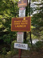
From the beginning of Canoe Launch Road, (intersection of Maple Soft Road and Canoe Launch Road), you will pass by Eagle Falls Powerhouse and Scenic Overlook Falls.

 
At about .3 miles you will come to the Eagle Falls takeout and Parking area, at which is the trail for the falls along their up to the dam.
 
Note: I believe from this trail you are only looking at the bottom portion of Eagle Falls. I plan to go back next season.

Parking Areas:
Eagle Falls put in                                                    N43.90172 W75.19481
Eagle Falls Take Out                                              N43.90677 W75.19860
Eagle Falls Powerhouse                                        N43.91001 W75.20142 1320 ft
Soft Maple Parked before bridge                        N43.91561 W75.22542 1320 ft

Soft Maple Scenic Overlook Falls Area Parking N43.91775 W75.22924 1285 ft

Points of Reference:
Eagle Reservoir                                                       N43.89727 W75.19018 1431 ft
Eagle Falls Dam                                                      N43.90092 W75.19337 1431 ft

Penstock begins                                                     N43.90306 W75.19589 1413 ft
Canoe rest area                                                      N43.90696 W75.19873 1361 ft

Penstock ends                                                        N43.90960 W75.20096 1302 ft
Eagle Falls Powerhouse                                        N43.91001 W75.20307
Upper Soft Maple Reservoir                                N43.91561 W75.22009 1293 ft
Soft Maple Reservoir                                             N43.91682 W75.22430
Soft Maple Development Overnight Camping Area N43.91596 W75.22410 1305 ft

Trail Description:
Parking at the Eagle Falls take out where the canoe rest area is, the trail starts here, and you can work your way up to the top where you will come to the base of the Eagle Falls Dam.
 
Before I get into describing the section of trail we actually took, I want to state that to actually get to the Eagle Falls portion you will need to cross over a portion of the stream/river. We seen where someone had left a board there for crossing, but it really did not occur to us that it was the cross over access to the actual falls. From what I can tell, is that from the base of the Eagle Falls Dam, the section of river splits. Of course we did not know this, and would have known if we had known how to access at the top where the dam is. The best way for me to describe is standing at the dam and looking down, Eagle Falls would be to your right and we were to the left. I would like to call it an big huge rock Island, which I am sure is not the proper name. We plan to return to this location in the future.
 
So, from the parking area, take the trail under the penstock and go right. The trail to begin with is very easy to follow. There were some very wet/muddy spots. For the most part the lower section of trail to where it meets the water is relatively easy to moderate. The last section, towards the top is difficult. The first .1 mile, there did not appear to be anything much going on. The first and second set of photos you will see before reaching the bottom of Eagle Falls. Your first view of the bottom portion of Eagle Falls is about .2 miles. In a couple hundred feet more, you will come to the section they call the overlook, as well as your about straight across from the bottom of Eagle Falls. From this point forward you need to use extreme caution as you now will be climbing upwards. It is about 250 feet to get to the bottom of this last section. If you follow the trail well above this last location you will not have a very good photo opportunity. However, if you go in from the bottom up, you will be walking on a slant, which is all flat smooth surfaced rock. When I say slippery, that is exactly what it was. We had leaves on top of moss. When you reached the top from here you will be standing at the base of the dam and beside the penstock. You will have to retrace your steps back down the trail, because at that point we could not figure out how to cross over to the road and just take the road back down. Total round trip is about .8 miles.
For additional information click on the following links 
Eagle Falls
Eagle Falls Dam
Eagle Falls Lower Section
Eagle Falls Powerhouse and Scenic Overlook Falls
Eagle Falls Scenic Overlook Area
Soft Maple Reservoir Dam and Falls
 
I have recorded the tracks for the Eagle Falls section and trail which can be viewed and downloaded, click on the following link.
Wikiloc Beaver River Whitewater Route Eagle Falls Section

Powered by Wikiloc

Taylorville Waterfalls (7 Waterfalls)

Taylorville Waterfalls (7 Waterfalls)
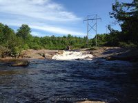
Taylorville Whitewater Section of the Beaver River
Lewis County, Town of Croghan

I have recorded the tracks for the upper waterfalls and trail only and can be viewed and downloaded, click on the following link.

Wikiloc Taylorville Whitewater Section

Powered by Wikiloc

Date Visited: 9-7-2015
 
Stream or River: The Beaver River flows into the Black River
 
Resources Used:
Eastern New York All Outdoors Atlas and Field Guide Publication 2008 pg 106 B3
American Whitewater-Beaver River Taylorville Section
Beaver River Project
Adirondack Tug Hill Attractions
 
Directions:
From the intersection of Hwy 126 and Hwy 812 in Croghan, take Hwy 812 north for .7 miles. (At .4 miles is Croghan Island Falls) Turn Right onto Belfort Road and drive for 3.6 miles. (Take note at .6 miles you will see High Falls Road on your left and this leads to High Falls Dam.) (Take note that at about 3.2 miles Belfort road veers left. Also here is Belfort Falls and Dam). Turn right onto Long Pond Road and drive another .1 mile to Taylorville Road which bears right. Continue on Taylorville Road for .5 miles. (Note: just before you reach the end you will see a dirt road off to your left. This is Double Eddy Road and if you continue another .5 miles to the end, it will lead you to the other falls in this area.
 
Parking Areas:
1-Double Eddy Road
N43.92734 W75.31376

2-End of Double Eddy Road
N43.92798 W75.31224

3-Taylorville Road
N43.92755 W75.32154

These photos are of the parking area before reaching the end of Double Eddy Road


Trail Description:
From the parking area near the end of Double Eddy road (Parking area photos shown above), you have two choices, either walk up to the end of Double Eddy Road and down to the start, or take the trail at the parking that starts after going under the penstock, either way it is about .2 miles. The trails are very easy to follow. I will describe how we went. We chose the trail right there by the parking. From the penstock, follow the wide trail down and to your left for about .2 miles. You will come out to the approximate area of the Beaverator Rapids. From here we turned left and followed the trail up about 280 ft to the put in location below the first dam. From here we walked over to the footbridge to take some snap shots of the kayakers starting off. We then crossed the bridge and went up the hill for about another 380 ft, that will take you to the top of both Dams and a nice view of Taylorville Pond. From here we retraced our steps back to the bottom of Taylorville Dam and Falls, (which is the second dam). In fact you can view both dams right from the walk bridge. From Taylorville Falls, we walked back down to the Beaverator Rapids section. At this point you will have walked .4 miles. Continue down the trail for about another .1 miles, which brings you to the top of the Great White Slide. You will find plenty of places to sit and relax and enjoy the view. From here you can either turn around and go back up or continue down the trail to the bottom of the Great White Slide. This trail will take you down and around to the picnic area on the other end of the lake. To continue on the trail, pick your way down and follow the trail around the lake for about .2 miles. Note: at .1 miles you will have come back to the trail you started at for the parking area. Continue left at this point to go to the picnic area. From the picnic area you will have a long distant view of the Great White Slide. From the location of the picnic table, continue straight a few hundred feet, and you will be at the top of the Dogleg Rapids. I could not figure out how to hop, skip and/or jump across to get to the top of the Mindscrambler. From here return back to the picnic table. Off to the left you will see a path that you can pick your way down to the bottom to get views of both the Dogleg Rapids and the Mindscrambler Rapids. Keep in mind that it does not appear as a very well used path. I would say most folks stop and turn around from the picnic area. This side scramble is about another 390 ft. At this point we decided to back track back to the parking area, and head down to the take out. I cannot tell you what the continuance of the trail maybe from the picnic area down to the take out. By the time you get back to the parking area you will now have walked about 1.1 miles. From here drive down to the Taylorville Power Plant, and park in designated areas. From there you will walk directly to the fence line headed towards the river. There is a gate that is open during events. From the gate you have two choices, taking the path straight ahead leads to the take out and a distant view of the Powerline Rapids. There was no trail at the take out that we could find to follow the river up. The other option is from the gate turn left and follow the penstock a short distance. Look for a pretty good travelled trail off to your right that leads down to Powerline Rapids. Take note that this path is not as well cared for as the trail for the upper waterfalls. You will have to pick your way down. The total distance down to the river and back maybe about .4 miles.

Photo Locations for the first two dam and falls:
On the walk bridge looking up to first dam
N43.92702 W75.31093 1067 ft

Taylorville Pond Top of first dam Taylorville Pond
N43.92771 W75.31070 1058 ft

Taylorville Pond Top of second dam
N43.92731 W75.31031 1093 ft

 
Taylorville Dam
Falls Location:
N43.92746 W75.31102

Elevation: 1046 ft
Type: Dam and Falls

 
First Dam and Put in Location


Views of the First Dam from the cross over bridge

 
Looking down from the top of the First Dam

 
Taylorville Falls aka Double Eddies
Falls Location:
N43.92703 W75.31016
Elevation: 980 ft
Type: Dam and Falls


Beaverator IV-Rapids
Photo Location: Beaverator IV-Rapids
N43.92666 W75.31125
Falls Location:
N43.92618 W75.31102
Elevation: 1050 ft
Type: Class IV Rapids


Great White Slide aka Taylorville Lower Falls
Photo Location: Great White Slide
N43.92552 W75.31224
Falls Location:
N43.92506 W75.31189

Height: 60 ft to 70 ft
Elevation: 1047 ft
Type: Long Slide Class III Rapids
Home » Taylorville Waterfalls (7 Waterfalls) » Taylorville Great White Slide III Rapids aka Taylorville Lower Falls 9-7-2015

 
Trail and Picnic area:
N43.92603 W75.31443


Photo Locations for Dogleg III Rapids and Mindscrambler Rapids
Photo Location: Dogleg III-Rapids
N43.92545 W75.31449

Photo Location: Looking back up at Dogleg Rapids and Mindscrambler
N43.92588 W75.31584

 
Dogleg III-Rapids  
Falls Location:
N43.92532 W75.31463
Landmark: Right side of island
Elevation: 1025 ft
Type: Class III+ Rapids

 
Mindscrambler Rapids
Falls Location:
N43.92534 W75.31709
Landmark: Left side of island
Elevation: 1000 ft
Type: Narrow Sluice Class III Rapids

 
The photos here include Dogleg III Rapids and Mindscrambler Rapids

 
Taylorville Lower Trail (2)


Powerline Boof IV-Rapids

Falls Location:
N43.92592 W75.31846
Landmark: Power Plant
Height: 8 ft
Elevation: 975 ft
Type: Class IV Rapids Slide on left 8 ft Drop on right


Between Take Out and Powerline

 
Looking Down at Take Out

 
Taylorville Take Out
N43.92540 W75.32038


Otter Creek Falls on: Eatonville Falls (7 Waterfalls)

Otter Creek Falls on: Eatonville Falls (7 Waterfalls)
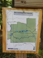
Otter Creek State Forest
Whitewater section on Otter Creek

Partridgeville Road to Pine Grove Road
Lewis County, Martinsburg Town

Named Waterfalls:
First Rapid IV aka Eatonville Falls,
Bridge Rapid (Class IV, Mile 0.1),
Boof III (Class III, Mile 0.3),
Ledges III (Class III, Mile 0.8),
Birdbath III (Class III+, Mile 1.0),
Eagles Talon 5.1 (Class 5.1, Mile 1.2),
Crumbly Dam (Class IV+, Mile 1.8)


I have recorded the tracks for the trail section near the bridge. This can be viewed and downloaded, click on the following link.

Wikiloc Otter Creek Falls

Powered by Wikiloc

Date Visited: 6/7/2015
We did not see all the falls for this location and plan to go back.

Stream or River: Otter Creek flows into the Black River

 
Resources Used:
Eastern New York All Outdoors Atlas And Field Guide Publication 2008 pg 107 E4
Otter Creek – Partridgeville Road to Pine Grove Rd.
http://www.adirondackstughill.com/index.php/site/attractions/waterfalls

Directions to Eatonville Camping and Picnic area:
From the town of Greig at the intersection of Blue Street (Main Street name changes to Blue Street) and Greig Road drive southeast on Greig Road for about 1.4 miles. Bear left onto Odett Road and drive .3 miles to Pine Grove Road. Turn left again, then a right onto Eatonville Road. Drive 1.4 miles on Eatonville Road, which changes to Otter Creek Truck Trail. Drive over the bridge to the parking area. The falls are located upstream and downstream from the bridge. A short trail is on both sides of the creek.

Directions to Take Out Location:
From the town of Greig at the intersection of Blue Street (Main Street name changes to Blue Street) and Greig Road drive southeast on Greig Road for about .5 miles. Turn left onto Otter Creek Road and drive about 1.5 miles. Turn left here onto Pine Grove Road and drive about .1 mile. Turn right here onto Chases Lake Road. There is a take out near the dam for the kayak-canoe route.

Parking Areas:
Eatonville Road
N43.71461 W75.34312 942 ft
Chases Lake Road
N43.71930 W75.36558 796 ft


Trail Description:
From the bridge looking upstream you can see the main falls from the bridge. There are trails on both sides of the creek both upstream and downstream. For upstream, we took the left side trail, and for downstream the right side trail, which is very easy.
.1 mile upstream and back

.2 miles total downstream and back
First Rapid IV aka Eatonville Falls
Closest Intersection: Eatonville Road And Van Arnam Road
Location: N43.71350 W75.34201
Height: 15 ft to 20 ft
Elevation: 950 ft
Type: Class IV Rapid Slide Steps
Hike: Short

Photo Location:
N43.71401 W75.34241

N43.71451 W75.34314


Bridge Rapid IV On Otter Creek
Closest Intersection: Eatonville Road And Van Arnam Road
Location: N43.71446 W75.34336
Height: 4 ft
Elevation: 925 ft
Type: Slide Class IV
Hike: Roadside
Photo Location:

N43.71460 W75.34334
N43.71481 W75.34397

Boof III (Class III, Mile 0.3)
Closest Intersection: Eatonville Road And Van Arnam Road
Location: N43.72010 W75.34459
Height: 1 ft to 2 ft

Elevation: 909 ft
Type: Drop
Hike: .3 mile from the Eatonville bridge located at the small campground and picnic area on Eatonville Road

Photo Location:
N43.71522 W75.34425

Ledges III (Class III, Mile 0.8)
Closest Intersection: Eatonville Road And Van Arnam Road
Location: N43.72355 W75.34748
Height 5 ft

Elevation 900 ft
Type: Ledges
Hike: .8 mile from the Eatonville bridge located at the small campground and picnic area on Eatonville Road.


Birdbath III (Class III+, Mile 1.0)
Closest Intersection: Chases Lake Road And Pine Grove Road
Location: N43.72391 W75.35282
Height: 15 ft To 20 ft

Elevation: 874 ft
Type: Slide Flume
Hike: 1 mile from the Eatonville bridge located at the small campground and picnic area on Eatonville Road

Eagles Talon 5.1 (Class 5.1, Mile 1.2)
Closest Intersection: Chases Lake Road And Pine Grove Road
Location: N43.72421 W75.35998
Height:

Elevation: 818 ft
Type: Class 5.1 Rapids
Hike: 1.2 mile from the Eatonville bridge located at the small campground and picnic area on Eatonville Road.

Crumbly Dam IV (Class IV+, Mile 1.8)
Closest Intersection: Chases Lake Road And Pine Grove Road
Location: N43.71885 W75.36449
Height: 8 ft To 10 ft

Elevation: 783 ft
Type: Dam Slide Ledges
Hike: 1.8 mile from the Eatonville bridge located at the small campground and picnic area on Eatonville Road.

Otter Creek Falls On (Partridgeville Road) Greig Town
Closest Intersection: Partridgeville Road And 10 Mile Truck Trail
Location: N43.72602 W75.17355
Elevation: 1525 ft
Hike: Roadside
From the intersection of Highway 12 and Burdicks Crossing Road going south from the town of Greig, turn left onto Burdicks Crossing Road and drive 1.4 miles to the intersection with Greig Road. Turn left onto Greig Road and drive .7 miles and turn right onto Brantingham Road. Drive on Brantingham Road for 3.6 miles. You will now be in the little town of Brantingham. Turn left onto Partridgeville Road, which is a dirt road. Drive about 7.5 miles to its end. The small falls are right there on your right at the turn around.

Independence River Falls on (5 Waterfalls)

Independence River Falls on (5 Waterfalls)
Whitewater section of the Independence River
Donnattsburgh Road to Old Pine Grove Road
Lewis County, Town of Greig

The Independence River was named to honor the national holiday by surveyor/engineer Pierre Pharoux in the 1790’s. In those days, the French called the Salmon “La Famine.”

Named Waterfalls: This area is named the Independence River Falls and includes the following waterfalls and rapids: The Wall Rapids, Bridge Boof Rapids, Fat Lady Rapids, Boof III-Rapids and Powerline III Rapids.

I have recorded the tracks for the section of trail near the Rudd Road bridge. This can be viewed and downloaded, click on the following link.

Wikiloc Independence River Falls

Powered by Wikiloc

Date Visited: 6/7/2015
I have not seen all of them. Plans to return in the future.

Stream or River: Independence River flows into the Black River
 
Resources Used:
Eastern New York All Outdoors Atlas and Field Guide Publication 2008 pg 106 D3
American Whitewater Independence River Donnattsburgh Road to Old Pine Grove Road

Directions:
From the intersection of Highway 12 and Glenfield Road, drive .2 miles east on Glenfield Road. You will come to an intersection of Main Street. Turn left onto Main Street and drive .2 miles to a right onto Grieg Road. Drive .5 miles on Grieg Road to a left onto Otter Creek Road. Drive 1.5 miles on Otter Creek Road to the intersection of Pine Grove Road. Turn left here onto Pine Grove Road and drive 1.4 miles. Where Rudd Road is on your right. Turn onto Rudd Road and drive .3 miles to the end where the bridge is out. This is the take out spot for the whitewater rafters.

Comment: Northern New York Waterfalls has this location listed as Rudd Road falls on aka Hidden Falls.

Parking Areas:
Put In: Donnattsburg Road
N43.74708 W75.33344

Powerline Possible Parking: Oxbow Lane
N43.74168 W75.34586

Boof III-Rapids Possible Parking: Independence Lane
N43.73631 W75.35352

Falls Parking: Rudd Road
N43.73213 W75.36155

Take Out: Pine Grove Road
N43.73080 W75.36493


Trail Description:

Powerline III Rapids (Class III, Mile 1.4) Town of Turin
Closest Intersection: Rudd Road And Pine Grove Road
Location: N43.74271 W75.34621

Elevation: 883 ft
Type: Class III Rapids
Hike Distance: 2.6 Mile Round Trip

 
Boof III-Rapids (Class III+, Mile 2.1)
Closest Intersection: Chases Lake Rd and Independence Ln
Location: N43.73804 W75.35348

Elevation: 859 ft
Type: Class III+ Rapids
Hike Distance: 1.2 Mile Round Trip

Independence River Falls
Closest Intersection: Rudd Road And Pine Grove Road
Location: N43.73378 W75.35958
Height: 50 ft
Elevation: 825 ft
Type: Slides, Rapids
Hike Distance: .4 Mile Round Trip

 
Along West Side Trail
Photo Locations:
N43.73388 W75.36024
N43.73357 W75.36052

Fat Lady Rapids
Closest Intersection: Rudd Road And Pine Grove Road
Location: N43.73311 W75.36026
Landmark: Located in the area of the old diversion dam.
Elevation: 825 ft
Type: Slide Class IV+ Rapids
Hike Distance: .4 Mile Round Trip


Bridge Boof Rapids aka Rudd Road falls on aka Hidden Falls
Closest Intersection: Rudd Road And Pine Grove Road
Location: N43.73206 W75.36123
Landmark: Located at the bridge
Height: 50 ft
Elevation: 800 ft
Type: Rapids
Hike Distance: .5 Mile Round Trip


The Wall Rapids Independence River
Closest Intersection: Rudd Road And Pine Grove Road
Location: N43.73195 W75.36131
Landmark: Less than 200 feet below the bridge
Elevation: 775 ft
Type: Class IV Rapids
Hike Distance: Short

Photo Locations:
N43.73157 W75.36196 783 ft
N43.73166 W75.36174 776 ft

Independence River falls on Pine Grove Rd
Closest Intersection: Rudd Road And Pine Grove Road
Location: N43.73089 W75.36340
Elevation: 775 ft
Type: Rapids
Hike Distance: Roadside
Drive By