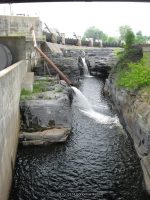
Ithaca Falls Natural Area, Fall Creek
Ithaca Falls Natural Area
Powered by Wikiloc


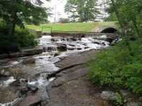
Cascadilla Upper Gorge Falls, Tompkins County, New York
AKA: |
—– |
Location: |
Webb Twn |
First Visit: |
6/27/2016 |
Region: |
Central |
County: |
Herkimer |
Park/Area: |
—– |
Gps of Falls: |
N43.85042 W74.99808 |
Gps of Parking: |
N43.85105 W74.99816 |
Gps of Trailhead: |
—– |
Trail Name/Reference to: |
—– |
Landmark: |
—– |
Stream/River/Watershed: |
Twitchell Creek |
Height of Falls/Type: |
—– |
Elevation: |
1734 ft |
Level of Difficulty/Hiking Distance: |
Roadside view |
Wikiloc: |
—– |
Whitewater Rte/Canoe Rte Map: |
—– |
Maps: |
—– |
Trails Websites: |
—– |
My Resource: |
Google Imagery |
Book Resource: |
—– |
Brochures/Travel Guides/Visitor Guides: |
—– |
Additional Information: |
—– |
Photos And Information I Contributed To or Posted To Other Websites: |
Digthefalls |
Nearest Intersection: |
Big Moose Rd and Woods Lake Rd |
Directions: |
From County Rte 28 and Big Moose Rd, in Eagle Bay, Get on Big Moose Rd and drive north for 5.8 miles. Turn left onto Big Moose Rd, and continue for 7.6 miles. Turn right onto Wood Lake Rd, which will be a loop road. Park off to the side and you will see the waterfall from the road. There is a gate at the beginning of Woods Lake Rd, please respect private property. |
Comments/Notes: |
There are five more waterfalls on Twitchell Creek. If anyone can help me with the access to them please contact me. N43.845556 W74.986245, N43.847463 W74.995043, N43.848699 W74.995787, N43.845819 W74.983879, N43.841484 W74.982408 |
For additional information on the one location I have please click on the following link

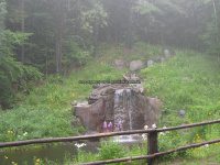
Twitchell Creek, falls on, Herkimer County, New York, Waterfall
Twitchell Creek Falls and Cascades
AKA: |
—– |
Location: |
Webb Twn |
First Visit: |
6/27/2016 |
Region: |
Central |
County: |
Herkimer |
Park/Area: |
—– |
Gps of Falls: |
N43.83756 W74.89447 |
Gps of Parking: |
N43.84081 W74.89351 |
Gps of Trailhead: |
—– |
Trail Name/Reference to: |
—– |
Landmark: |
Twitchell Lake |
Stream/River/Watershed: |
Twitchell Creek |
Height of Falls/Type: |
total 100 ft spanned over 1/3 mile, several small cascades and 1 large cascade |
Elevation: |
2079 ft |
Level of Difficulty/Hiking Distance: |
.3 miles walking back down the road from the parking area brings you to the trail. Look for a faint pink double ribbon on a tree. It then is a couple hundred feet to the top of the large falls. |
Wikiloc: |
|
Whitewater Rte/Canoe Rte Map: |
—– |
Maps: |
—– |
Trails Websites: |
—– |
My Resource: |
Discover the Central Adirondacks, Four-Season Adventures in the Heart of the Northwoods, 4th Edition 2007, Barbara McMartin & Bill Ingersoll |
Book Resource: |
Discover the Central Adirondacks, Four-Season Adventures in the Heart of the Northwoods, 4th Edition 2007, Barbara McMartin & Bill Ingersoll |
Brochures/Travel Guides/Visitor Guides: |
—– |
Additional Information: |
—– |
Photos And Information I Contributed To or Posted To Other Websites: |
Digthefalls |
Nearest Intersection: |
Twitchell Inn Rd and Pond Trl |
Directions: |
From County Rte 28 and Big Moose Rd, in Eagle Bay, Get on Big Moose Rd and drive north for 5.8 miles. Turn left onto Big Moose Rd and drive for 1.7 miles. Turn right onto Twitchell Rd and drive 2.1 miles to parking area. |
Comments/Notes: |
As you are walking down the road you will see several small cascades and some can be seen from the road. A short scramble/bushwhack will lead you to another waterfall here N43.83862 W74.89346 Please use caution in this area. Not a good location for children. For the main waterfall, the trail is easy and short. You can continue on the trail to the base of the waterfall. It is steep in some spots, and close to the edge of the waterfall. |
For further information on this area, please click on the following links:
Twitchell Creek Falls and Cascades #1 bridge falls
Twitchell Creek Falls and Cascades #2
Twitchell Creek Falls and Cascades #3
Twitchell Creek Falls and Cascades #4 Main Falls
Twitchell Creek Falls and Cascades
Shallow Pond Outlet – 3 Waterfalls
AKA: |
—– |
Location: |
Webb Twn |
First Visit: |
6/25/2016 |
Region: |
Central |
County: |
Herkimer |
Park/Area: |
—– |
Gps of Falls: |
N43.91938 W75.03960 |
Gps of Parking: |
N43.89661 W75.05433 |
Gps of Trailhead: |
—– |
Trail Name/Reference to: |
—– |
Landmark: |
2.0 miles one way .3 miles up from Kettle hole |
Stream/River/Watershed: |
Shallow Pond Outlet |
Height of Falls/Type: |
12 ft, first 2 falls are a series of twisting ledges, #3 upper most cascade drops 12 ft |
Elevation: |
1927 ft |
Level of Difficulty/Hiking Distance: |
2.0 miles one way |
Wikiloc: |
|
Whitewater Rte/Canoe Rte Map: |
—– |
Maps: |
—– |
Trails Websites: |
—– |
My Resource: |
Discover the Northwestern Adirondacks, Four-Season Guide to the Oswegatchie Wilderness, 3rd Edition 2007, Barbara McMartin & Bill Ingersoll |
Book Resource: |
Discover the Northwestern Adirondacks, Four-Season Guide to the Oswegatchie Wilderness, 3rd Edition 2007, Barbara McMartin & Bill Ingersoll |
Brochures/Travel Guides/Visitor Guides: |
—– |
Additional Information: |
—– |
Photos And Information I Contributed To or Posted To Other Websites: |
|
Nearest Intersection: |
Necessary Dam Rd and Stillwater Rd |
Directions: |
From County Rte 28 and Big Moose Rd, in Eagle Bay, Get on Big Moose Rd and drive north for 5.8 miles. Turn left onto Big Moose Rd and drive for 11.7 miles. Turn right onto Stillwater Rd, and drive .4 miles. Turn left onto Necessary Dam Rd and drive 1.2 miles to parking area for trailhead. |
Comments/Notes: |
—– |

Shallow Pond Outlet Falls, Herkimer County, New York State, Waterfall
For additional information please click on the following links
Shallow Pond Falls #1
Shallow Pond Falls #2
Shallow Pond Falls #3
Kettle Hole Falls, Shallow Pond Outlet Falls, Stillwater-Wikiloc

Updated Waterfall Locations in Sullivan County New York 2-21-2016
These waterfall locations are located in Sullivan County, New York in the Town of Liberty
There is a small rest area with picnic tables. You will find the small trail fairly easy and almost straight back from picnic tables. Located on the Little Beaver Kill this is a very Short Scramble.

There was a new restaurant built here. The sign stated opening soon. There was a high privacy fence on both sides of this building with no way to see the falls. The name of the place is Eden By The Falls. Located on the Mongaup River and is a 6 foot Drop that can be seen from the roadside.

You can see this waterfall from the bridge in the distance. Further up the road there is a trail that leads to the falls. Even though the trail looks very well warn, please also note there are posted signs right by the falls. Located on the Little Beaver Kill this waterfall is a 10 foot plunge and seen from the roadside.


Updated Waterfall Locations in Warren County New York 2-20-2016
The following waterfall locations are in Warren County, New York in the Towns of Lake Luzerne, Chester, and South Glens Falls.
Glens Falls South Located in South Glens Falls, borders the counties of Warren and Saratoga
South Glens Falls Historical Park, The South Glens Falls Hydroelectric Project
Dam and Falls /Hudson River
Mill Park Falls (Lake Luzerne) Located in Lake Luzerne Town
Mill Park Lake/Luzerne Village Park
25 ft Slide Roadside
Rockwell Falls (Lake Luzerne) aka Jessups Little Falls, Luzerne Falls
Located in Lake Luzerne Town, borders the counties of Warren and Saratoga
Rockwell Falls Church/Bridge Of Hope
Hudson River 10 ft Horseshoe Cascades Roadside
Trout Brook Falls (Adirondack Natural Stone Bridge and Caves) Located in Chester Town
Trout Brook 8 ft Various Types
Moderate to Difficult
Natural Stone Bridge and Caves
Natural Stone Bridge and Caves Park Map

Updated Double Drop Falls (Flint Creek) in Ontario County, New York 2-12-2016
Double Drop Falls (Flint Creek)
Flint Creek
10 ft and 5 ft Ledges
1.2 Mile Round Trip


11-2-2014 New Additions and Updates
THE FOLLOWING LOCATIONS HAVE BEEN ADDED
FALLBROOK FALLS in ONEIDA COUNTY
STONEY BROOK FALLS in OSWEGO COUNTY
These are located at The High Braes Refuge Campgrounds
JENNY CREEK FALLS in ST LAWRENCE COUNTY