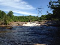
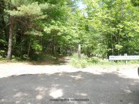
Fowlerville falls
Fowlerville falls and lower falls


Fowlerville falls and lower falls
Forestport ny area
made a revisit to forestport.


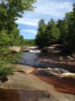
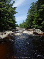
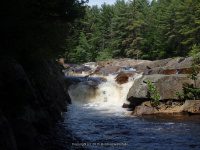
Small falls along route 274
Small falls along route 274
went driving around yesterday just for the fun of it. Here is some small falls along route 274.


9/5/2015 Lewis County Ny Waterfalls, Croghan
Beaver Falls (Croghan)

Beaver Falls Map Croghan

As you can see here Google imagery showed falls here, but there was no falls. I asked a couple of folks that were fishing from the tracks when was the last time they had seen any amount of water running, and they said next to never. I am not sure at this time when they would be.

View looking downstream standing on the railroad tracks

View looking upstream standing on the railroad tracks

View looking downstream standing on the railroad tracks

Belfort Dam And Falls Map

Belfort Dam and Falls Map (2) from Google imagery

Belfort Dam Parking 9-5-2015_00001

Belfort Dam And Falls (1) 9-5-2015_00002

Belfort Dam And Falls (1) 9-5-2015_00002

Belfort Dam And Falls (2) 9-5-2015_00005 Directly on the bridge across from the big dam you will see this.

Belfort Dam And Falls (2) 9-5-2015_00005

This is across from the parking area, and the trail leads down below the dam.
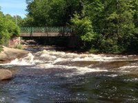
Twin Bridge Falls (New Bremen)

Croghan Island Falls Map

Croghan Islands Falls Map Google imagery

Croghan Island Bridge

Croghan-Island-Falls-1-9-5-2015_00002

Croghan-Island-Falls-1-9-5-2015_00003

Croghan-Island-Falls-2-9-5-2015_00004

Croghan-Island-Falls-2-9-5-2015_00003
High Falls (Croghan)

High Falls Croghan Map

High Falls Croghan Map Google imagery

High-Falls-Croghan-Parking-9-5-2015_00004

High-Falls-Croghan-Parking-9-5-2015_00007

High-Falls-Croghan-Parking-9-5-2015_00006

High-Falls-Dam-And-Falls-Croghan-9-5-2015_00001

High-Falls-Dam-And-Falls-Croghan-9-5-2015_00007

High-Falls-Dam-And-Falls-Croghan-9-5-2015_000010

High-Falls-Dam-And-Falls-Croghan-9-5-2015_000011

High-Falls-Croghan-2-9-5-2015_00003 I was standing up near the dam, and the area shown here would be the west side of the dam.

High-Falls-Croghan-2-9-5-2015_00004

Jerden Fall Map 2

Jerden Fall Map Google imagery

Looking up at top section of Jerden Falls

Top section of Jerden Falls

Top section of Jerden Falls

Looking down on Jerden Falls lower section

Jerden Falls lower section
Taylorville Whitewater Section Lewis County, NY 9/7/2015
The map below shows a good portion of the route that I had tracked.
This is where we parked, which was the start point of the tracking. (Note: We did not go to the end of Double Eddy Road to park, as there was no room to park at the time) From there we took the trail which comes out to the bottom of the second falls.

Above alternate parking

Above is the trail
When we got to the end of the trail we wanted to start from the put in at the first dam. The trail length is less then .1 mile.
Taylorville Dam aka Taylorville Falls

Above the Put In

(Above) Looking downstream from the small walk bridge at the Put In

This is the second dam. Taylorville Lower Falls

The 2 dams combine and flow into a section called the Beaverator IV-Rapids


In the photo above I tried capturing one of the guys coming thru, the next guy went under but came out okay.

Above shows the section to the right of the second dam, viewed from the main trail.

(Above) We are approaching the top of the Great White Slide Section. The following photos are of the Great White Slide area.


The following photos were taken down along the trail to where there was a picnic table. Note: In the photo above, where the tree line is at back end of photo is where the picnic area is.) Just continue down the trail from the bottom of the Great White Slide.


(Above) This is the trail viewed from the picnic area.

The next set of photos are taken at the picnic area. This section I believe is the Dogleg III Rapids and Mindscrambler III Rapids section. I took photos from the top, and then we walked around further down to get some lower views.


It was at this point we back tracked and went to our vehicle and drove down to the take out on Taylorville Road. Which is at the power plant. Silly me also thought I was still tracking, BUT did not turn it back on, so I will do my best to detail.
To view the Take Out section, and to view the Powerline Boof IV Rapids Section from the bottom. From the parking area you will walk through the gate and continue straight ahead following the small path to the river.

(Above) This is on your right before going through the gate. You will have the power plant on your left, the river straight ahead and then if you go right before the fence line the short graveled road leads to the canoe boat launch area.

The next set of photos are taken at the Take Out site.


The next set of photos are also taken from the Take Out section looking upstream towards Powerline Boof IV Rapids Section.


From here we back tracked back towards the parking area. When you reach the gate, turn and walk right along the fence line and follow the penstock a short distance. You will see a small path that leads again back to the river. The following photo is a visual from where I was standing at the trail that leads down to the river, and I am looking back up towards the parking area.

These photos are of the Powerline Boof IV Rapids Section


To explore this whole section from start to finish took us about 2 1/2 hours. For actual walking distance in both areas maybe about 1 1/2 miles.
Taylorville Whitewater Section on the Beaver River 9/7/2015


I cannot believe it is September already!
It has been a seemly long summer. I have not had the chance to see new waterfalls or make a road trip. I do have a tentative one planned for the upcoming weekend. I have had some changes in my life, and had some re adjusting to do.
In the meantime, I have been working on some changes to the website, which will not yet take place for a few more months.
I did however, hit a burn out phase on researching and plotting waterfalls to visit. But, at least that part is done, and can quickly pull out a road trip.
I am also working on a side project, which also came to a stand still. History along with the research of is a downfall for me, but I am getting it done.
So with this, I thank all my followers and reader for re visiting my website. Hope everyone has enjoyed their summer! Check out the up coming events in the Adirondacks!! Lots of things going on for the whitewater folks as well.
Three Falls Woods, Onondaga County, New York
Three Falls Woods contains three separate waterfalls. The most direct trail to the base of the waterfalls is approximate 1.6 miles round trip.
The Falls from left to right is Staircase Falls, Tall Twin Falls and then Cascade Falls.
To see the tracks for the trail on Wikiloc for Filmore Corners-Three Falls Woods
For additional information on these waterfalls go to Three Falls Woods, or the individual links above.
The next few sets of photos were taking on the trail at the top and above the three main falls.
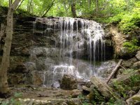
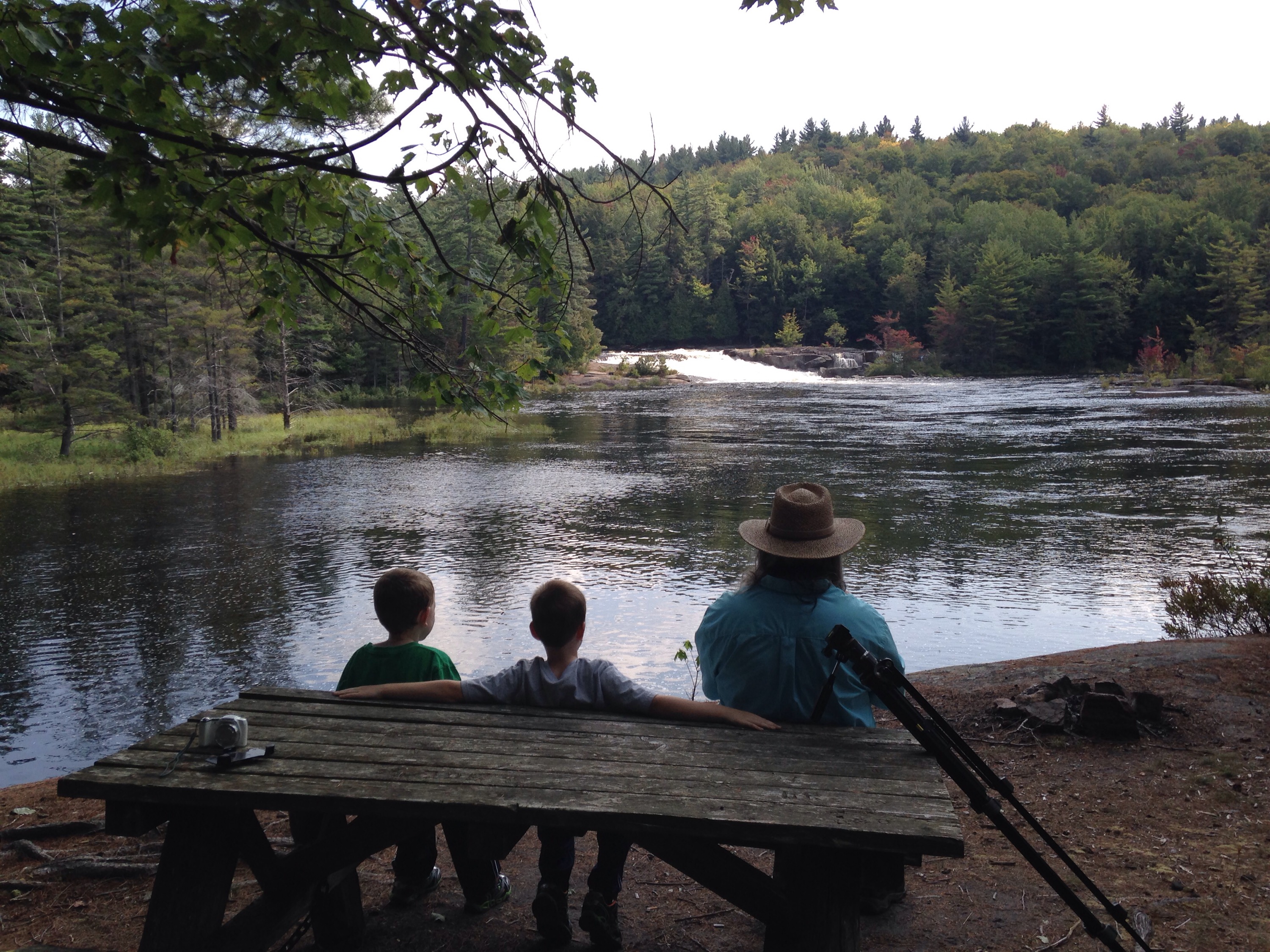
Eatonville Falls, Lewis County Waterfall Trip on 6-7-2015 part 3
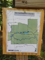
From the town of greig at the intersect of blue street (main street name changes to blue street) and greig road drive southeast on greig road for about 1.4 Miles. Bear left onto odett road and drive .3 Miles to pine grove road. Turn left again then a right onto eatonville road. Drive 1.4 Miles on eatonville road which changes to otter creek truck trail. Drive over the bridge to the parking area.
Small campground and picnic area, no restrooms! There are trails on both sides going upstream. I only took the trail on the right going downstream. The trails are very easy.
American Whitewater Rafting Route Otter Creek: Partridgeville road to Pine Grove Road
Tracks for Eatonville Falls on the Otter Creek Trail location on Wikiloc
EATONVILLE FALLS MAY BE NAMED THE FIRST RAPID ON THE WHITEWATER ROUTE FOR THIS SECTION.
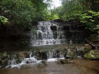
EATONVILLE FALLS on OTTER CREEK
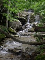
BRIDGE RAPID IV on OTTER CREEK
THIS LAST SECTION IS LOCATED A SHORT DISTANCE DOWN BELOW THE BRIDGE
Lewis County Waterfall Trip on 6-7-2015 part 1
From the intersection of highway 12 and glenfield road, drive .2 Miles east on glenfield road. You will come to an intersection of main street. Turn left onto main street and drive .2 Miles to a right onto grieg road. Drive .5 Miles on grieg road to a left onto otter creek road. Drive 1.5 Miles on otter creek road to the intersection of pine grove road. Turn left here onto pine grove road and drive 1.4 Miles. Where rudd road is on your right. Turn onto rudd road and drive .3 Miles to the end where the bridge is out. This is the take out spot for the whitewater rafters.
The trail is fairly easy and is .5 mile round trip on the west side trail. The falls below the bridge is only a few hundred yards and also can be viewed from the bridge.
Additional Resources
EASTERN NY ALL OUTDOORS ATLAS AND FIELD GUIDE
From the American Whitewater Rafting Route: Bradish Road to Old Pine Grove Road
Wikiloc tracks for The Independence River Falls
Parking and Trail head.
Photos taken here also include the Bridge Boof IV Rapids, and Fat Lady IV Rapids
I believe by the photos, that the Bridge Boof IV Rapids may also be the same as Hidden Falls
RUDD ROAD FALLS on INDEPENDENCE RIVER aka HIDDEN FALLS
BRIDGE BOOF IV-RAPIDS on INDEPENDENCE RIVER
FAT LADY IV-RAPIDS on INDEPENDENCE RIVER
Fat Lady is located in the section below the Independence River Falls. The photos are included under the Independence River Falls.
The Wall IV Rapids and the Independence river (falls on) are located downstream from the bridge. I firmly believe I had viewed the latter from the other road, as can see by the tracking.
THE WALL IV-RAPIDS on INDEPENDENCE RIVER
This section are the photos I had taken when we took the trail on the west side of the river, going as far as we could just below the dam. Another trip is planned to this location taken the trail on the east side to go further upstream for the other falls listed here.


