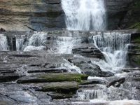
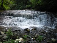
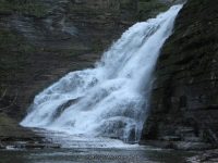
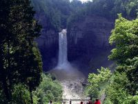
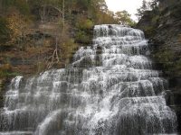
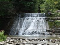
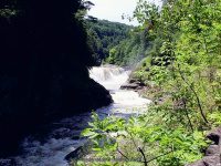
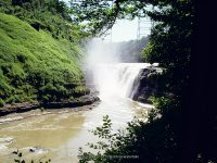
Waterfalls of New York State 100+ Challenge, Dig the Falls, part 3, The Finger Lakes Region
For more information on this challenge click here
To purchase “Waterfalls of New York State”, click here
To purchase “A Waterfall Guide to Letchworth State Park” by Scott A. Ensminger and Douglas K. Bassett, click here
The following list, is the third set of locations listed in the book by “Waterfalls of New York State” by Scott A. Ensminger (Western New York Waterfall Survey), David J. Schryver (Northern New York Waterfalls) and Edwards M. Smathers (Dig the Falls) Be sure to check them out! I myself have personally contributed a lot of waterfall location information to both Mr. Edward Smathers and Mr. David Schryver. I am currently a team member with “Dig the Falls”. The simple rules of this challenge, is to visit 100 waterfall locations in the book. One location may have several waterfalls, counts as one location. Click on the links (I have visited) in the boxes below, which will take you to additional information pages.
Please refer to “A Waterfall Guide to Letchworth State Park” by Scott A. Ensminger and Douglas K. Bassett, serious Letchworth State Park is a region of it’s own!!
Side Note: as I am putting this all together, I have additional photos that I never uploaded, my bad!
Waterfall Name, info |
Additional Falls in location, or close by |
County |
Date First visited |
Photo |
Chittenango Falls Chittenango Falls State Park 167 ft Easy to moderate Hike |
….. |
Madison |
7-4-2001 |
|
Chittenango Twin Sister Falls Chittenango Falls State Park Easy to moderate Hike |
additional falls |
Madison |
7-4-2001 |
|
Pratts Falls Pratts Falls County Park 137 ft Cascade Short Hike |
….. |
Onondaga |
6-24-2002 |
|
Unnamed Falls Largest of 6 other unnamed falls in park Pratts Falls County Park 30 ft Short Hike |
additional falls |
Onondaga |
No |
….. |
Tinkers Falls aka Labrador Falls, Tully Falls Labrador Hollow State Nature Preserve 45 ft, Plunge About 15 Minutes rt to the bottom |
….. |
Cortland |
4-11-2008 |
|
Bucktail Falls Green Gully 35 ft Total |
….. |
Onondaga |
3-23-2008 |
|
Bucktail Additional falls: Green Gully Upper Falls #04 75 ft, Upper Falls #05 3 Small falls, Upper Falls #03 20 ft, Upper Falls #02 Small falls, Upper Falls #01 Appx Location/Need Info |
additional falls |
Onondaga |
No |
….. |
Carpenter Falls aka Grey Cliff Falls Bahar Preserve 76 ft .4 Mile rt |
….. |
Cayuga |
8-10-2008 |
|
Bear Swamp Cascades Bahar Preserve 10 ft/14 ft series of cascades Private/No Access |
additional falls |
Cayuga |
No |
….. |
Carpenter Second Falls Bahar Preserve 1.0 Mile Rt |
additional falls |
Cayuga |
8-10-2008 |
….. |
Carpenter Middle Falls, Bahar Preserve 60 ft, Cascade 1.0 Miles rt, Downstream from Carpenter Falls |
additional falls |
Cayuga |
8-10-2008 |
|
Carpenter In-Between Falls Bahar Preserve 1.0 Mile Rt |
additional falls |
Cayuga |
8-10-2008 |
|
Carpenter Rooster Tail Falls Bahar Preserve 1.0 Mile Rt |
additional falls |
Cayuga |
8-10-2008 |
….. |
Carpenter Lower Falls aka Angel Falls Bahar Preserve 62 ft 1.0 Miles rt, Downstream from Carpenter Falls |
additional falls |
Cayuga |
8-10-2008 |
|
Carpenter Lower Falls #02 Bahar Preserve 1.0 Mile Rt |
additional falls |
Cayuga |
8-10-2008 |
|
Cowsheds Falls aka Lower Falls, Dry Falls Fillmore Glen State Park 37 ft 4 Mile Loop 2 Hours |
….. |
Cayuga |
6-19-2004 |
|
Cowsheds Upper Falls, Fillmore Glen State Park 14 ft 4 Mile Loop 2 Hours |
additional falls |
Cayuga |
6-19-2004 |
|
Dalibarda Falls aka Delbardi Falls Fillmore Glen State Park 85 ft 4 Mile Loop 2 Hours |
additional falls |
Cayuga |
6-19-2004 |
|
Pinnacle Lower Falls, Fillmore Glen State Park 14 ft 4 Mile Loop 2 Hours |
additional falls |
Cayuga |
6-19-2004 |
|
Pinnacle Upper Falls, Fillmore Glen State Park 14 ft 4 Mile Loop 2 Hours |
additional falls |
Cayuga |
6-19-2004 |
|
Hog Back Falls aka Upper Falls Fillmore Glen State Park 80 ft .5 Mile rt |
additional falls |
Cayuga |
6-19-2004 |
|
Ludlowville Falls Ludlowville Park 45 ft .2 mile rt |
….. |
Tompkins |
7-15-2006 |
|
Little Ludlowville Falls aka Salmon Creek falls .5 mile |
additional falls |
Tompkins |
9-17-2017 |
….. |
Ithaca Falls aka Olympic Falls Fall Creek Gorge/Ithaca Falls Natural Area 150 ft Total .4 mi rt |
….. |
Tompkins |
5-25-2008 |
|
Forest Falls Fall Creek Gorge/Ithaca Falls Natural Area 20 ft Approx 2 Mile Rt/W for 4 Falls |
additional falls |
Tompkins |
5-25-2008 |
|
Horseshoe Falls Fall Creek Gorge/Ithaca Falls Natural Area Approx 2 Mile Rt/W for 4 Falls |
additional falls |
Tompkins |
5-25-2008 |
….. |
Foaming Falls Fall Creek Gorge/Ithaca Falls Natural Area 15 ft Approx 2 Mile Rt/W for 4 Falls |
additional falls |
Tompkins |
5-25-2008 |
|
Rocky Falls aka Sibley Falls Fall Creek Gorge/Ithaca Falls Natural Area 25 ft Cascade Approx 2 Mile Rt/W for 4 Falls |
additional falls |
Tompkins |
5-25-2008 |
|
Fall Creek Tributary Falls (Falls in woods) Fall Creek Gorge |
additional falls |
Tompkins |
9-17-2017 |
|
Triphammer Falls Fall Creek Gorge/Ithaca Falls Natural Area 55 ft/80 ft total Less than .2 mi rt |
additional falls |
Tompkins |
5-25-2008 |
|
Triphammer Falls, Top drop Fall Creek Gorge/Ithaca Falls Natural Area 35 ft/80 ft total Less than .2 mi rt |
additional falls |
Tompkins |
5-25-2008 |
….. |
Buttermilk Lower Falls Buttermilk Fall State Park 90 ft Gorge Trail: 0.75 miles. Strenuous, Rim Trail: 0.75 miles Strenuous, Bear Trail: 0.5 miles. Moderate, Lake Treman: 1.5 miles. Easy |
….. |
Tompkins |
7-15-2006 |
|
Buttermilk Upper Falls Buttermilk Fall State Park 80 ft Long sloped Cascade |
additional falls |
Tompkins |
7-15-2006 |
|
Buttermilk Falls State Park Additional Falls: Pulpit Falls, 2 tiered, Pinnacle Lower Falls, 9 ft, Pinnacle Middle Falls, Lower Gorge Area, 19 ft, Pinnacle Upper Falls, Lower Gorge Area, 5 ft, Shower Bath Falls, 18 ft, Flume Falls |
additional falls |
Tompkins |
No |
….. |
Owl Creek, series of cascades Buttermilk Falls State Park Just a short distance from trailhead |
additional falls |
Tompkins |
No |
….. |
Lake Treman Falls Buttermilk Falls State Park 35 ft 1.5 mile |
additional falls |
Tompkins |
No |
….. |
Owl Creek Falls Buttermilk Falls State Park 70 ft Trailhead used is from parking area inside the park, possible creekwalk up to the falls |
additional falls |
Tompkins |
No |
….. |
Lower Falls Robert H. Treman State Park 32 ft Gorge Trail: 2.25mi./Rim Trail: 2.25mi./Red Pine Trail: 0.5mi./CCC Memorial Trail: 0.33mi. |
….. |
Tompkins |
7-15-2006 |
|
Fish Kill Falls aka Enfield Falls. Old Mill Falls Robert H. Treman State Park 15 ft/15 ft Gorge Trail: 2.25mi./Rim Trail: 2.25mi./Red Pine Trail: 0.5mi./CCC Memorial Trail: 0.33mi. |
additional falls |
Tompkins |
7-15-2006 |
|
Devil’s Kitchen Falls aka Lucifer Falls above (Enfield Glen) Robert H. Treman State Park 15 ft Gorge Trail: 2.25mi./Rim Trail: 2.25mi./Red Pine Trail: 0.5mi./CCC Memorial Trail: 0.33mi. |
additional falls |
Tompkins |
7-15-2006 |
….. |
Lucifer Falls aka Enfield Falls, Enfield Creek & Glen Robert H. Treman State Park 115 ft Gorge Trail: 2.25mi./Rim Trail: 2.25mi./Red Pine Trail: 0.5mi./CCC Memorial Trail: 0.33mi. |
additional falls |
Tompkins |
7-15-2006 |
|
Sulphur Falls Robert H. Treman State Park Gorge Trail: 2.25mi./Rim Trail: 2.25mi./Red Pine Trail: 0.5mi./CCC Memorial Trail: 0.33mi. |
additional falls |
Tompkins |
No |
….. |
Mill Falls aka Enfield Glen, Old Mill Falls, Fishkill Falls Robert H. Treman State Park Gorge Trail: 2.25mi./Rim Trail: 2.25mi./Red Pine Trail: 0.5mi./CCC Memorial Trail: 0.33mi. |
additional falls |
Tompkins |
7-15-2006 |
….. |
Taughannock Falls Taughannock Falls State Park 215 ft |
….. |
Tompkins |
7-15-2006 |
|
Taughannock Upper Falls, Taughannock Falls State Park Black Diamond Trail |
additional falls |
Tompkins |
NO |
….. |
Taughannock Creek Lower Falls Taughannock Falls State Park 15 ft Step Cascade Gorge Trail: 3/4 mile Easy, South Rim Trail: 1 1/8 mile Moderate, North Rim Trail: 1.5 mile Moderate |
additional falls |
Tompkins |
7-15-2006 |
|
Hector Falls aka Factory Falls 165 ft total Roadside View |
….. |
Schuyler |
10/19/2010 |
|
Hector Lower Falls 165 ft total Roadside View |
additional falls |
Schuyler |
10/19/2010 |
|
Pluto falls Watkins Glen State Park 9 ft At .8 Miles |
….. |
Schuyler |
6-13-1991 |
|
Triple Cascade aka Cascade at Rainbow Falls Watkins Glen State Park approx. .7 to .8 miles 1-way |
….. |
Schuyler |
6-13-1991 |
|
Rainbow Falls Watkins Glen State Park 95 ft approx. .7 to .8 miles 1-way |
….. |
Schuyler |
6-13-1991 |
|
Glen of Pool Falls Watkins Glen State Park 9 ft approx. .6 to .7 miles 1-way |
….. |
Schuyler |
6-13-1991 |
|
Central Cascade Watkins Glen State Park 42 ft approx. .6 mile 1-way |
….. |
Schuyler |
6-13-1991 |
|
Cavern Cascade Watkins Glen State Park 50 ft approx. .3 to .4 mile 1-way |
….. |
Schuyler |
6-13-1991 |
|
Minnehaha Falls Watkins Glen State Park 21 ft approx. .3 to .4 mile 1-way |
….. |
Schuyler |
6-13-1991 |
|
Entrance Cascade aka Sentry Falls Watkins Glen State Park 41 ft approx. .2 to .3 miles 1-way |
….. |
Schuyler |
6-13-1991 |
|
Jacobs Ladder Falls Watkins Glen State Park Short From Top Parking Area |
additional falls |
Schuyler |
6-13-1991 |
|
Fairies Pool Falls Watkins Glen State Park 6 ft |
additional falls |
Schuyler |
6-13-1991 |
|
Mile Point Falls aka Arcadia Falls Watkins Glen State Park 12 ft At 1.1 Miles |
additional falls |
Schuyler |
6-13-1991 |
|
Pool Of Nymphs Falls Watkins Glen State Park 58 ft approx .8 to .9 miles 1-way |
additional falls |
Schuyler |
6-13-1991 |
|
Glen Omega Falls Watkins Glen State Park 8 ft approx .8 to .9 miles 1-way |
additional falls |
Schuyler |
6-13-1991 |
|
Unnamed Falls Watkins Glen State Park 12 ft |
additional falls |
Schuyler |
6-13-1991 |
….. |
Glen Cathedral Falls Baptismal Font Watkins Glen State Park 6 ft approx. .5 to .6 miles 1-way |
additional falls |
Schuyler |
6-13-1991 |
|
Sylvan Rapids Watkins Glen State Park 13 ft approx. .5 to .6 miles 1-way |
additional falls |
Schuyler |
6-13-1991 |
|
The Narrows Falls Watkins Glen State Park 8 ft approx. .4 to .5 miles 1-way |
additional falls |
Schuyler |
6-13-1991 |
|
Diamond Falls Watkins Glen State Park 12 ft approx. .4 to .5 miles 1-way |
additional falls |
Schuyler |
6-13-1991 |
|
Whispering Falls Watkins Glen State Park 8 ft approx. .4 to .5 miles 1-way |
additional falls |
Schuyler |
6-13-1991 |
|
Still Water Gorge Falls Watkins Glen State Park approx. .2 to .3 miles 1-way |
additional falls |
Schuyler |
6-13-1991 |
|
Twin Lower Falls aka Templer Falls 8 ft FLT Map M14TF/.03 Miles |
….. |
Schuyler |
10-19-2010 |
|
Twin Upper Falls aka Templer Falls 12 ft FLT Map M14TF/.03 Miles |
….. |
Schuyler |
10-19-2010 |
|
Aunt Sarah Falls aka Montour Falls/per google map 90 ft Total Roadside FLT – QCASarahFalls |
….. |
Schuyler |
10-19-2010 |
|
Chequagua Falls aka Shequaga Falls (The Falls) 156 ft Roadside view |
….. |
Schuyler |
10-19-2010 |
|
Eagle Cliff Falls Havana Glen/McClure Glen 40 ft /Rapids below |
….. |
Schuyler |
10-19-2010 |
|
Havana Glen, Additional falls: Flume Falls, Curtain Cascade, Echo Falls, Fairies Cascade 30 ft, Portal Cascade 12 ft total, Summit Falls, Whispering Falls Private/No Access, Bridal Veil Falls Individual GPS’s unknown |
additional falls |
Schuyler |
10-19-2010 |
|
Seneca Mills Falls aka Mays Mills Falls 45 ft |
….. |
Yates |
8-10-2013 |
|
Cascade Mills Falls Keuka Lake Outlet, 2 waterfalls 25 ft /50 ft 4h |
additional falls |
Yates |
8-10-2013 |
|
Wolcott Falls aka Ganadsgo Falls Wolcott Falls Park Trail to bottom .4 Mile Rt/short walk to overlook near parking area |
….. |
Wayne |
4-17-2009 |
|
First Falls aka No Official Name, French Hill Falls Grimes Glen County Park 59 ft |
….. |
Ontario |
No |
….. |
Second Falls aka Middle Falls, No Official Name Grimes Glen County Park 62 ft Total |
….. |
Ontario |
No |
….. |
Third Falls aka Upper Falls, Indian Falls Grimes Glen County Park |
additional falls |
Ontario |
No |
….. |
Springstead Creek Falls Grimes Glen County Park |
additional falls |
Ontario |
No |
….. |
County Line Upper Falls 50 ft cascade 1 mile rt/30 Minute |
….. |
Livingston |
No |
….. |
County Line Lower Falls 25 ft freefall 1 mile rt/30 Minute |
….. |
Livingston |
No |
….. |
High Falls of the Genesee River aka Main Falls, Upper Falls Rochester, Falls In 96 ft Roadside view |
….. |
Monroe |
4-17-2009 |
|
Lower Falls of the Genesee River aka Rochester, Falls In 110 ft Roadside view/.8 Mile Rt |
….. |
Monroe |
4-17-2009 |
|
Middle Falls of the Genesee River aka Rochester, Falls In 23 ft Roadside view/.8 Mile Rt |
….. |
Monroe |
4-17-2009 |
|
Middle Falls Stony Brook State Park 25 ft Approx 2 Mile Rt |
….. |
Steuben |
8-11-2013 |
|
Lower Falls Stony Brook State Park 36 ft Approx 2 Mile Rt |
….. |
Steuben |
8-11-2013 |
|
Upper Falls Stony Brook State Park 42 ft Approx 2 Mile Rt |
….. |
Steuben |
8-11-2013 |
|
Hourglass Falls Stony Brook State Park Approx 2 Mile Rt |
additional falls |
Steuben |
8-11-2013 |
….. |
Cascade Below Lower Swimming Pool Stony Brook State Park 12 ft Approx 2 Mile Rt |
additional falls |
Steuben |
8-11-2013 |
….. |
Stony Brook Falls Stony Brook State Park Approx 2 Mile Rt |
additional falls |
Steuben |
8-11-2013 |
….. |
Second Bridge Falls Stony Brook State Park 6 ft Approx 2 Mile Rt |
additional falls |
Steuben |
8-11-2013 |
….. |
Stony Brook State Park, Additional Falls: Campground Falls #01 9 ft, Falls #02 6 ft, Falls #03 7 ft, Falls #04 8 ft, Falls #05 6 ft, Falls #06 7 ft, Falls #02 7 ft. Falls #01 6 ft, Swamp Falls 7 ft, Stoney Brook Rapids 7 ft, East Stoney Brook Cascade 70 ft, Unnamed Falls |
additional falls |
Steuben |
No |
….. |
Middle Falls Letchworth State Park West Side 107 ft |
….. |
Wyoming |
7-15-2006 |
|
Lower Falls Letchworth State Park West Side 30 ft/40 ft |
….. |
Wyoming |
7-15-2006 |
|
Letchworth State Park Additional falls: Paul Rock Cascade 35 ft, Canoe Shower and Dish Creek Falls 40 ft, Crucifix Cascades 70 ft, Wriggling Waters 60 ft, Abutment Falls 50 ft ,, Detour Cliff Cascade 110 ft, Horsetail Falls 130 ft, Sawmill Chute 13 ft, Papermill Falls, Upper (Silver Lake Outlet) 25 ft, Papermill Falls, Lower (Silver Lake Outlet) 24 ft/24 ft, Crapsey Clay Falls 200 ft, Highbanks Falls |
additional falls |
Livingston |
No |
Please use Falzguy for your references |
Letchworth State Park Additional falls: Eldest Stepsister cascade 45 ft, Deh-Ge-Wa-Nus Falls 14 ft, Bubbling Tiers Falls 38 ft, Genesee Valley Greenway Trail #7 (FLT) 5.75 miles, Deh-ga-Ya-Soh Falls 150 ft Total, Cinderella Cascade 500 ft Total, Denton Brook Cascade 500 ft Total, Dear Run Cascade, Not Safe, Deer Run Trail #11 1.5 Miles, Stepmother Cascade 470 ft Total, Youngest Stepsister Cascade 500 ft, Timber Tunnel Cascade 140 ft Total, |
additional falls |
Wyoming |
No |
Please use Falzguy for your references |
Inspiration Falls Letchworth State Park East Side 350 ft Total |
additional falls |
Wyoming |
7-15-2006 |
….. |
Wolf Creek Cascade, Letchworth State Park West side, First Section – Wide Expanse 65 ft , Second Section – Zig Zag 38 ft, Second Section – Zig Zag Lower Power Chute 35 ft ,Third Section – Block and Waggle 28 ft, Forth Section – Shower Curtain/Diagonal Shower Hole Paddler Falls, Cascade of the Marching Bubble Beetles 60 ft |
additional falls |
Wyoming |
7-15-2006 |
….. |
Wee Water Willy Letchworth State Park West Side 117 ft Can Be Seen With Middle Falls Less Then .1 Mile |
additional falls |
Wyoming |
7-15-2006 |
|
Shadow Cascade Letchworth State Park West Side 14 ft |
additional falls |
Wyoming |
7-15-2006 |
….. |
Upper Falls Letchworth State Park West Side 70 ft Easy .4 Mile Rt |
additional falls |
Wyoming |
7-15-2006 |
|
Waterline Cascade Letchworth State Park 10 ft Letchworth State Park Kisil Point Trail #18 |
additional falls |
Wyoming |
7-15-2006 |
….. |
Waterline Falls Letchworth State Park 19 ft Letchworth State Park Gibsonville Trail #19 |
additional falls |
Wyoming |
7-15-2006 |
….. |


