Thankful for my readers!!

Thankful for my readers!!

Thankful for my readers!!
Just a quick post to show gratitude to my readers. As I am preparing my next road trip post, I came across some errors. I would say this came on my part, starting out doing this website as a personal hobby of mine. Choosing to share it, make one double check the information provided. Nothing big, spelling errors, wrong county but correct locations, etc.. None the less, I am thankful for not receiving criticism on them.

My First Road Trip in 2014 Was Adventurous But not Productive

My First Road Trip in 2014 Was Adventurous But not Productive

My First Road Trip in 2014 Was Adventurous But not Productive
On February 15 2014 a weekend road trip was planned to the Catskill Region.

This was not a very good start to my year for a road trip! But, as I mentioned in my prior post, I would share my road trips for the 2014 season.

To start off the morning we left late. So right off, I had to cut off some of the first few stops, as we had our destination planned to where we had to be by end of day. So we jumped on the thruway and headed on our way.

So the very next unforeseen issue was the gps did not want to cooperate and follow the route entered into it. I so dislike when that happens. But, as always I had all my paperwork and maps with me. This brought us even farther out of the way, and farther behind time.

So we get off the thruway (after I noticed we had missed the prior exits) and start heading south. We had no knowledge that we were driving right into a snowstorm and un-plowed roads. There were trucks and cars off the road. I was getting very nervous, and in my mind saying to turn around and go home.

So next, after barely making up and over some hills we decided that we had enough and was going to head home, only to come upon a truck off the road, and we had to stop and wait till the road was cleared to let us go by. What gave us some humor in this situation was we were driving a car, kept it on the road, but sitting there watching the one truck trying to get the other truck out of the ditch, and that truck got stuck too.

After the vehicles had moved out of the way, we continued on only to find a van off the road and a young girl sitting there. So we pulled over to see if we could be of help. We ended up leaving her van there stuck, and took her to her families home where they could help her. We headed for home!!

Needless to say, all that traveling and time and never seen a thing! We did try to find a couple of locations on the front end of the trip, but could not locate them or it is possible with the snow, they were not visible or frozen or anything is possible.

Flat Creek in Montgomery County, is on private property, but I have still yet to find it.

Buttermilk Falls, may also be known as Yatesville Falls in Montgomery County, we went around the entire park and there was no signs of anyone hiking into the falls and the snow was to deep to attempt without snowshoes.

We found Panther Creek Trailhead in Schoharie County, but again, it looked as though no one attempting the hike in. This particular location has gotten the best of me. I have tried on different occasions to get back to the location and seemed to just keep going around it. Burnt-Rossman Hill State Forest is quite a large area down there. It is now almost a year later and I have obtained more detailed information on this.

It was at this point we gave up the trip and headed  home.

Our next roadtrip of the season made up for this one! Stay tuned…….

12-31-2014 End of Year Update

12-31-2014 End of Year Update

12-31-2014 End of Year Update
As some of you may already know, this website was created as a personal goal of mine.

I am grateful for the opportunity to be a part of Adirondack Magazine “The Adirondacker” by John Haywood.

I am grateful for new connections with these people also:

Russell Dunn, here is a link to the many books he has to offer “Books by Russell Dunn

Dean Goss, “World Waterfall Database” and “Waterfalls of the Northeastern United States

Edward Smathers, “Dig the Falls

I will be forever grateful to David Schryver of Northern New York Waterfalls. In December of 2012, Mr. Schryver had helped me to set up and create my first website. I had absolute no knowledge in all the bottom underlying technical stuff that goes into building a website from scratch.

In June of 2014, due unanswered technical issues, I had to start over, and created this website. I have learned so much in doing this project. I still have much to learn in design and layout to make it much easier for the readers. I am personally proud of my accomplishment so far.

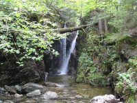
So this brings me to say, that I really need to get back to my main purpose of waterfalls. I started out going to well known waterfalls back about 1986 or so, give or take. I really got into them more so after the year 2000. I had made a personal goal to see at least 30 waterfalls a year. Over the past maybe 4 to 5 years I have more then doubled that goal amount. I guess you could call this my bucket list. My goal is to see as many waterfalls as I can before my time is up. In the meantime I am in hopes that either one of my children or my grandchildren will continue this on with their families. The purpose of this website is to share with others, my road trips, that I have taken with family and friends. You will see a lot of them in my photos.

Years ago, I did not have the resources available, that we have today. I had paper maps, books, and word of mouth. The world of internet is full of available resources. I spend a lot of time planning my road trips, whether they be for one day or a whole weekend or a whole week. I call them road trips based on the fact that I can’t seem to find myself just relaxing and sitting around a bonfires, when there is so much exploring to do.

I have much data on here that needs fixing, or updated, or new information I have found out after visiting or publishing a waterfall information and location. I have several I need to go back to. This year I spent time revisiting some old ones, and those will be updated as well. I will be creating a special page for waterfalls that I had gone to look for and could not find. Maybe someone will recognize it and give me new leads.

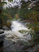
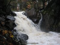
For the year of 2014, I have visited over 100 waterfall locations. Some were revisits, some I could not find and the majority are new. I still have yet to get all of them published on the website. This was my most busiest year ever……

14 Day trips approximately 60 waterfall locations

5 Weekend Trips approximately 83 waterfall locations

1 Vacation approximately 7 waterfall locations

Over the next several weeks, my plan is to recap my road trips for 2014. I would also like to try and load a snap shot of the tracks for each road trip. I think it would help in folks seeing where I traveled to narrow down the locations of the waterfalls I could not find. I will also be working on getting the other state waterfalls posted on here.

Through all of this, my goal is to keep this fun for me. I enjoy the adventures, I enjoy sharing the excitement. I will be honest, not sure I enjoy all the technical research on the history of the waterfall. I would like to keep this website simple. I will continue to post where the resources I use come from and lead you to them for further reading. Here, I will continue posting the waterfall name, any other names I am aware of, location, and any landmarks I see, as well as the closet intersection. I also preferred to give location based on where you park your vehicle. If other resources give height, distance etc I will capture those and post it.

Good luck in 2015.. plan your adventures, and most of all have fun!!

Rainbow Falls in High Falls Gorge, Essex County, New York

12/21/2014 Update

12/21/2014 Update

12/21/2014 Update
The following locations are now published.

Ausable Chasms in Essex/Clinton County, New York State

High Falls Gorge in Essex County, New York State

Russell Falls in Essex County, New York State


Gill Brook Trail Waterfalls, St. Huberts, Keene Valley, New York

Artist Falls and Gill Brook Trail Waterfalls

Artist Falls and Gill Brook Trail Waterfalls

Artist Falls and Gill Brook Trail Waterfalls (St Huberts)

AKA:
—–
Location:
Keene Twn
First Visit:
8/11/2011
Region:
Northern
County:
Essex
Park/Area:
—–
Gps of Falls:
N44.12673 W73.80830
Gps of Parking:
N44.14903 W73.77027
Gps of Trailhead:
—–
Trail Name/Reference to:
—–
Landmark:
—–
Stream/River/Watershed:
Gill Brook
Height of Falls/Type:
10 ft, to 20 ft, Cascade
Elevation:
1811 ft
Level of Difficulty/Hiking Distance:
0.5
Wikiloc:
—–
Whitewater Rte/Canoe Rte Map:
—–
Maps:
Eastern New York all outdoors Atlas & Field Guide Publication 2008
Trails Websites:
—–
My Resource:
Eastern New York all outdoors Atlas & Field Guide Publication 2008
Book Resource:
Brochures/Travel Guides/Visitor Guides:
—–
Additional Information:
Photos And Information I Contributed To or Posted To Other Websites:
—–
Nearest Intersection:
St Huberts Rd and Ausable Club Rd and Lake Rd
Directions:
From I-87 N in North Hudson, Take exit 30 to the right onto US-9 towards Rt-73/Keene Valley/Keene and drive for .2 miles. Turn left onto US 9 and drive for 2.2 miles. Keep left onto Hwy 73 N and drive for 5.4 miles. Turn left onto Ausable Rd and drive for .2 miles to the parking area.
Comments/Notes:

Waterfalls on the Gill Brook
#1 15 ft Block     N44.12480 W73.80906

#2 Chute             N44.12397 W73.80948
#4 15 ft Flume   N44.12293 W73.80988
#5 9 ft Cascade  N44.12247 W73.81003
#6 25 ft                N44.12198 W73.81019
#7 Flume             N44.12148 W73.81035
#8 Long Slide      N44.12080 W73.81075
#9 10 ft                N44.11999 W73.81125


Main Falls, Ausable Chasm, Clinton County, New York

Ausable Chasm – 11 Named Waterfalls and Rapids

Ausable Chasm – 11 Named Waterfalls and Rapids

Ausable Chasm – 11 Named Waterfalls and Rapids

AKA:
Adgate Falls, Birmingham Falls, Grand Canyon of the East
Location:
Chesterfield Twn/Au Sable Twn
First Visit:
8/17/2008
Region:
Northern
County:
Clinton/Essex
Park/Area:
Ausable Chasm
Gps of Falls:
N44.52490 W73.46301
Gps of Parking:
N44.52530 W73.46253
Gps of Trailhead:
—–
Trail Name/Reference to:
—–
Landmark:
Tourist Attraction
Stream/River/Watershed:
Ausable River
Height of Falls/Type:
Various
Elevation:
300-150 ft
Level of Difficulty/Hiking Distance:
Inner Sanctum Trail (1 mile) Rim Walk Trail (2 miles) Dry Chasm Trail (1.5 miles) Rainbow Falls/Elephant’s Head Vista (1/2 mile)
Wikiloc:
—–
Whitewater Rte/Canoe Rte Map:
Maps:
—–
Trails Websites:
—–
My Resource:
Book Resource:
Adirondack Waterfall Guide “New York’s Cool Cascades” By Russell Dunn 2004
Brochures/Travel Guides/Visitor Guides:
Adirondack Great Walks & Day Hikes A Guide to paths less taken in the Northeast’s last great wilderness
Additional Information:
Ausable Chasm Grand Canyon of the Adirondacks
Photos And Information I Contributed To or Posted To Other Websites:
Northern New York Waterfalls
Nearest Intersection:
Rte 9 and Old State Rd
Directions:
From I-87 N in Keeseville, Take exit 34 to the right onto Rt-9n towards Ausable Forks/Keeseville for .3 miles. Turn right onto Hwy 9n and drive for 1.3 miles. Turn left onto US 9 and drive for 1.5 miles.
Comments/Notes:
—–

For additional information click on the following links
Dam And Falls
Rainbow Falls
Horseshoe Falls
Horseshoe Lower Falls
Diagonal Slide IV
Elephant Head Class III

Elephant Rock Rapid IV+
Long One IV Rapids
Mike’s Hole (lead-in) IV+ Rapids
Mike’s Hole Itself Class IV Rapids
The Pinch of the Chasm Class I
Exit Canal Class II+ Rapids

Stoney Brook Falls, Oswego County, New York

11-2-2014 New Additions and Updates

11-2-2014 New Additions and Updates

11-2-2014 New Additions and Updates
THE FOLLOWING LOCATIONS HAVE BEEN ADDED

FALLBROOK FALLS in ONEIDA COUNTY

STONEY BROOK FALLS in OSWEGO COUNTY
These are located at The High Braes Refuge Campgrounds

JENNY CREEK FALLS in ST LAWRENCE COUNTY

Jenny Creek Lower Falls, St. Lawrence County, New York

Jenny Creek Waterfalls on (7 Named Waterfalls)

Jenny Creek Waterfalls on (7 Named Waterfalls)

Jenny Creek Waterfalls on (7 Named Waterfalls)
Whitewater Route Jenny Creek  
St Lawrence County, Town of Pitcairn
 
Date Visited: 10/7/2010
 
Stream or River: Gulf Stream/Jenny Creek
 
Resources Used:
World Waterfall Database
American Whitewater

Directions:
From I-81 N in Theresa, Take exit 49 to the right onto Rt-411 towards Theresa/Lafargeville for .3 miles. Turn right onto Highway 411 and drive for 4.7 miles. Turn left onto Commercial Street  and drive for .7 miles. Turn left onto Oxbow Road  and drive for 9.6 miles. Turn right onto Cr-25 and drive for 8.8 miles. Turn left onto W Main Street and drive for .3 miles. Turn right onto William Street and drive for  6.1 miles. Turn right onto Highway 812 and drive for  9.5 miles. Turn left onto Pitcairn-Fowler Road and drive for 1.3 miles. Turn left onto Highway 3 and drive for 1.3 miles. Bear right onto Jayville Road and drive for 1.0 miles. The first falls is Jenny Creek Falls Lower. I have not been to this one yet. Continue on Jayville Road for 1.0 miles. This next one is Jenny Creek Falls. Continue on Jayville Road and drive for .6 miles to Jenny Creek Middle Falls. Continue on Jayville Road and drive for .2 miles, this brings you to the last one, Jenny Creek Upper Falls.
   
Trail Description: Described within
 
Comments:
Putting together this whole section of Jenny Creek was and still is a bit confusing so I will piece it together as best as possible. When I checked this location out back in 2010, I had only 2 locations with the coordinates for. And those I had gotten from the World Waterfall database. Since then I have gain more knowledge along with better technology. I recently found that the American Whitewater has a page on this section of Jenny Creek. By matching my photos up with theirs along with similar descriptions, I have been able to make some corrections.
 
The whitewater route starts at Powell Road, south of Hwy 3. When I was there you could not drive on Jayville road all the way, as you come to where the bridge is out. So I did not check out their first 1.3 miles of the route.
 
1-Mike’s Boof Class III-Gulf Stream

2-Railroad Slide Class III+-Gulf Stream


Beaver Pond/Dam Class I-Gulf Stream

 
3-This one here I had called Jenny Creek Upper Falls (Footbridge rapid Class III+)
Described as starting under a footbridge and ending behind a camp. Viewing from this is roadside only, private property.

Another Beaver Pond/Dam Class I-Jenny Creek
 
4-Now this one I had called Jenny Creek Middle Falls, but it falls in the location they called the Ugly Drop-Jenny Creek
You will see a huge rock and smaller rock on top, looks like a huge cairn, on the side of the road. It is a short scramble but the view was hard to get.


5-Middle Section Class IV-Jenny Creek


6-And this one I had called Jenny Creek Lower Falls, and again it falls within the location and photo match with what they called Jayville Rapid Class 5.0/Jayville Slide. This may also be known as Jenny Creek Falls. This is a roadside view.

7-Horrific– which is described as being 30-35 foot drop.-Jenny Creek
8-The Rest Class III they describe one more dangerous section which maybe what resources are calling Jenny Creek Lower Falls.

Fallbrook Falls, Oneida County, New York

Fallbrook Falls (Annsville Town)

Fallbrook Falls (Annsville Town)

Fallbrook Falls – 5 Waterfalls

AKA:
The 5 Cascades
Location:
Annsville Twn
First Visit:
10/26/2008
Region:
Central
County:
Oneida
Park/Area:
—–
Gps of Falls:
N43.34828 W75.58355
Gps of Parking:
N43.35082 W75.58912
Gps of Trailhead:
—–
Trail Name/Reference to:
—–
Landmark:
Fallbrook Stables
Stream/River/Watershed:
Fallbrook
Height of Falls/Type:
Various (5) Falls Total
Elevation:
900-843 ft
Level of Difficulty/Hiking Distance:
approx. 1 mile rt
Wikiloc:
—–
Whitewater Rte/Canoe Rte Map:
Maps:
Trails Websites:
—–
My Resource:
Friends
Book Resource:
—–
Brochures/Travel Guides/Visitor Guides:
—–
Additional Information:
Photos And Information I Contributed To or Posted To Other Websites:
Northern New York Waterfalls, Digthefalls
Nearest Intersection:
Slater Rd And Coal Hill Rd
Directions:
From I-90 W, in Westmoreland, Take exit 32 to the right towards Rt-233/Westmoreland/Rome and drive for .7 miles. Turn right onto Cider Street and drive for .1 miles. Turn right onto Highway 233 and drive for 5.7 miles. Take the Rt-49 W/Rt-69 W/Rt-365 W ramp to the left  and drive for .4 miles. Take the Rt-49 W/Rt-69 W ramp to the right towards Rt-26 N/Rt-46/Downtown Rome and drive for 1.3 miles. Keep left onto Erie Blvd E and drive for 10.5 miles. Turn right onto Main Street  and drive for .7 miles. Turn right onto Coal Hill Road and drive for 3.6 miles.             
Comments/Notes:
Park on the side of the road just a little north from the intersection of Slater Road and Coal Hill Road and then walk to the back of the field. Go right and follow the field edge down and into the second field. On your left watch for a well worn path. You will hear the river along the way.

Fallbrook Falls #1, Annsville
Fallbrook Falls #2, Annsville
Fallbrook Falls #3, Annsville
Fallbrook Falls #4, Annsville
Fallbrook Falls #5, Annsville

Krystal Falls, Schenectady County, New York

Krystal Falls in Schenectady County, New York

Krystal Falls in Schenectady County, New York

Krystal Falls in Schenectady County, New York
Looking for information to help a reader out. Does anyone have any knowledge of the following area and or history, or where we may find some?

Here is what they asked…I grew up near Krystal Falls in Burnt Hills, N.Y. back in the 1930’s. I am the granddaughter of the late Charles Heckeler, once owner of the mill that was located at this falls. Back in the nineties I visited the restaurant there, the site where we kids went swimming. I was looking for info. about my grandpa’s mill and possibly pictures of the area. Do you have any suggestions where I can locate this information?

Krystal Falls Upper