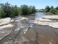
9/5/2015 Lewis County Ny Waterfalls, Croghan
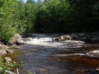
Beaver Falls (Croghan)
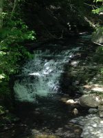
Twin Bridge Falls (New Bremen)
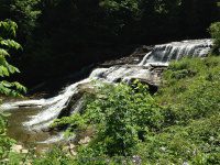
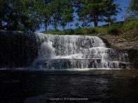
High Falls (Croghan)
9/5/2015 Lewis County Ny Waterfalls, Croghan
Beaver Falls (Croghan)
Twin Bridge Falls (New Bremen)
High Falls (Croghan)
Taylorville Whitewater Section Lewis County, NY 9/7/2015
The map below shows a good portion of the route that I had tracked.
This is where we parked, which was the start point of the tracking. (Note: We did not go to the end of Double Eddy Road to park, as there was no room to park at the time) From there we took the trail which comes out to the bottom of the second falls.
When we got to the end of the trail we wanted to start from the put in at the first dam. The trail length is less then .1 mile.
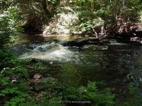
Taylorville Dam aka Taylorville Falls
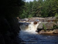
This is the second dam. Taylorville Lower Falls
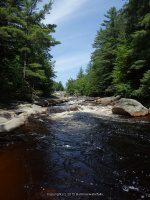
The 2 dams combine and flow into a section called the Beaverator IV-Rapids
The following photos were taken down along the trail to where there was a picnic table. Note: In the photo above, where the tree line is at back end of photo is where the picnic area is.) Just continue down the trail from the bottom of the Great White Slide.
The next set of photos are taken at the picnic area. This section I believe is the Dogleg III Rapids and Mindscrambler III Rapids section. I took photos from the top, and then we walked around further down to get some lower views.
It was at this point we back tracked and went to our vehicle and drove down to the take out on Taylorville Road. Which is at the power plant. Silly me also thought I was still tracking, BUT did not turn it back on, so I will do my best to detail.
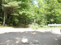
To view the Take Out section, and to view the Powerline Boof IV Rapids Section from the bottom. From the parking area you will walk through the gate and continue straight ahead following the small path to the river.
The next set of photos are taken at the Take Out site.
The next set of photos are also taken from the Take Out section looking upstream towards Powerline Boof IV Rapids Section.
From here we back tracked back towards the parking area. When you reach the gate, turn and walk right along the fence line and follow the penstock a short distance. You will see a small path that leads again back to the river. The following photo is a visual from where I was standing at the trail that leads down to the river, and I am looking back up towards the parking area.
These photos are of the Powerline Boof IV Rapids Section
To explore this whole section from start to finish took us about 2 1/2 hours. For actual walking distance in both areas maybe about 1 1/2 miles.
Eatonville Falls, Lewis County Waterfall Trip on 6-7-2015 part 3
From the town of greig at the intersect of blue street (main street name changes to blue street) and greig road drive southeast on greig road for about 1.4 Miles. Bear left onto odett road and drive .3 Miles to pine grove road. Turn left again then a right onto eatonville road. Drive 1.4 Miles on eatonville road which changes to otter creek truck trail. Drive over the bridge to the parking area.
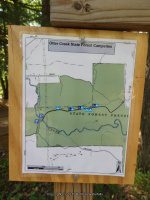
Small campground and picnic area, no restrooms! There are trails on both sides going upstream. I only took the trail on the right going downstream. The trails are very easy.
American Whitewater Rafting Route Otter Creek: Partridgeville road to Pine Grove Road
Tracks for Eatonville Falls on the Otter Creek Trail location on Wikiloc
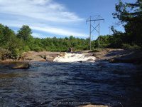
EATONVILLE FALLS MAY BE NAMED THE FIRST RAPID ON THE WHITEWATER ROUTE FOR THIS SECTION.
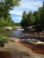
EATONVILLE FALLS on OTTER CREEK
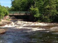
BRIDGE RAPID IV on OTTER CREEK
THIS LAST SECTION IS LOCATED A SHORT DISTANCE DOWN BELOW THE BRIDGE
Lewis County Waterfall Trip on 6-7-2015 part 2
This is a roadside waterfall, most likely best seen in the spring or fall.
This next set of photos were taken at different areas along Gomer Hill Road. We had meant to be on the next road over. Good thing! All of it are roadside views only.
MILL CREEK falls on (GOMER HILL ROAD)
This next one is not really considered a fall, and currently I find no name for it. Roadside only from the bridge.
MILL CREEK (SILVER CREEK) falls on (CEMETERY ROAD)
BOTH MOORES FALLS AND SILVER CREEK FALLS ARE LOCATED ON PRIVATE PROPERTY. THE HOME OWNER GRANTED ME PERMISSION TO ACCESS THIS WATERFALL AND ANOTHER ONE ON THEIR PROPERTY. THE HOME OWNER ALSO REQUESTED THAT I POST ABSOLUTELY NO INFORMATION ON THE LOCATION, BUT DID GRANT ME PERMISSION TO POST THE PHOTO. I WAS ALSO ASKED IF ANY RESOURCES OUT THERE HAD POSTED INFORMATION TO THIS LOCATION TO PLEASE REMOVE IT. THE HOMEOWNER STATED THEY HAVE BEEN HAVING TROUBLE WITH FOLKS TRESPASSING, HAVING CAMP FIRES, AND EVEN TRYING TO CAMP, AS WELL AS LEAVING GARBAGE. THIS HAS LEAD TO THERE DECISION TO PRIVACY. PLEASE RESPECT HOME OWNERS. THE HOME OWNER ALSO STATED THAT, LIKE ME, IF WE STOP AND KNOCK AND ASK…..YOU MAYBE GRANTED!!
MY MAPS SHOW THE STREAM AS MILL CREEK, RESOURCES HAVE IT LISTED AS SILVER CREEK.
SILVER CREEK FALLS (MILL CREEK)
This next one, the story for this! We wasted so much time. If you ever traveled in this area you would understand. We drove over 8 miles on this dirt road and totally by passed the locations we were looking for. Fact was we could not find actual trail starts and kept going. Needless to say driving all the way to the end and had to turn around and back track the 8 miles. It would be nice if there was any sign stating DEAD END road!! Anyways, right at the end was a turn around and this was there.
OTTER CREEK falls on (PARTRIDGEVILLE ROAD)
Talcottville Falls was a revisit for me. The last time I was here it was in the winter. What a difference. That and this time could see the trail down in.
Tracks for Talcottville Falls on Wikiloc
TALCOTTVILLE FALLS aka SUGAR RIVER FALLS
This is also a re visit. I had did a post on this earlier I believe. A well known attraction. This time I went in from the northern end and took the south trail in.
Tracks for Whetstone Creek Falls on Wikiloc
Lewis County Waterfall Trip on 6-7-2015 part 1
From the intersection of highway 12 and glenfield road, drive .2 Miles east on glenfield road. You will come to an intersection of main street. Turn left onto main street and drive .2 Miles to a right onto grieg road. Drive .5 Miles on grieg road to a left onto otter creek road. Drive 1.5 Miles on otter creek road to the intersection of pine grove road. Turn left here onto pine grove road and drive 1.4 Miles. Where rudd road is on your right. Turn onto rudd road and drive .3 Miles to the end where the bridge is out. This is the take out spot for the whitewater rafters.
The trail is fairly easy and is .5 mile round trip on the west side trail. The falls below the bridge is only a few hundred yards and also can be viewed from the bridge.
Additional Resources
EASTERN NY ALL OUTDOORS ATLAS AND FIELD GUIDE
From the American Whitewater Rafting Route: Bradish Road to Old Pine Grove Road
Wikiloc tracks for The Independence River Falls
Parking and Trail head.
Photos taken here also include the Bridge Boof IV Rapids, and Fat Lady IV Rapids
I believe by the photos, that the Bridge Boof IV Rapids may also be the same as Hidden Falls
RUDD ROAD FALLS on INDEPENDENCE RIVER aka HIDDEN FALLS
BRIDGE BOOF IV-RAPIDS on INDEPENDENCE RIVER
FAT LADY IV-RAPIDS on INDEPENDENCE RIVER
Fat Lady is located in the section below the Independence River Falls. The photos are included under the Independence River Falls.
The Wall IV Rapids and the Independence river (falls on) are located downstream from the bridge. I firmly believe I had viewed the latter from the other road, as can see by the tracking.
THE WALL IV-RAPIDS on INDEPENDENCE RIVER
This section are the photos I had taken when we took the trail on the west side of the river, going as far as we could just below the dam. Another trip is planned to this location taken the trail on the east side to go further upstream for the other falls listed here.
Lewis County Waterfall Road Trip on 5-23-2015
Tracking on Wikiloc for Inman Gulf
THE TRAIL IS APPROXIMATELY 1 MILE TO THE RAINBOW FALLS OVERLOOK N43.83144 W75.83506. THE TRAIL ITSELF IS RELATIVELY EASY AND THERE ARE SIGNS ALONG THE WAY.
KINGS FALLS aka DEER RIVER FALLS
Tracking on Wikiloc for Kings Falls Trail
This is an easy walk on a graveled road. It is approximately 1.8 mile round trip.
HIGH FALLS (COPENHAGEN)
Every time I am in this area I try and see about access. Will continue to do so until I get photos.
This is a small roadside waterfall.
BLANCHARD CREEK FALLS aka KNICKERDOCKER FALLS
A return to this location is planned. We had a hard time finding where the trail was, or to get permission.
Roadtrip on 10-18-2014 through Lewis and Oneida Counties
DENLEY DAM AND FALLS LEWIS COUNTY
This is a portage site for kayakers and canoes. There is a small parking area and the dam and falls can be seen from there.
ROCK ISLAND DAM AND FALLS LEWIS COUNTY
This is also another portage area for kayakers and canoes. The gate was open as they had the whitewater rafting run going on this weekend. Also from here you can look upstream and see Port Leyden dam and falls in the distance.
PORT LEYDEN DAM AND FALLS LEWIS COUNTY
We did not try accessing this from the other side as before. There is a school located there, and we parked in the lot and did a short scramble to get better views.
MILKHOUSE FALLS LEWIS COUNTY
The actual location for this waterfall is posted on private property. I realized when I got home and threw in my tracks in my mapping program, that I was at the backside of this. As I mentioned in my description, the land was not posted. HOWEVER, I do not recommend visiting location by this means. It is unsafe and very much a big liability should someone get hurt. I was following a stream down and came upon it, I was at the top of the falls, and went out and around to see what it looked like. But the whole area looks as though someone used it as a dump site and there is glass and metal everywhere. I would say to try and contact someone and get permission by other location listed on internet resources. And the same time maybe get a look at the Orthodox Church sitting there.
SWAN’S FALLS LEWIS COUNTY
This is on privately owned property but good views can be seen from the road.
ROARING BROOK UPPER FALLS LEWIS COUNTY
This waterfall is located within walking distance from the gate of Whitaker Falls State Park.
WHITAKER FALLS STATE PARK LEWIS COUNTY
I could not believe how much work had taken place at the park. However the trail in and around the waterfalls is still in dire need of repair and safety fencing. We happen to be lucky and came across a rope that someone had tied up and that’s how we got down in there. When we got down there was a group of young adults that we encountered and found out they had just been the ones to put the rope there. We were very thankful they left the rope there for us to get back
UNNAMED FALLS ON HWY 12 NEAR RAILROAD TRACKS LEWIS COUNTY
This was a delight to see. How we missed it on the way up, no clue. There is no trail up to the top. It was posted on the left hand side of the falls. We tried walking up the falls rock hopping as far as we could. It was very slippery, as it was raining. From the road you will have to walk across the railroad tracks, but this can be seen right from the highway.
BAKERS FALLS ONEIDA COUNTY
LANSING KILL FALLS ONEIDA COUNTY
The access to both Lansing and Bakers is same parking, same path. There is parking for maybe two or three cars. You can see the falls right from the road. The canal trail system is right there also. The path was very slippery and steep.
New Additions 10-25-2014
BRIDAL VEIL FALLS IN DELAWARE COUNTY
COOKS FALLS IN DELAWARE COUNTY
CLIFFORD FALLS IN ESSEX COUNTY
HANGING SPEAR FALLS IN ESSEX COUNTY
SCHROON FALLS IN ESSEX COUNTY
SQUAW BROOK FALLS IN HAMILTON COUNTY
MILL CREEK FALLS ON IN HERKIMER COUNTY
WEST CANADA CREEK FALLS ON IN HERKIMER COUNTY
NATURAL BRIDGE FALLS IN JEFFERSON COUNTY
COPENHAGEN FALLS IN LEWIS COUNTY
GLEASMANS FALLS IN LEWIS COUNTY