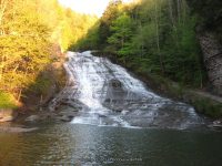
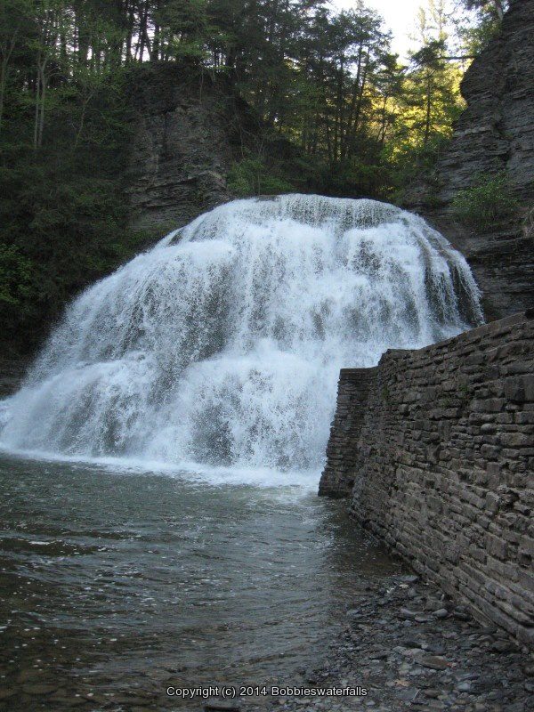
Tag Archives: newyorkwaterfalls

Waterfalls of New York State 100+ Challenge, Dig the Falls, part 3, The Finger Lakes Region

Waterfalls of New York State 100+ Challenge, Dig the Falls, part 3, The Finger Lakes Region

For more information on this challenge click here
To purchase “Waterfalls of New York State”, click here 
To purchase “A Waterfall Guide to Letchworth State Park” by Scott A. Ensminger and Douglas K. Bassett, click here

The following list, is the third set of locations listed in the book by “Waterfalls of New York State” by Scott A. Ensminger (Western New York Waterfall Survey), David J. Schryver (Northern New York Waterfalls) and Edwards M. Smathers (Dig the Falls) Be sure to check them out! I myself have personally contributed a lot of waterfall location information to both Mr. Edward Smathers and Mr. David Schryver. I am currently a team member with “Dig the Falls”. The simple rules of this challenge, is to visit 100 waterfall locations in the book. One location may have several waterfalls, counts as one location. Click on the links (I have visited) in the boxes below, which will take you to additional information pages.

Please refer to “A Waterfall Guide to Letchworth State Park” by Scott A. Ensminger and Douglas K. Bassett, serious Letchworth State Park is a region of it’s own!!

Side Note: as I am putting this all together, I have additional photos that I never uploaded, my bad!

Waterfall Name, info

Additional Falls in location, or close by

County

Date First visited

Photo

Chittenango Falls Chittenango Falls State Park 167 ft Easy to moderate Hike
…..
Madison
7-4-2001
Chittenango Twin Sister Falls
Chittenango Falls State Park Easy to moderate Hike
additional falls
Madison
7-4-2001
Pratts Falls
Pratts Falls County Park
137 ft Cascade Short Hike
…..
Onondaga
6-24-2002
PRATTS ONONADAGA CENTRAL NY 4-11-2008_00005.JPG
Unnamed Falls
Largest of 6 other unnamed falls in park
Pratts Falls County Park
30 ft Short Hike
additional falls
Onondaga
No
…..
Tinkers Falls
aka Labrador Falls, Tully Falls
Labrador Hollow State Nature Preserve
45 ft, Plunge About 15 Minutes rt to the bottom
…..
Cortland
4-11-2008
TINKERS CORTLAND CENTRAL NY 4-11-2008_00031.JPG
Bucktail Falls
Green Gully
35 ft Total
…..
Onondaga
3-23-2008
BUCKTAIL FALLS ONONADAGA 6-14-2015_00009.JPG
Bucktail Additional falls: Green Gully
Upper Falls #04 75 ft,
Upper Falls #05 3 Small falls, Upper Falls #03 20 ft,
Upper Falls #02 Small falls, Upper Falls #01
Appx Location/Need Info
additional falls
Onondaga
No
…..
Carpenter Falls
aka Grey Cliff Falls
Bahar Preserve
76 ft .4 Mile rt
…..
Cayuga
8-10-2008
CARPENTERS CAYUGA CENTRAL NY 8-10-2008_00007.JPG
Bear Swamp Cascades Bahar Preserve
10 ft/14 ft series of cascades Private/No Access
additional falls
Cayuga
No
…..
Carpenter Second Falls Bahar Preserve
1.0 Mile Rt
additional falls
Cayuga
8-10-2008
…..
Carpenter Middle Falls, Bahar Preserve
60 ft, Cascade 1.0 Miles rt, Downstream from Carpenter Falls
additional falls
Cayuga
8-10-2008
CARPENTERS MIDDLE CAYUGA CENTRAL NY 8-10-2008_00003.JPG
Carpenter In-Between Falls Bahar Preserve
1.0 Mile Rt
additional falls
Cayuga
8-10-2008
CARPENTERS MIDDLE CAYUGA CENTRAL NY 8-10-2008_00004.JPG
Carpenter Rooster Tail Falls Bahar Preserve
1.0 Mile Rt
additional falls
Cayuga
8-10-2008
…..
Carpenter Lower Falls
aka Angel Falls
Bahar Preserve
62 ft 1.0 Miles rt, Downstream from Carpenter Falls
additional falls
Cayuga
8-10-2008
CARPENTERS LOWER CAYUGA CENTRAL NY 8-10-2008_00004.JPG
Carpenter Lower Falls #02 Bahar Preserve
1.0 Mile Rt
additional falls
Cayuga
8-10-2008
CARPENTERS LOWER CAYUGA CENTRAL NY 8-10-2008_00005.JPG
Cowsheds Falls
aka Lower Falls, Dry Falls
Fillmore Glen State Park
37 ft 4 Mile Loop 2 Hours
…..
Cayuga
6-19-2004
FILMORE beginning to bridge 1 cow shed_00006.JPG
Cowsheds Upper Falls, Fillmore Glen State Park
14 ft 4 Mile Loop 2 Hours
additional falls
Cayuga
6-19-2004
FILMORE beginning to bridge 1 cow shed_00016.JPG
Dalibarda Falls
aka Delbardi Falls
Fillmore Glen State Park
85 ft 4 Mile Loop 2 Hours
additional falls
Cayuga
6-19-2004
FILMORE bridge 6 to bridge 7 dalibarda_00012.JPG
Pinnacle Lower Falls, Fillmore Glen State Park
14 ft 4 Mile Loop 2 Hours
additional falls
Cayuga
6-19-2004
FILMORE bridge 7 to 8 upper pinnacle_00013.JPG
Pinnacle Upper Falls, Fillmore Glen State Park
14 ft 4 Mile Loop 2 Hours
additional falls
Cayuga
6-19-2004
FILMORE bridge 7 to 8 upper pinnacle_00003.JPG
Hog Back Falls
aka Upper Falls
Fillmore Glen State Park
80 ft .5 Mile rt
additional falls
Cayuga
6-19-2004
FILMORE dam and hogsback falls_00006.JPG
Ludlowville Falls
Ludlowville Park
45 ft .2 mile rt
…..
Tompkins
7-15-2006
LUDLOWVILLE TOMPKINS CENTRAL NY 7-15-2006_00002.JPG
Little Ludlowville Falls
aka Salmon Creek falls
.5 mile
additional falls
Tompkins
9-17-2017
…..
 Ithaca Falls
aka Olympic Falls
Fall Creek Gorge/Ithaca Falls Natural Area
150 ft Total .4 mi rt
…..
Tompkins
5-25-2008
ITHACA TOMPKINS CENTRAL NY 5-24-2008_00003.JPG
Forest Falls
Fall Creek Gorge/Ithaca Falls Natural Area
20 ft Approx 2 Mile Rt/W for 4 Falls
additional falls
Tompkins
5-25-2008
FOREST TOMPKINS CENTRAL NY 5-24-2008_00002.JPG
Horseshoe Falls
Fall Creek Gorge/Ithaca Falls Natural Area Approx 2 Mile Rt/W for 4 Falls
additional falls
Tompkins
5-25-2008
…..
Foaming Falls
Fall Creek Gorge/Ithaca Falls Natural Area 15 ft Approx 2 Mile Rt/W for 4 Falls
additional falls
Tompkins
5-25-2008
FOREST TOMPKINS CENTRAL NY 5-24-2008_00002.JPG
Rocky Falls
aka Sibley Falls
Fall Creek Gorge/Ithaca Falls Natural Area
25 ft Cascade Approx 2 Mile Rt/W for 4 Falls
additional falls
Tompkins
5-25-2008
ROCKY FALLS TOMPKINS CENTRAL NY 5-24-2008_00003.JPG
Fall Creek Tributary Falls (Falls in woods)
Fall Creek Gorge
additional falls
Tompkins
9-17-2017
TRIPHAMMER TOMPKINS CENTRAL NY 5-24-2008_00002.JPG
Triphammer Falls
Fall Creek Gorge/Ithaca Falls Natural Area
55 ft/80 ft total Less than .2 mi rt
additional falls
Tompkins
5-25-2008
TRIPHAMMER TOMPKINS CENTRAL NY 5-24-2008_00009.JPG
Triphammer Falls, Top drop Fall Creek Gorge/Ithaca Falls Natural Area
35 ft/80 ft total Less than .2 mi rt
additional falls
Tompkins
5-25-2008
…..
Buttermilk Lower Falls Buttermilk Fall State Park
90 ft Gorge Trail: 0.75 miles. Strenuous, Rim Trail: 0.75 miles Strenuous, Bear Trail: 0.5 miles. Moderate, Lake Treman: 1.5 miles. Easy
…..
Tompkins
7-15-2006
BUTTERMILK FALLS TOMPKINS  CENTRAL NY 5-06-2012_00002.JPG
Buttermilk Upper Falls Buttermilk Fall State Park
80 ft Long sloped Cascade
additional falls
Tompkins
7-15-2006
BUTTERMILK FALLS TOMPKINS CENTRAL NY 9-02-2006_00006.JPG
Buttermilk Falls State Park Additional Falls: Pulpit Falls, 2 tiered, Pinnacle Lower Falls, 9 ft, Pinnacle Middle Falls, Lower Gorge Area, 19 ft, Pinnacle Upper Falls, Lower Gorge Area, 5 ft, Shower Bath Falls, 18 ft, Flume Falls
additional falls
Tompkins
No
…..
Owl Creek, series of cascades
Buttermilk Falls State Park Just a short distance from trailhead
additional falls
Tompkins
No
…..
Lake Treman Falls Buttermilk Falls State Park 35 ft 1.5 mile
additional falls
Tompkins
No
…..
Owl Creek Falls
Buttermilk Falls State Park 70 ft Trailhead used is from parking area inside the park, possible creekwalk up to the falls
additional falls
Tompkins
No
…..
Lower Falls
Robert H. Treman State Park 32 ft
Gorge Trail: 2.25mi./Rim Trail: 2.25mi./Red Pine Trail: 0.5mi./CCC Memorial Trail: 0.33mi.
…..
Tompkins
7-15-2006
LOWER FALLS TOMPKINS COUNTY CENTRAL NY 5-06-2012_00003.JPG
Fish Kill Falls
aka Enfield Falls. Old Mill Falls
Robert H. Treman State Park 15 ft/15 ft
Gorge Trail: 2.25mi./Rim Trail: 2.25mi./Red Pine Trail: 0.5mi./CCC Memorial Trail: 0.33mi.
additional falls
Tompkins
7-15-2006
FISHKILL FALLS TOMPKINS CENTRAL NY 5-06-2012_00001.JPG
Devil’s Kitchen Falls
aka Lucifer Falls above (Enfield Glen)
Robert H. Treman State Park 15 ft
Gorge Trail: 2.25mi./Rim Trail: 2.25mi./Red Pine Trail: 0.5mi./CCC Memorial Trail: 0.33mi.
additional falls
Tompkins
7-15-2006
…..
Lucifer Falls
aka Enfield Falls, Enfield Creek & Glen
Robert H. Treman State Park 115 ft
Gorge Trail: 2.25mi./Rim Trail: 2.25mi./Red Pine Trail: 0.5mi./CCC Memorial Trail: 0.33mi.
additional falls
Tompkins
7-15-2006
LUCIFER FALLS TOMPKINS CENTRAL NY 5-6-2012_00008.JPG
Sulphur Falls
Robert H. Treman State Park Gorge Trail: 2.25mi./Rim Trail: 2.25mi./Red Pine Trail: 0.5mi./CCC Memorial Trail: 0.33mi.
additional falls
Tompkins
No
…..
Mill Falls
aka Enfield Glen, Old Mill Falls, Fishkill Falls
Robert H. Treman State Park Gorge Trail: 2.25mi./Rim Trail: 2.25mi./Red Pine Trail: 0.5mi./CCC Memorial Trail: 0.33mi.
additional falls
Tompkins
7-15-2006
…..
Taughannock Falls Taughannock Falls State Park 215 ft
…..
Tompkins
7-15-2006
TAUGHANNOCK TOMPKINS CENTRAL NY 7-15-2006_00002.JPG
Taughannock Upper Falls, Taughannock Falls State Park Black Diamond Trail
additional falls
Tompkins
NO
…..
Taughannock Creek Lower Falls
Taughannock Falls State Park
15 ft Step Cascade
Gorge Trail: 3/4 mile Easy, South Rim Trail: 1 1/8 mile Moderate, North Rim Trail: 1.5 mile Moderate
additional falls
Tompkins
7-15-2006
TAUGHANNOCK TOMPKINS CENTRAL NY 9-02-2006_00005.JPG
Hector Falls
aka Factory Falls
165 ft total Roadside View
…..
Schuyler
10/19/2010
HECTOR SCHUYLER CENTRAL NEW YORK 10-19-2010_00004.JPG
Hector Lower Falls
165 ft total Roadside View
additional falls
Schuyler
10/19/2010
HECTOR SCHUYLER CENTRAL NEW YORK 10-19-2010_00007.JPG
Pluto falls
Watkins Glen State Park
9 ft At .8 Miles
…..
Schuyler
6-13-1991
PLUTO FALLS in WATKINS GLEN SCHUYLER COUNTY CENTRAL NEW YORK 8-10-2013_00004.JPG
Triple Cascade
aka Cascade at Rainbow Falls
Watkins Glen State Park approx. .7 to .8 miles 1-way
…..
Schuyler
6-13-1991
TRIPLE CASCADES in WATKINS GLEN SCHUYLER CENTRAL NEW YORK 8-10-2013_00002.JPG
Rainbow Falls
Watkins Glen State Park
95 ft approx. .7 to .8 miles 1-way
…..
Schuyler
6-13-1991
RAINBOW FALLS in WATKINS GLEN SCHUYLER CENTRAL NEW YORK 8-10-2013_00005.JPG
Glen of Pool Falls
Watkins Glen State Park
9 ft approx. .6 to .7 miles 1-way
…..
Schuyler
6-13-1991
GLEN OF POOLS in WATKINS GLEN SCHUYLER CENTRAL NEW YORK 8-10-2013_00003.JPG
Central Cascade
Watkins Glen State Park
42 ft approx. .6 mile 1-way
…..
Schuyler
6-13-1991
CENTRAL CASCADE in WATKINS GLEN SCHUYLER CENTRAL NY 8-10-2013_00006.JPG
Cavern Cascade
Watkins Glen State Park
50 ft approx. .3 to .4 mile 1-way
…..
Schuyler
6-13-1991
CAVERN CASCADE in WATKINS GLEN SCHUYLER CENTRAL NY 8-10-2013_00012.JPG
Minnehaha Falls
Watkins Glen State Park
21 ft approx. .3 to .4 mile 1-way
…..
Schuyler
6-13-1991
Minihaha Falls Watkins Glen Schuyler Central NY 8-10-2013_00004.JPG
Entrance Cascade
aka Sentry Falls
Watkins Glen State Park
41 ft approx. .2 to .3 miles 1-way
…..
Schuyler
6-13-1991
ENTRANCE CASCADE in WATKINS GLEN SCHUYLER CENTRAL NY 8-10-2013_00013.JPG
Jacobs Ladder Falls
Watkins Glen State Park Short From Top Parking Area
additional falls
Schuyler
6-13-1991
JACOBS LADDER in WATKINS GLEN SCHUYLER CENTRAL NEW YORK 8-10-2013_00003.JPG
Fairies Pool Falls
Watkins Glen State Park
6 ft
additional falls
Schuyler
6-13-1991
FAIRIES POOL in WATKINS GLEN SCHUYLER COUNTY CENTRAL NEW YORK 8-10-2013_00001.JPG
Mile Point Falls
aka Arcadia Falls
Watkins Glen State Park
12 ft At 1.1 Miles
additional falls
Schuyler
6-13-1991
ARCADIA FALLS in WATKINS GLEN  SCHUYLER CENTRAL NY 8-10-2013_00006.JPG
Pool Of Nymphs Falls Watkins Glen State Park
58 ft approx .8 to .9 miles 1-way
additional falls
Schuyler
6-13-1991
POOL OF NYMPHS in WATKINS GLEN SCHUYLER CENTRAL NEW YORK 8-10-2013_00002.JPG
Glen Omega Falls
Watkins Glen State Park
8 ft approx .8 to .9 miles 1-way
additional falls
Schuyler
6-13-1991
OMEGA FALLS in WATKINS GLEN SCHUYLER COUNTY CENTRAL NEW YORK 8-10-2013_00005.JPG
Unnamed Falls
Watkins Glen State Park
12 ft
additional falls
Schuyler
6-13-1991
…..
Glen Cathedral Falls Baptismal Font
Watkins Glen State Park
6 ft approx. .5 to .6 miles 1-way
additional falls
Schuyler
6-13-1991
GLEN CATHEDRAL in WATKINS GLEN SCHUYLER CENTRAL NY 8-10-2013_00003.JPG
Sylvan Rapids
Watkins Glen State Park
13 ft approx. .5 to .6 miles 1-way
additional falls
Schuyler
6-13-1991
SYLVAN RAPIDS in WATKINS GLEN  SCHUYLER CENTRAL NEW YORK 8-10-2013_00010.JPG
The Narrows Falls
Watkins Glen State Park
8 ft approx. .4 to .5 miles 1-way
additional falls
Schuyler
6-13-1991
THE NARROWS in WATKINS GLEN SCHUYLER COUNTY CENTRAL NEW YORK 8-10-2013_00014.JPG
Diamond Falls
Watkins Glen State Park
12 ft approx. .4 to .5 miles 1-way
additional falls
Schuyler
6-13-1991
DIAMOND FALLS in WATKINS GLEN SCHUYLER CENTRAL NY 8-10-2013_00004.JPG
Whispering Falls
Watkins Glen State Park
8 ft approx. .4 to .5 miles 1-way
additional falls
Schuyler
6-13-1991
WHISPERING FALLS in WATKINS GLEN SCHUYLER  CENTRAL NEW YORK 8-10-2013_00003.JPG
Still Water Gorge Falls Watkins Glen State Park approx. .2 to .3 miles 1-way
additional falls
Schuyler
6-13-1991
STILL WATER GORGE in WATKINS GLEN SCHUYLER CENTRAL NEW YORK 8-10-2013_00004.JPG
Twin Lower Falls 
aka Templer Falls
8 ft FLT Map M14TF/.03 Miles
…..
Schuyler
10-19-2010
TWIN SCHUYLER CENTRAL NEW YORK 10-19-2010_00008.JPG
Twin Upper Falls
aka Templer Falls
12 ft FLT Map M14TF/.03 Miles
…..
Schuyler
10-19-2010
TWIN SCHUYLER CENTRAL NEW YORK 10-19-2010_00007.JPG
Aunt Sarah Falls
aka Montour Falls/per google map
90 ft Total Roadside FLT – QCASarahFalls
…..
Schuyler
10-19-2010
AUNT SARAS SCHUYLER CENTRAL NEW YORK 10-19-2010_00002.JPG
Chequagua Falls
aka Shequaga Falls (The Falls)
156 ft Roadside view
…..
Schuyler
10-19-2010
SHEQUAGA SCHUYLER CENTRAL NY 10-19-2010_00002.JPG
Eagle Cliff Falls
Havana Glen/McClure Glen 40 ft /Rapids below
…..
Schuyler
10-19-2010
EAGLE CLIFF SCHUYLER CENTRAL NY 10-19-2010_00018.JPG
Havana Glen, Additional falls: Flume Falls, Curtain Cascade, Echo Falls, Fairies Cascade 30 ft, Portal Cascade 12 ft total, Summit Falls, Whispering Falls Private/No Access, Bridal Veil Falls
Individual GPS’s unknown
additional falls
Schuyler
10-19-2010
EAGLE CLIFF SCHUYLER CENTRAL NY 10-19-2010_00003.JPG
Seneca Mills Falls
aka Mays Mills Falls
45 ft
…..
Yates
8-10-2013
SENECA MILL FALLS YATES COUNTY WESTERN NEW YORK 8-10-2013_00007.JPG
Cascade Mills Falls
Keuka Lake Outlet, 2 waterfalls 25 ft /50 ft 4h
additional falls
Yates
8-10-2013
CASCADE MILL FALLS YATES COUNTY WESTERN NEW YORK 8-10-2013_00007.JPG
Wolcott Falls
aka Ganadsgo Falls
Wolcott Falls Park
Trail to bottom .4 Mile Rt/short walk to overlook near parking area
…..
Wayne
4-17-2009
WOLCOTT FALLS WAYNE COUNTY CENTRAL NEW YORK 4-17-2009_00003.jpg
First Falls
aka No Official Name, French Hill Falls
Grimes Glen County Park
59 ft
…..
Ontario
No
…..
Second Falls
aka Middle Falls, No Official Name
Grimes Glen County Park
62 ft Total
…..
Ontario
No
…..
Third Falls
aka Upper Falls, Indian Falls Grimes Glen County Park
additional falls
Ontario
No
…..
Springstead Creek Falls Grimes Glen County Park
additional falls
Ontario
No
…..
County Line Upper Falls 
50 ft cascade 1 mile rt/30 Minute
…..
Livingston
No
…..
County Line Lower Falls 
25 ft freefall 1 mile rt/30 Minute
…..
Livingston
No
…..
High Falls of the Genesee River
aka Main Falls, Upper Falls Rochester, Falls In
96 ft Roadside view
…..
Monroe
4-17-2009
ROCHESTER HIGH FALLS MONROE COUNTY WESTERN NEW YORK 4-17-2009_00008.JPG
Lower Falls of the Genesee River
aka Rochester, Falls In
110 ft Roadside view/.8 Mile Rt
…..
Monroe
4-17-2009
ROCHESTER LOWER FALLS MONROE COUNTY WESTERN NEW YORK  4-17-2009_00002.jpg
Middle Falls of the Genesee River
aka Rochester, Falls In
23 ft Roadside view/.8 Mile Rt
…..
Monroe
4-17-2009
ROCHESTER MIDDLE FALLS MONROE COUNTY WESTERN NEW YORK  4-17-2009_00001.JPG
Middle Falls
Stony Brook State Park
25 ft Approx 2 Mile Rt
…..
Steuben
8-11-2013
STONEY BROOK  MIDDLE SECTION STEUBEN WESTERN NY 8-11-2013_00002.JPG
Lower Falls
Stony Brook State Park
36 ft Approx 2 Mile Rt
…..
Steuben
8-11-2013
STONEY BROOK LOWER SECTION STEUBEN WESTERN NY 8-11-2013_00037.JPG
Upper Falls
Stony Brook State Park
42 ft Approx 2 Mile Rt
…..
Steuben
8-11-2013
STONEY BROOK UPPER SECTION STEUBEN WESTERN NY 8-11-2013_00021.JPG
Hourglass Falls
Stony Brook State Park Approx 2 Mile Rt
additional falls
Steuben
8-11-2013
…..
Cascade Below Lower Swimming Pool
Stony Brook State Park
12 ft Approx 2 Mile Rt
additional falls
Steuben
8-11-2013
…..
Stony Brook Falls
Stony Brook State Park Approx 2 Mile Rt
additional falls
Steuben
8-11-2013
…..
Second Bridge Falls
Stony Brook State Park
6 ft Approx 2 Mile Rt
additional falls
Steuben
8-11-2013
…..
Stony Brook State Park, Additional Falls: Campground Falls #01 9 ft, Falls #02 6 ft,  Falls #03 7 ft, Falls #04 8 ft,  Falls #05 6 ft,  Falls #06 7 ft, Falls #02 7 ft. Falls #01 6 ft, Swamp Falls 7 ft, Stoney Brook Rapids 7 ft, East Stoney Brook Cascade 70 ft, Unnamed Falls
additional falls
Steuben
No
…..
Middle Falls
Letchworth State Park
West Side 107 ft
…..
Wyoming
7-15-2006
GENESEE MIDDLE WYOMING WESTERN NY 7-15-2006_00004.JPG
Lower Falls
Letchworth State Park 
West Side 30 ft/40 ft
…..
Wyoming
7-15-2006
GENESEE LOWER WYOMING WESTERN NY 7-15-2006_00004.JPG
Letchworth State Park Additional falls: Paul Rock Cascade 35 ft, Canoe Shower and Dish Creek Falls 40 ft, Crucifix Cascades 70 ft, Wriggling Waters 60 ft, Abutment Falls 50 ft ,, Detour Cliff Cascade 110 ft, Horsetail Falls 130 ft, Sawmill Chute 13 ft, Papermill Falls, Upper (Silver Lake Outlet) 25 ft, Papermill Falls, Lower (Silver Lake Outlet) 24 ft/24 ft, Crapsey Clay Falls 200 ft, Highbanks Falls
additional falls
Livingston
No
Please use Falzguy for your references
Letchworth State Park Additional falls: Eldest Stepsister cascade 45 ft, Deh-Ge-Wa-Nus Falls 14 ft, Bubbling Tiers Falls 38 ft, Genesee Valley Greenway Trail #7 (FLT) 5.75 miles, Deh-ga-Ya-Soh Falls 150 ft Total, Cinderella Cascade 500 ft Total, Denton Brook Cascade 500 ft Total, Dear Run Cascade, Not Safe, Deer Run Trail #11 1.5 Miles, Stepmother Cascade 470 ft Total, Youngest Stepsister Cascade 500 ft, Timber Tunnel Cascade 140 ft Total,
additional falls
Wyoming
No
Please use Falzguy for your references
Inspiration Falls
Letchworth State Park 
East Side 350 ft Total
additional falls
Wyoming
7-15-2006
…..
Wolf Creek Cascade, Letchworth State Park
West side, First Section – Wide Expanse 65 ft , Second Section – Zig Zag 38 ft, Second Section – Zig Zag Lower Power Chute 35 ft ,Third Section – Block and Waggle 28 ft, Forth Section – Shower Curtain/Diagonal Shower Hole Paddler Falls, Cascade of the Marching Bubble Beetles 60 ft
additional falls
Wyoming
7-15-2006
…..
Wee Water Willy
Letchworth State Park 
West Side 117 ft Can Be Seen With Middle Falls Less Then .1 Mile
additional falls
Wyoming
7-15-2006
GENESEE MIDDLE WYOMING WESTERN NY 7-15-2006_00001.JPG
Shadow Cascade
Letchworth State Park 
West Side 14 ft
additional falls
Wyoming
7-15-2006
…..
Upper Falls
Letchworth State Park 
West Side 70 ft Easy .4 Mile Rt
additional falls
Wyoming
7-15-2006
GENESEE UPPER WYOMING WESTERN NY 7-15-2006_00005.JPG
Waterline Cascade Letchworth State Park
10 ft Letchworth State Park Kisil Point Trail #18
additional falls
Wyoming
7-15-2006
…..
Waterline Falls Letchworth State Park 19 ft Letchworth State Park Gibsonville Trail #19
additional falls
Wyoming
7-15-2006
…..

Stone Valley Cooperative Recreation Area Road Trip 5-23-2015

Stone Valley Cooperative Recreation Area Road Trip 5-23-2015

Stone Valley Cooperative Recreation Area Road Trip 5-23-2015

This took me some time to put together. These locations are now published. Click on the links for more information.

The following links are great resources

The Stone Valley Trail, Colton, NY

American Whitewater Stone Valley: Colton to Brown’s Bridge

Tracking on Wikiloc for Stone Valley Trail

STONE VALLEY TRAIL with WATERFALLS

This is the parking area to the start of the trail. Also the put-in for the whitewater rafters.

From the parking area, there is a small trail on the left side that leads down to the dam and the top of Colton Falls.

COLTON DAM (STONEY VALLEY TRAIL)

On the trail you will come to a sign in register. This area is referred to as the “Whitewater Excitement”

COLTON FALLS 5.0 (STONEY VALLEY TRAIL)

Tannery Ledges is .2 miles down from the dam.

TANNERY LEDGES IV (STONEY VALLEY TRAIL)

At 0.4 miles you come to the Mushroom Ledges. This area is referred to as the “Bedrock”

MUSHROOM LEDGES III (STONEY VALLEY TRAIL)

At 0.5 miles you come to the Narrows

THE NARROWS (STONEY VALLEY TRAIL)

At 0.8 miles you come to the Tubs

THE TUBS (STONEY VALLEY TRAIL)

At 0.9 miles you come to the Island Falls

ISLAND FALLS 5.0 (STONEY VALLEY TRAIL)

At 1.0 mile you come to the 200 Proof Rapids

200 PROOF IV (STONEY VALLEY TRAIL)

Lucy’s Hole is also referred to as “The Gut” This is located in the area called the “High Terrace”

LUCYS HOLE (STONEY VALLEY TRAIL)

O’malley Brook overlook is in the area called “Cathedral Grove”

OMALLEY BROOK FALLS (STONEY VALLEY TRAIL) 

Road trip to Hamilton County New York area now published 5-10-2015

Road trip to Hamilton County New York area now published 5-10-2015

Road trip to Hamilton County New York area now published 5-10-2015
THESE ARE FROM OUR ROAD TRIP ON 5-10-2015

ALGONQUIN HYDRO DAM   Hamilton County, New York

AUGER FALLS  Hamilton County, New York

AUSTIN FALLS  Hamilton County, New York

BEECHER CREEK FALLS  Saratoga County, New York

BEECHER CREEK FALLS 2  Saratoga County, New York

CHRISTINE FALLS  Hamilton County, New York

GRIFFEN FALLS  Hamilton County, New York

JIMMY CREEK EAST LOWER FALLS  Hamilton County, New York

JIMMY CREEK WEST FALLS  Hamilton County, New York

RIVER ROAD (FALLS ON) NORTHVILLE  Hamilton County, New York

SACANDAGA RIVER FALLS ON  Hamilton County, New York

WHISKY BROOK FALLS  Hamilton County, New York


Hamilton, Saratoga County Waterfall Trip 5-10-2015

Hamilton, Saratoga County Waterfall Trip 5-10-2015

Hamilton, Saratoga County Waterfall Trip 5-10-2015

This was a wonderful day for a road trip. We had 12 waterfall locations planned. We accomplished 10 of the locations. We by passed two based on time. The round trip travel was approximately 257 miles. Two of these locations are revisits for me and the others are new to me. We met up with a young Lady and her daughter at Whiskey Brook and they followed us along to Austin Falls. I wished that I had grabbed her name. Also at Austin Falls there was a couple of young guys that were planning on kayaking the section, but we had a mission for the day, and moved on. I still have to get together the rest of the information on these locations. They will be posted soon along with more pics of the falls.

Whiskey Brook Falls, Hamilton County, New York

This is a roadside waterfall.

OLYMPUS DIGITAL CAMERA

The Rifts, Hamilton County, New York
Could not locate anything for this one!

Christine Falls, Hamilton County, New York

We were unsure of accessing this waterfall from the power plant road. The gate was open, but there was posted signs everywhere. I jotted the number down, tried to call to get permission, but hello.. no cell reception!! We did find this from the Route 8 side. You could see a trail, as well as parking here. However, you could also see that it was posted, even though the posted signs were well worn and barely readable. I will wait and get formal permission for access.

OLYMPUS DIGITAL CAMERA

Austin Falls, Hamilton County, New York

I have more photos of this location. This is just a portion of it.

OLYMPUS DIGITAL CAMERA

Auger Falls, Hamilton County, New York

I also have more of this location. I took picture of the section up above this as well as below this. I called this the middle section for reference purposes.

OLYMPUS DIGITAL CAMERA

East Jimmy Creek Falls, Hamilton County, New York

Again, I have more photos here also. There is a couple more small falls.

OLYMPUS DIGITAL CAMERA

Griffin Falls, Hamilton County, New York

OLYMPUS DIGITAL CAMERA

West Jimmy Creek Falls, Hamilton County New York

This appears to be one of those falls best visited in early spring.

OLYMPUS DIGITAL CAMERA

Algonquin Hydro Dam, Hamilton County, New York

OLYMPUS DIGITAL CAMERA

River Road (falls on), Hamilton County, New York

This waterfall was difficult for me to get a good angle on! As you look at the falls, the right side is posted.

OLYMPUS DIGITAL CAMERA

Beecher Creek (falls on), Saratoga County, New York

This one is located on Beecher Creek right at the four corner intersection

OLYMPUS DIGITAL CAMERA

This is located on Beecher Creek at the Historical Copeland Covered Bridge Park

OLYMPUS DIGITAL CAMERA

The following 2 falls are located on Beecher Creek further upstream

OLYMPUS DIGITAL CAMERA

Copeland Covered Bridge

OLYMPUS DIGITAL CAMERA

Smokey Hollow Falls and Black Creek Reservoir (Historical) 5-2-2015

Smokey Hollow Falls and Black Creek Reservoir (Historical) 5-2-2015

The following were locations that I wanted to check out and see what I would find.

Smokey Hollow Falls, Herkimer County, New York. This small waterfall is located in Smokey Hollow, and I am not sure of the proper name. There is no access to get down in as it is posted, roadside view only.

Smokey Hollow Falls 5-2-2015

Smokey Hollow Falls 5-2-2015

Black Creek Reservoir is located in Herkimer County, New York. The property all around this is now posted. The landowner took the time and walked us in to this and was telling us that the dam was taken down about 12 years ago. He also did confirm information regarding a small waterfall further upstream, and suggested I go back and he would take me to it. I took a few extra photos of the area as I was impressed by the fact that where we were standing once was completely all water.

Black Creek Reservoir Historical 5-2-2015

Black Creek Reservoir Historical 5-2-2015

OLYMPUS DIGITAL CAMERA

The photo above the gentleman stated that all the way to the tree line in the background was water.

OLYMPUS DIGITAL CAMERA

The above is all that is left of the dam.

The next couple of photos is a couple of locations I wanted to check out and they were really not something great.

Big Bill Brook

OLYMPUS DIGITAL CAMERA

Hurricane Brook

OLYMPUS DIGITAL CAMERA

I was also passing by Prospect Falls, and grab another photo. Every time I am in this location I can never hit it when any volume of water is flowing.

OLYMPUS DIGITAL CAMERA


Prospect Quarry Falls, Wilmurt Falls 5-2-2015

Prospect Quarry Falls, Wilmurt Falls 5-2-2015

Prospect Quarry Falls, Wilmurt Falls 5-2-2015
Today was another eventful day!

Our first stop was Prospect Quarry Falls located in Herkimer County, New York, yet access from the Oneida County side.

I had visited this location before but was actually up on the bridge, viewing down on it. This is way more beautiful up close.

OLYMPUS DIGITAL CAMERA

Wilmurt Falls is located in Herkimer County, New York There is a small park here, but the road and access is heavily posted. We had to park down the road, just off on a seasonal highway and walk back up to the bridge.

OLYMPUS DIGITAL CAMERA

Information not yet posted. I am getting way behind, but in the meantime having fun!

Guppy Falls, Skaneatles Conservation Area, Onondaga County, New York

Guppy Falls, Onondaga County New York 4-29-2015

Guppy Falls, Onondaga County New York 4-29-2015

Guppy Falls, Onondaga County New York 4-29-2015

Guppy Falls deserved a post of it’s own. This is located in the Skaneateles Conservation Area. There is a kiost at the parking area, with large map, as well as you can pick up a paper trail map of the area.

OLYMPUS DIGITAL CAMERA

There is two different trails to access the falls. We chose to take the streambed in to get to the bottom of the falls. The other trail leads you up a set of stairs and to the above overlook. This took us about 30 minutes to walk into the falls.

The first thing we noticed was the uncountable number of eggs in the streambed. We only seen one frog!

OLYMPUS DIGITAL CAMERA

OLYMPUS DIGITAL CAMERA

A few picks along the trail

OLYMPUS DIGITAL CAMERA

OLYMPUS DIGITAL CAMERA

OLYMPUS DIGITAL CAMERA

OLYMPUS DIGITAL CAMERA

OLYMPUS DIGITAL CAMERA

Guppy Falls

OLYMPUS DIGITAL CAMERA

OLYMPUS DIGITAL CAMERA

OLYMPUS DIGITAL CAMERA

Sixteen Falls Creek, Seneca County, New York

The Following Pages Are Now Published 3/21/2015

The Following Pages Are Now Published 3/21/2015

The Following Pages Are Now Published 3/21/2015
FALLS ON SIXTEEN FALLS CREEK LOCATED IN SENECA COUNTY, NEW YORK

THE ADDITIONAL LOCATIONS FOR THE FALLS ON THE TRENTON FALLS SCENIC TRAIL, LOCATED IN ONEIDA COUNTY, NEW YORK

TRENTON FALLS HYDRO DAM, TRENTON FALLS MORGAN DAM, AND TRENTON FALLS MILL DAM

FALLS ON SALT SPRINGVILLE ROAD LOCATED IN OTSEGO COUNTY, NEW YORK

NIAGARA FALLS LOCATED IN NIAGARA COUNTY, NEW YORK

AT THIS TIME I HAVE CHOSEN TO COMBINE THE FALLS. I PLAN ON RETURNING TO NIAGARA FALLS TO UPDATE PHOTOS AND INFORMATION. INCLUDED IS BRIDAL VEIL FALLS, HORSESHOE FALLS, NIAGARA RAPIDS AND AMERICAN FALLS.

LETCHWORTH STATE PARK LOCATED IN LIVINGSTON AND WYOMING COUNTIES, NEW YORK STATE

I AM IN THE PROCESS OF GETTING ALL MY INFORMATION TOGETHER FOR ANOTHER VISIT IN THE VERY NEAR FUTURE. FOR NOW I HAVE UPPER FALLS, I AM PRETTY SURE I CAPTURED DEH-GE-WA-NUS FALLS IN THE LONG DISTANT SHOT OF THE UPPER FALLS.  MIDDLE FALLS I AM PRETTY SURE I HAVE CAPTURED WEE WATER WILLY FALLS, SHOWN IN THE PHOTOS, AND LOWER FALLS. I STILL YET NEED TO PUBLISH WOLF CREEK FALLS, AND SILVER FALLS ON THE GIBSONVILLE TRAIL 19.

Barberville Falls, Rennselaer County, New York

Road Trip to Rensselaer County, New York area 2/23/2014 Day 2

Road Trip to Rensselaer County, New York area 2/23/2014 Day 2

Road Trip to Rensselaer County, New York area 2/23/2014 Day 2
Our first stop on this, was to go back to Mount Ida Falls. We had stopped here the night before, but it was to dark to get any good photos.

In doing so both the night before and this morning we drove passed Burden Falls and the others on Wynants kill.

The result in the turn back of this allowed us to see Barberville Falls which was not on the route plan. In doing so, we ended up straying from the rest of the plan and by passed some of the stops.

If it were not for my personal goal here, some of these falls I would not otherwise stop at or would not make the trip unless bigger and better was in the area. The pleasing part of it all, is they are marked as done on my list.

Click on the links for more photos and information

Day 2

Mount Ida Falls Rensselaer County Eastern New York  Aka Poestenkill Falls, High Falls, and Wire Mill Falls

This is a small park, that is in dire need of some safety repair. The railing were broken. The small platform for the overlook was rotted and my foot actually broke thru and I quickly got off it. You could tell there is a lot of activity in the park for sledding. The steep hill made it for some awesome sledding.

Mount Ida Falls Rensselaer County Eastern New York 2-23-2014_00018.JPG


Dam above Mount Ida Rensselaer County Eastern New York

Dam above Mount Ida Rensselaer County Eastern New York 2-23-2014_00003.JPG


Wynants Kill (Falls on) and Burden Falls Rensselaer County Eastern New York  Drove by


Eagle Mill Falls Rensselaer County Eastern New York

If I am back in this area, I will stop by here and see if there was something I missed. Resources state there is 4 to 5 feet cascades here. Again, snow can change the look of everything.

Eagle Mill Falls Rensselaer County Eastern New York 2-23-2014_00003.JPG


Barberville Falls Rensselaer County Eastern New York

Barberville Falls was the highlight of the entire trip. This is a definite return to in warmer months. The majority of your walk is from the parking area on Route 40 up to Blue Factory Road and the trail head is right there on the left as soon as you cross the bridge. The trail takes you right to the top portion of the falls. From there you take the steep trail down to the bottom. There are signs for warnings of the trail.

Barberville Falls Rensselaer County Eastern New York 2-23-2014_00023.JPG


Little Hoosic (Falls on) Rensselaer County Eastern New York  By passed

Coon Brook (Falls on) Rensselaer County Eastern New York  By passed


Wynants Kill Upper (Falls on) Rensselaer County Eastern New York

Wynants Kill Upper Falls Rensselaer County Eastern New York 2-23-2014_00003.JPG


Burden Lake Road (Falls on) Rensselaer County Eastern New York  Drove by


Tsatsawassa Creek (Falls on) Rensselaer County Eastern New York

Falls on Tsatsawassa Creek Rensselaer County Eastern New York 2-23-2014_00001.JPG


East Nassau (Falls in) Rensselaer County Eastern New York

East Nassau Falls Rensselaer County Eastern New York 2-23-2014_00004.JPG


Moordener Kill (Falls on) Rensselaer County Eastern New York  Aka Mooerdnaars Kill Falls, and Moordener Kill Lower Falls

For this one, we parked before the bridge and walked up the road to the small dam. So the photos show what I seen. Plans to return either in the spring or early fall. The main falls is under the bridge. There are more cascades, and a larger one below.


Moordener Kill Falls Rensselaer County Eastern New York 2-23-2014_00006.JPG

Moordener Kill Falls Rensselaer County Eastern New York 2-23-2014_00010.JPG


Muitzes Kill (Falls on) Rensselaer County Eastern New York

This is another location to revisit. The book states an old Agway building, however at this time it is no longer Agway and looks like someone may live there or something, but now is totally posted. I did walk the road and took some photos.

(6′ fall) (8′ fall and 5′ fall by island) (15′ Upper cascade with dam)


Muitzes Kill Falls Rensselaer County Eastern New York 2-23-2014_00005.JPG


Vloman Kill (Falls on) Albany County Eastern New York  By passed

Norman Kill (Falls on) Albany County Eastern New York  By passed

Red Mill Falls Rensselaer County Eastern New York   Aka Irwin Falls By passed, because only photo op was obscured by trees.

Saint Mary's Falls, Otsego County, New York

February 1 2014 New Pages Posted

February 1 2014 New Pages Posted

February 1 2014 New Pages Posted
The following are now available

Judd Falls in Otsego County, New York

Saint Marys Falls in Otsego County, New York