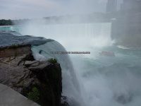
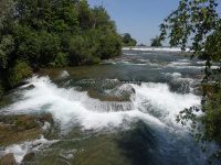
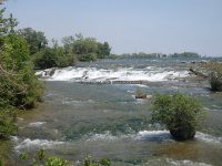
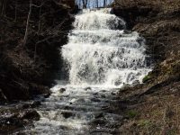
Tag Archives: newyorkstatewaterfalls

Waterfalls of New York State 100+ Challenge, Dig the Falls, part 5, The North Country Region

Waterfalls of New York State 100+ Challenge, Dig the Falls, part 5, The North Country Region

For more information on this challenge click here
To purchase “Waterfalls of New York State”, click here 
To purchase “A Waterfall Guide to Letchworth State Park” by Scott A. Ensminger and Douglas K. Bassett, click here

The following list is the first set of locations listed in the book “Waterfalls of New York State” by Scott A. Ensminger of (Western New York Waterfall Survey), David J. Schryver of (Northern New York Waterfalls) and Edwards M. Smathers of (Dig the Falls)

Be sure to check them out! I myself have personally contributed a lot of waterfall location information to both Mr. Edward Smathers and Mr. David Schryver. I am currently a team member with “Dig the Falls”. The simple rules of this challenge, is to visit 100 waterfall locations in the book. One location may have several waterfalls, but counts as one location. Click on the links (I have visited) in the boxes below, which will take you to additional information pages. (NOTE: format is different then the first 4 parts of challenge already posted prior. I thought I had posted all of these, but, ummm well, I did not)

Park, Area
County
Waterfall Name
Aka
 
Oswego
——-
——-
Oneida
——-
——-
Lewis
Sugar River
——-
Lewis
High Falls
——-
Lewis
Whetstone Creek Falls, Whetstone Gulf Falls
Whitaker Falls State Park
Lewis
——-
——-
Lewis
——-
——-
Lewis
Frenchs Mills and Myers Mills
——-
Lewis
——-
——-
Jefferson
Burr’s Mill Falls, Cider Mill Falls
——-
Jefferson
Boynton Creek, falls on
——-
——-
Jefferson
——-
——-
Jefferson
Great Falls, Watertown Falls
——-
Jefferson
——-
——-
Jefferson
Glen Park Falls
——-
——-
Jefferson
Evans Mills Falls, The Falls at Evans Mills
——-
St. Lawrence
Fullerville Falls
——-
——-
St. Lawrence
Brown’s Falls
——-
——-
St. Lawrence
Butter Tub Falls
——-
——-
St. Lawrence
Chipmunk Falls
Schuyler Falls
——-
St. Lawrence
——-
——-
St. Lawrence
——-
——-
St. Lawrence
——-
——-
St. Lawrence
Flat Rock Falls
——-
——-
St. Lawrence
——-
——-
St. Lawrence
Stewart Rapids
——-
St. Lawrence
Bulkhead Falls
——-
——-
St. Lawrence
Large Marge
——-
St. Lawrence
——-
——-
St. Lawrence
——-
——-
St. Lawrence
——-
Willow Island/Falls Island
St. Lawrence
leftside
Willow Island/Falls Island
St. Lawrence
——-
——-
St. Lawrence
——-
——-
Franklin
——-
——-
Franklin
——-
——-
Franklin
——-
Ausable Chasm
Clinton Essex
Tiny Cascades and Rapids, downstream from Horseshoe Falls
Ausable Chasm
Clinton Essex
——-
Ausable Chasm
Clinton Essex
Adgate Falls, Birmingham Falls, Anderson Falls
——-
Essex Clinton
Alice Falls
Little Falls
——-
Essex
Jay Falls
——-
High Falls Gorge
Essex
——-
High Falls Gorge
Essex
——-
High Falls Gorge
Essex
——-
High Falls Gorge
Essex
——-
High Falls Gorge
Essex
——-
——-
St. Lawrence
Bog River Falls
Upper,Lower
AMR
Essex
——-
——-
Essex
——-
——-
Essex
——-
——-
Hamilton
——-
——-
Hamilton
Auger Falls
——-
Hamilton
Auger Falls
——-
Hamilton
Auger Falls

Waterfalls of New York State 100+ Challenge, Dig the Falls part 4, The Greater Niagara Region

Waterfalls of New York State 100+ Challenge, Dig the Falls, part 4, The Greater Niagara Region

For more information on this challenge click here
To purchase “Waterfalls of New York State”, click here 
To purchase “A Waterfall Guide to Letchworth State Park” by Scott A. Ensminger and Douglas K. Bassett, click here

The following list, is the first set of locations listed in the book by “Waterfalls of New York State” by Scott A. Ensminger (Western New York Waterfall Survey), David J. Schryver (Northern New York Waterfalls) and Edwards M. Smathers (Dig the Falls) Be sure to check them out! I myself have personally contributed a lot of waterfall location information to both Mr. Edward Smathers and Mr. David Schryver. I am currently a team member with “Dig the Falls”. The simple rules of this challenge, is to visit 100 waterfall locations in the book. One location may have several waterfalls, this counts as one location. Click on the links (I have visited) in the boxes below, which will take you to additional information pages.

Additional Falls in location, or close by

Waterfall Name, info

County

Date First visited

Photo

…..
Glen Mills Falls
More falls nearby 12 ft, 8 ft, 4 ft narrow flume
Chautauqua
No
…..
…..
Buttermilk Falls
15 ft, 54 ft, tiered ribbon Roadside view from the top/.2 mile to bottom
Erie
4/12/2014
Buttermilk Falls (North Evans) Erie County Western New York 4-12-2014_00008.JPG
…..
Eternal Flame Falls
Chestnut Ridge Park
30 ft, Ribbon Falls .56 mile
Erie
4/13/2014
Eternal Flame Falls  Erie County Western New York 4-13-2014_00018.JPG
additional falls
Chestnut Ridge Cascade, West
Chestnut Ridge Park
15 ft Ward Hill Walkway Trail 1.15 mile 
Erie
No
…..
additional falls
Chestnut Ridge Cascade aka East Shale Creek Cascade
Chestnut Ridge Park aka Shale Creek Preserve
18 ft 
Erie
No
…..
…..
Glen Falls
Glen Park/Town Park 
27 ft, Curtain Falls
Erie
4/12/2014
Glen Falls Erie County Western New York 4-12-2014_00017.JPG
…..
Akron Lower Falls
aka Falkirk Falls
Akron Falls Park
44 ft total, 5 ft, 20 ft 20 ft
Erie
4/13/2014
Akron Falls Park Erie County Western New York 4-13-2014_00015.JPG
additional falls
Akron Upper Falls
Akron Falls Park
20 ft, Private/No Access
Erie
No
…..
additional falls
Akron Park Dam
Akron Falls Park
10 ft
Erie
4/13/2014
Akron Falls Park Erie County Western New York 4-13-2014_00013.JPG
…..
American Falls
Niagara Falls State Park 183 ft National Park/trail 
Niagara
June 1984
Niagara Falls, Maid of the Mist 8-15-2016_00019.JPG
…..
Bridal Veil Falls
Niagara Falls State Park 181 ft
Luna Island
Niagara
June 1984
Niagara Falls, Cave of the Winds 8-15-2016_00010.JPG
additional falls
Cascade of the American Rapids aka Niagara Rapids, Hells Half Acre Niagara Falls State Park
7 ft Green Island
Niagara
June 1984
Niagara Falls, American Rapids 8-15-2016_00010.JPG
…..
Horseshoe Falls
aka Canadian Falls Niagara Falls State Park 173 ft
Goat Island,Terrapin Point
Niagara
June 1984
Horseshoe Falls 7-6-2016_00002.JPG
additional falls
Green Cascade
Niagara Falls State Park 10 ft .2 rt
Three Sisters Island 
Niagara
7/6/2016
Three Sisters Islands views from 7-6-2016_00015.JPG
additional falls
Second Sister Falls
Niagara Falls State Park
5 ft .2 rt
Three Sisters Island 
Niagara
7/6/2016
Three Sisters Islands views from 7-6-2016_00017.JPG
additional falls
Third Sister Falls
Niagara Falls State Park
7 ft .2 rt
Three Sisters Island 
Niagara
7/6/2016
Three Sisters Islands views from 7-6-2016_00022.JPG
…..
Clarendon Falls
aka Clarendon, Falls At 25 ft Park View
Orleans
4/12/2014
Clarendon Falls Orleans County Western New York 4-12-2014_00009.JPG
…..
Glen Falls At Holley
aka Glen Falls, Holley Canal Falls
30 ft Roadside or short walk down to the falls
Orleans
4/12/2014
Holley Canal Falls Orleans County Western New York 4-12-2014_00010.JPG

Waterfalls of New York State 100+ Challenge, Dig the Falls, part 2, The Hudson Valley Region

Waterfalls of New York State 100+ Challenge, Dig the Falls, part 2, The Hudson Valley Region For more information on this challenge click here To purchase “Waterfalls of New York State”, click here  To purchase “A Waterfall Guide to Letchworth State Park” by Scott A. Ensminger and Douglas K. Bassett, click here

The following list is the first set of locations listed in the book “Waterfalls of New York State” by Scott A. Ensminger (Western New York Waterfall Survey), David J. Schryver (Northern New York Waterfalls) and Edwards M. Smathers (Dig the Falls) Be sure to check them out! I myself have personally contributed a lot of waterfall location information to both Mr. Edward Smathers and Mr. David Schryver. I am currently a team member with “Dig the Falls”. The simple rules of this challenge, is to visit 100 waterfall locations in the book. One location may have several waterfalls, but counts as one location. Click on the links (I have visited) in the boxes below, which will take you to additional information pages.

As you will notice, I really have to work on my Southern Waterfalls! Jump on over to Digthefalls for additional information on the other waterfalls listed here below.

Additional Falls in location, or close by
Waterfall Name, info
Date First visited
County
…..
Artist Falls
Winter Clove
Platform View
15′
…..
Greene
additional falls
Countryman Kill, Falls #1
3.3 rt public
small 5′ cascade on top with a 10′ plunge waterfall at the bottom
…..
Greene
additional falls
Countryman Kill, Falls #2
3.3 rt public
14′ plunge
…..
Greene
additional falls
Countryman Kill, Falls #3
3.3 rt public
15′ plunge
…..
Greene
additional falls
Countryman Kill, Falls #4
3.3 rt public
26′ plunge
…..
Greene
additional falls
Countryman Kill, Falls #5
Countryman Kill
possible private
19′ cascade
…..
Greene
additional falls
Winter Clove Falls
Winter Clove
3.6 mile rt
70′ Total
…..
Greene
Kaaterskill Falls
Kaaterskill Clove/Lake Creek Ravine
aka Catterskill Falls, Cauterskill Falls
Roadside view/1.5 mile rt
230′ Total
Visited 8/18/2013
Greene
additional falls
Bastion Falls
Kaaterskill Clove/Lake Creek Ravine
aka Sebation Falls, Horse shoe Falls, Rip Van Winkle Falls
Roadside View/.2 mile walk along the roadside
71′ Cascade
Visited 8/18/2013
Greene
Plattekill Falls
Platte Clove
aka Plaaterskill Falls, Pomeroy Falls
.2 mile/several small cascades above
75′ (some sources state 51′)
Visited 8/18/2013
Greene
additional falls
Black Chasm Falls
Platte Clove
aka Everits Cascade, Platte Clove Falls
5.5 miles Rt for all waterfalls on the Plattkill Creek
100′
…..
Greene
additional falls
Blue Hole Falls
Platte Clove
5.5 miles Rt for all waterfalls on the Plattkill Creek
…..
Greene
additional falls
Bridal Veil Falls
Platte Clove
Hard Dangerous
Approx. 1.8 Mile Rt/Can be seen best by overlook at
Hells Hole N42.13066 W74.08354
Trailhead N42.13323 W74.0859490′
Visited 8/18/2013
Greene
additional falls
Evergreen Falls
Platte Clove
aka Gray Rock Falls, Green Falls, Lower Platte-kill Falls
Roadside View/5.5 miles Rt for all waterfalls on the Plattkill Creek
40′
…..
Greene
additional falls
Gray Rock Falls
Platte Clove
aka Evergreen Falls, Green Falls, Lower Platte-kill Falls
Gps location is based upon gathered sorces
5.5 miles Rt for all waterfalls on the Plattkill Creek
…..
Greene
additional falls
Green Falls
Platte Clove
aka Evergreen Falls, Gray Rock Falls, Lower Platte-kill Falls, The Ghost
Gps location is based upon gathered sorces
5.5 miles Rt for all waterfalls on the Plattkill Creek
20′ to 50′ approx
…..
Greene
additional falls
Grey Rock Falls
Platte Clove
aka Horseshoe Bend Falls
Roadside View/5.5 miles Rt for all waterfalls on the Plattkill Creek
…..
Greene
additional falls
Hells Hole Falls #1
Platte Clove
aka The Devils Kitchen Falls
Roadside Views/.2 mile Rt
Falls in Close Proximity
4′
…..
Greene
additional falls
Hells Hole Falls #2
Platte Clove
aka The Devils Kitchen Falls
Roadside Views/.2 mile Rt
Falls in Close Proximity
cascade
…..
Greene
additional falls
Hells Hole Falls #3
Platte Clove
aka The Devils Kitchen Falls
Roadside Views/.2 mile Rt
4′-5′ cascade
…..
Greene
additional falls
Japanese Falls
Platte Clove
5.5 miles Rt for all waterfalls on the Plattkill Creek
20’/20’/80′
…..
Greene
additional falls
Old Mill Falls
Platte Clove
.1 mile
10′ Total
Visited 8/18/2013
Greene
additional falls
Pomeroy Falls
Platte Clove
According to resources, this waterfall is stated to be one of the three largest falls,
based on the order of waterfalls, this maybe an aka of Plattekill Falls.
5.5 miles Rt for all waterfalls on the Plattkill Creek
Individual GPS unknown…..
…..
Greene
additional falls
Rainbow Falls
Platte Clove
Roadside view
5.5 miles Rt for all waterfalls on the Plattkill Creek
50′
…..
Greene
additional falls
Rainbow Falls, Lower
Platte Clove
aka Hell Hole Falls, Japanese Falls, Upper
Roadside view/5.5 miles Rt for all waterfalls on the Plattkill Creek
20’/20’/80′ Total with Japanese Falls
…..
Greene
additional falls
Red Falls, Upper
Platte Clove
aka Red Rock Falls, Honoulu Falls, Twins Falls, Reds Falls, Carns Falls
5.5 miles Rt for all waterfalls on the Plattkill Creek
…..
Greene
additional falls
Red Rock Falls, Lower
Platte Clove
aka Honoulu
Public – State Land
35′
…..
Greene
additional falls
Red Rock Falls, Upper
Platte Clove
aka Gray Rock Falls
Roadside View
25′
…..
Greene
additional falls
Rocky Rapids
Platte Clove
Location is based on gathered resources
5.5 miles Rt for all waterfalls on the Plattkill Creek
Individual GPS unknown
…..
Greene
…..
High Falls
High Falls Conservation Area
1.5 mile loop
80′
…..
Columbia
additional falls
Agawamuck Falls
High Falls Conservation Area
aka Ackawamack Falls
http://clctrust.org/discover/public-conservation-areas/
discover-our-places-high-falls/
70′-80′
…..
Columbia
additional falls
Unnamed Falls
High Falls Conservation Area
Part of Dam, Philmont Dam
1.5 mile loop
15′-20′
…..
Columbia
…..
Bash Bish Falls
Taconic State Park
5 mile – crossing into MA
80′ Total
…..
Columbia
additional falls
Copake Falls
Taconic State Park
https://parks.ny.gov/parks/attachments/
TaconicCopakeFallsAreaTrailMap-NorthernSection.pdf/
Individual GPS unknown
……..
Columbia
High Falls
High Falls Historic District
aka Great Falls
.1 mile
25′
…..
Ulster
Awosting Falls
Minnewaska State Park
Inside State park
.6 mile/Designated Carriage Roads/Red 1.4
https://parks.ny.gov/parks/attachments/
SamPointAreaMinnewaskaStateParkTrailMap.pdf60′
…..
Ulster
additional falls
Coxing Kill, Falls on Lower
Minnewaska State Park
…..
Ulster
additional falls
Coxing Kill, Falls on Tributary to
Minnewaska State Park
…..
Ulster
additional falls
High Peters Kill Waterfall
Minnewaska State Park
https://www.alltrails.com/explore/recording/high-peters-kill-trail–33…..
…..
Ulster
additional falls
Rainbow Falls
Minnewaska State Park/Sam’s Point
3.4 Miles 1-Way
75′
…..
Ulster
additional falls
Sanders Kill, Falls on
Minnewaska State Park
6 mile rt/1.6 mile rt
8’/4′
…..
Ulster
additional falls
Saw Mill Falls
Minnewaska State Park
1.4 Mile Rt
18′
…..
Ulster
additional falls
Split Rock Falls
Minnewaska State Park
aka Coxing Kill Falls
.1 mile
8′
…..
Ulster
additional falls
Stony Kill Falls
Minnewaska State Park
5 mile
135′ Total
…..
Ulster
…..
Verkeerder Kill Falls
Sams Point preserve
aka Kittykill Falls, Kaidy Kill Falls, Katy Kill Falls
5.6 mile RT
Fee Required
72′
…..
Ulster
additional falls
South Gully, Diana’s Pool
Sam’s Point/South Gully
Approx 6 mile Rt
…..
Ulster
additional falls
South Gully, Falls on #01
Sam’s Point/South Gully
Approx 6 mile Rt
…..
Ulster
additional falls
South Gully, Falls on #02
Sam’s Point/South Gully
Approx 6 mile Rt
…..
Ulster
additional falls
South Gully, Falls on #03
Sam’s Point/South Gully
Approx 6 mile Rt
…..
Ulster
additional falls
South Gully, Falls on #04
Sam’s Point/South Gully
Approx 6 mile Rt
…..
Ulster
…..
Dover Stone Church Cave Falls
.5 mile
35′
…..
Dutchess
additional falls
Seven Wells, The
Access not yet verified
…..
Dutchess
…..
Fitzgerald Falls
.3 mile
Appalation Trail
30′
…..
Orange
Russell Brook Falls
Cherry Ridge Wild Forest
1 mile rt
30’/10′
Visited 8/10/2014
Delaware
additional falls
Russell Brook Falls, Upper
Cherry Ridge Wild Forest
1 Mile rt
30’/10′
Visited 8/10/2014
Delaware
…..
Buttermilk Falls #1.
Private/No Access
25′
…..
Chenango
additional falls
Buttermilk Falls (New Berlin)
Roadside
25′, Cascade
Visited 8/8/2014/not in same location as the other 4 falls, which are farther north
Chenango
additional falls
Buttermilk Falls #2
Private/No Access
25′
…..
Chenango
additional falls
Buttermilk Falls #3
Private/No Access
25′
…..
Chenango
additional falls
Buttermilk Falls #4
Private/No Access
25′
…..
Chenango

Dig the Falls, Waterfalls, Trail Cleanup, Partnerships

Dig the Falls, Waterfalls, Trail Cleanup, Partnerships

Dig the Falls, Waterfalls, Trail Cleanup, Partnerships, Head on over to our Dig the Falls website and Subscribe to keep informed of our future endeavors!


New York State Waterfall Map v3.6 BETA

New York State Waterfall Map v3.6 BETA

New York State Waterfall Map v3.6 BETA


— Read on digthefalls.com/new-york-state-waterfall-map-v3-6-beta/

Bobbieswaterfalls, Improvements 2-19-2017

Bobbieswaterfalls, Improvements 2-19-2017

Bobbieswaterfalls, Improvements 2-19-2017
Just an update! I am still working on a lot of background improvements and changes to the website. At times there will be locations, or sections, that are unavailable. I have learned so much in the past few weeks, regarding pages, posts etc. Background work is more than I ever thought. The steps it takes to set up a proper working website that until now never understood their functions. So, hang in there, check back often. Thanks for all you patience as I work through it all.

For all you “Waterfall Lover’s” out there!

For all you “Waterfall Lover’s” out there!

It is time for me to announce to the world (some folks already know), some commitments I have made not only to my personal website, but also to bigger and better attachment to the waterfall communities.

First, I had been asked if I would like to join the  “Digthefalls” team, and I have accepted and along with that opened up new responsibilities and commitments.
www.digthefalls.com

In case you did not know, Digthefalls also has a partnership with Field Trip, creator of the Field Trip App. If you have not yet joined you may do so here
http://www.fieldtripper.com/

Another New important announcement was the “New York State Waterfall Coalition”
Check this out here
https://newyorkstatewaterfalls.com/

My personal website here, will still follow my personal simple basic structure. Links and pages will be live for those waterfall locations I personally visited. I am slowly moving towards listing all the waterfall locations that I have had on my personal private, compiled list of 20 plus years. Which I am sure may have wrong information, until confirmed.

Anyone that I have on my Resource page, please check back and confirm that they are still most current and up to date! Also check my Other Link Resources to.

I am behind on my “Other States” waterfall lists, but will continue adding and posting them.

I am excited about new opportunities, new friends, new projects and most of all utilizing my self-worth in something I value more than almost everything!! WATERFALLS!!

Feel free to checkout http://www.cafepress.com/bobbieswaterfalls
I will continue adding products as I sort out my best photos!!

Road trip to Herkimer County area now published 5-2-2010

Road trip to Herkimer County area now published 5-2-2010

Road trip to Herkimer County area now published 5-2-2010
These waterfall locations are now published from our road trip on 5-2-2015

BIG BILL BROOK FALLS ON   Herkimer County, New York

BLACK CREEK RESERVOIR  Herkimer County, New York

HURRICANE BROOK FALLS ON  Herkimer County, New York

SMOKEY HOLLOW FALLS  Herkimer County, New York

WEST CANADA CREEK falls on aka PROSPECT QUARRY FALLS  Herkimer County, New York

WILMURT FALLS  Herkimer County, New York

Road trip to Hamilton County New York area now published 5-10-2015

Road trip to Hamilton County New York area now published 5-10-2015

Road trip to Hamilton County New York area now published 5-10-2015
THESE ARE FROM OUR ROAD TRIP ON 5-10-2015

ALGONQUIN HYDRO DAM   Hamilton County, New York

AUGER FALLS  Hamilton County, New York

AUSTIN FALLS  Hamilton County, New York

BEECHER CREEK FALLS  Saratoga County, New York

BEECHER CREEK FALLS 2  Saratoga County, New York

CHRISTINE FALLS  Hamilton County, New York

GRIFFEN FALLS  Hamilton County, New York

JIMMY CREEK EAST LOWER FALLS  Hamilton County, New York

JIMMY CREEK WEST FALLS  Hamilton County, New York

RIVER ROAD (FALLS ON) NORTHVILLE  Hamilton County, New York

SACANDAGA RIVER FALLS ON  Hamilton County, New York

WHISKY BROOK FALLS  Hamilton County, New York


Cedar Bay Park

Roadtrip on 4-29-2015 to Onondaga County Area

Roadtrip on 4-29-2015 to Onondaga County Area

Roadtrip on 4-29-2015 to Onondaga County Area

Today’s roadtrip consisted of checking out some new locations for me. I used google imagery to first locate possible falls. Some of these locations are already well known, but new to me.

Cedar Bay Park, Ononadaga County, New York

This is part of the Old Erie Heritage Canal

OLYMPUS DIGITAL CAMERA

This one is called Coye Road (falls on), Ononadaga County New York

the only view is from the roadside as it is private property on both sides. There was no real good photo opportunity for this one.

OLYMPUS DIGITAL CAMERA

Gristmill Park, Ononadaga County, New York

and small falls downstream on Solvay Road

OLYMPUS DIGITAL CAMERA

OLYMPUS DIGITAL CAMERA

OLYMPUS DIGITAL CAMERA

These next few location are along Highway 174, on Ninemile Creek, Ononadaga County, New York

OLYMPUS DIGITAL CAMERA

OLYMPUS DIGITAL CAMERA

OLYMPUS DIGITAL CAMERA

OLYMPUS DIGITAL CAMERA

Skaneateles Creek Falls, Ononadaga County, New York

OLYMPUS DIGITAL CAMERA